Archive for the ‘travel’ Category

Waimea Canyon

February 12, 2015

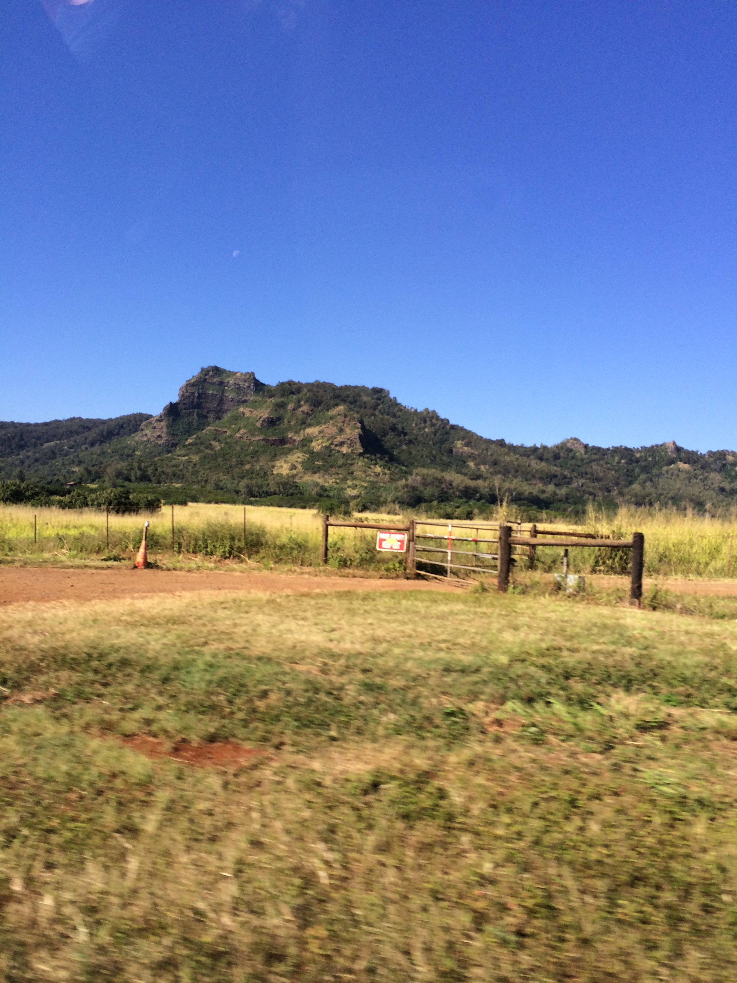
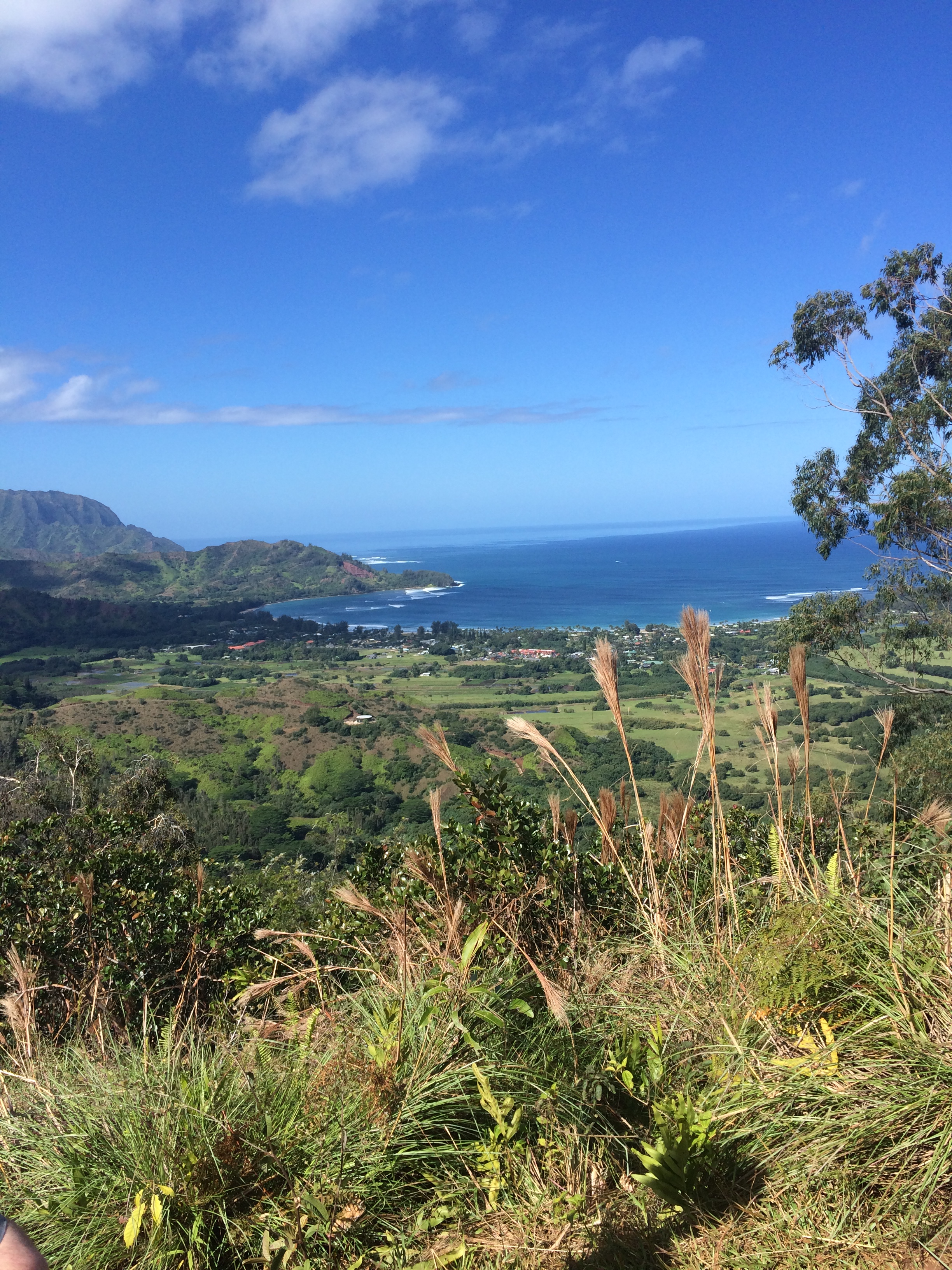
So of course, weather permitting, you can’t visit Kauai without checking out Waimea Canyon. Princeville is on the north center shore of Kauai and as the crow flies, is probably only 20 miles from Wiamea Canyon. Except, to get there by car you have to circle about 3/4 the way around the island to the town of Wiamea and then drive north about 10 miles. The drive takes about 2 1/2 hours. Here is a link to pictures of the island so you can locate Princeville and Wiamea Canyon.

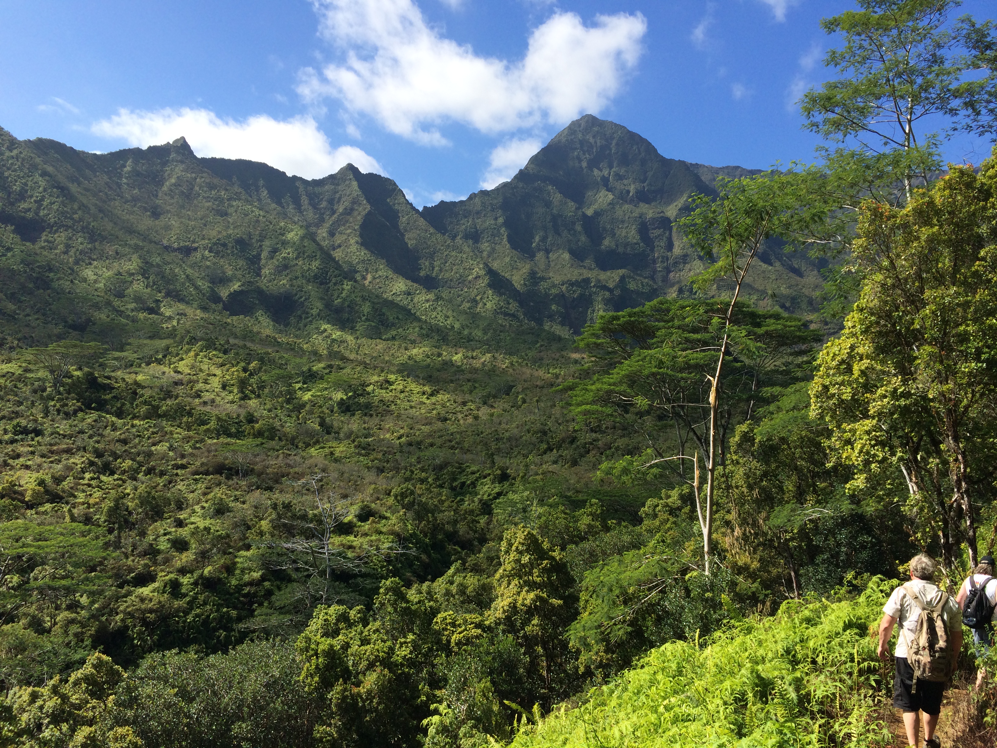
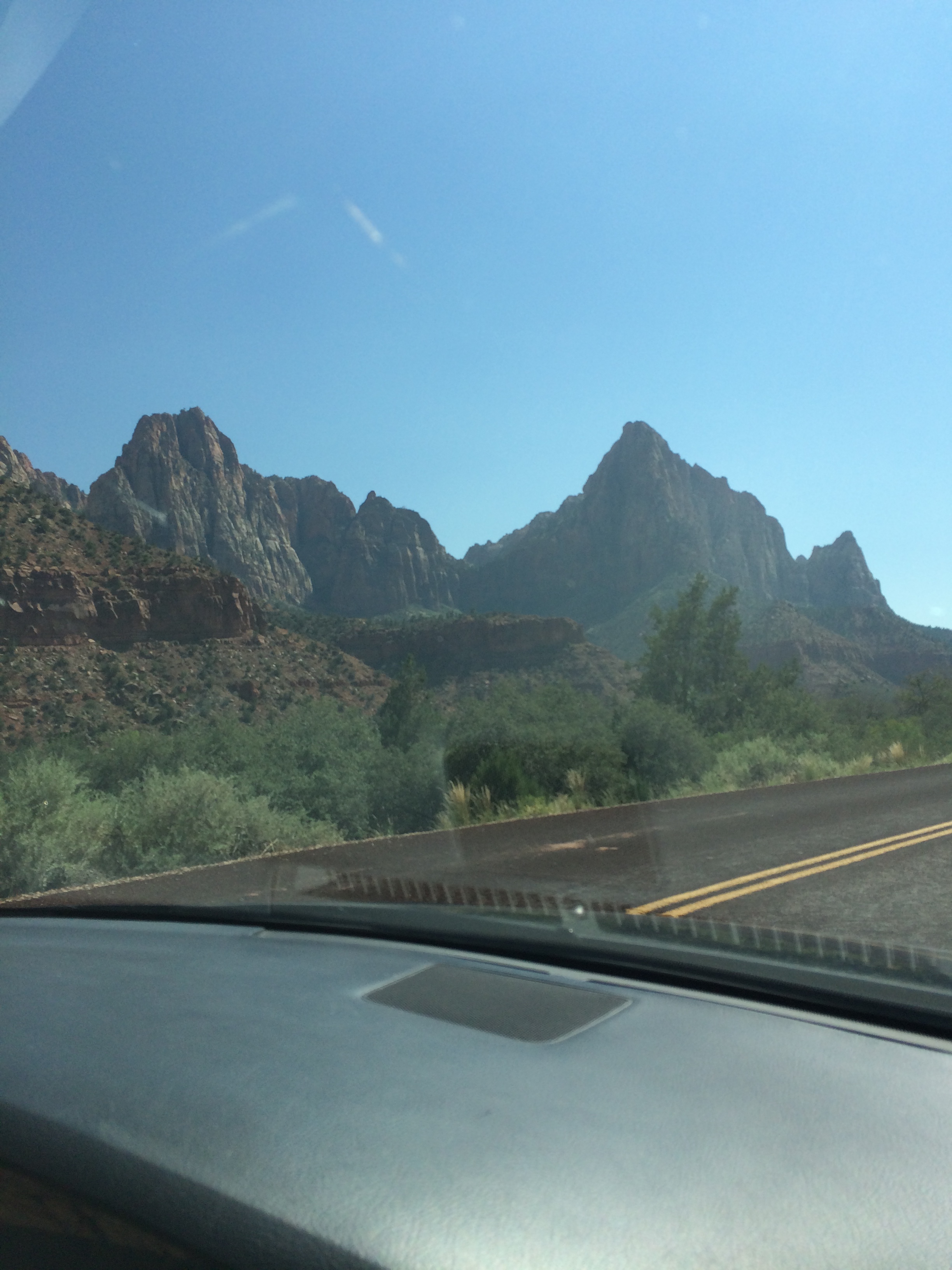
We eat a hearty breakfast and hit the road from Princeville about 9am. Two hours later we are traveling north on Wiamea Canyon Drive – soon the canyon comes into view! And Wai ‘alae Falls:

IMG_0042

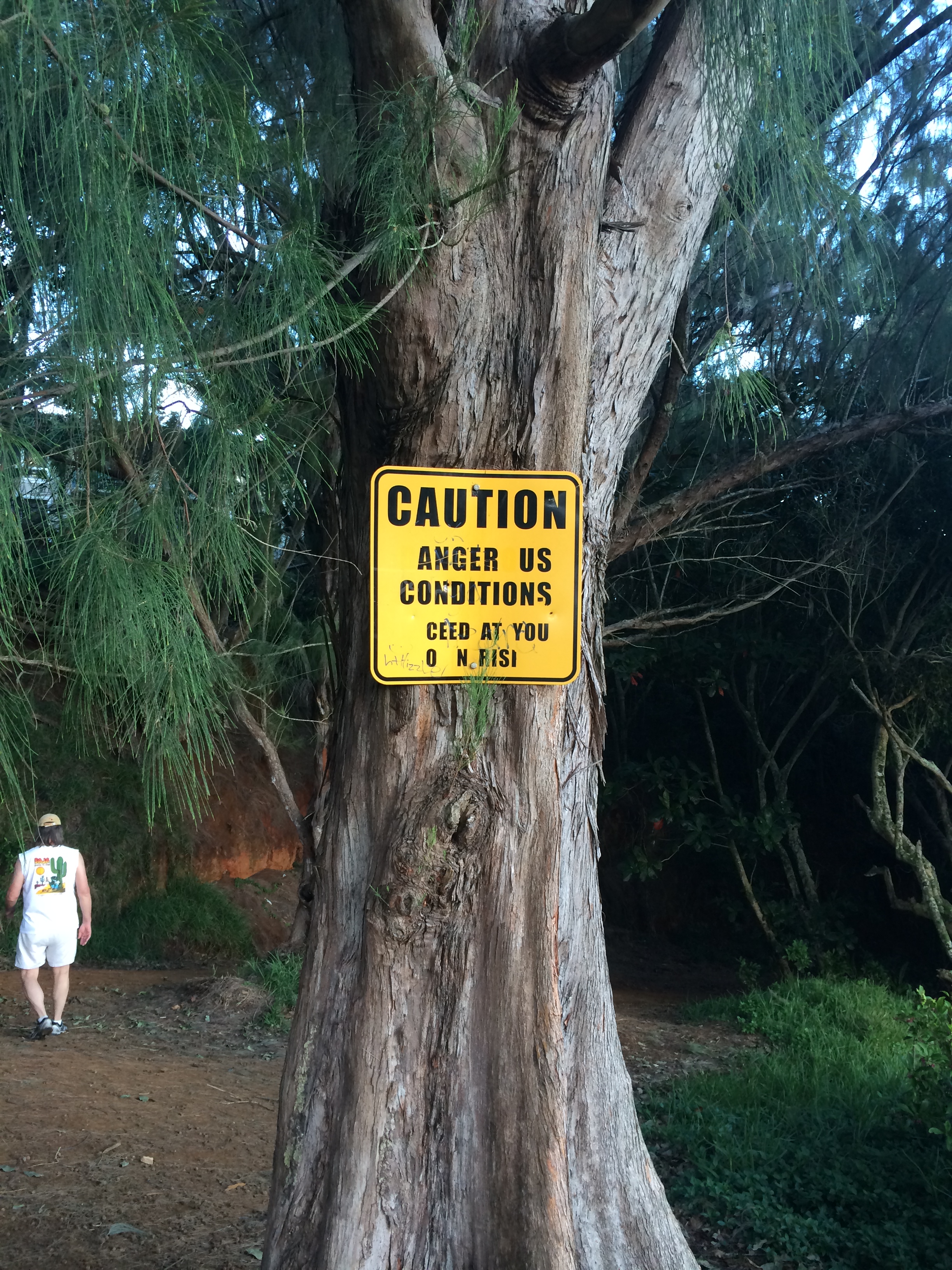
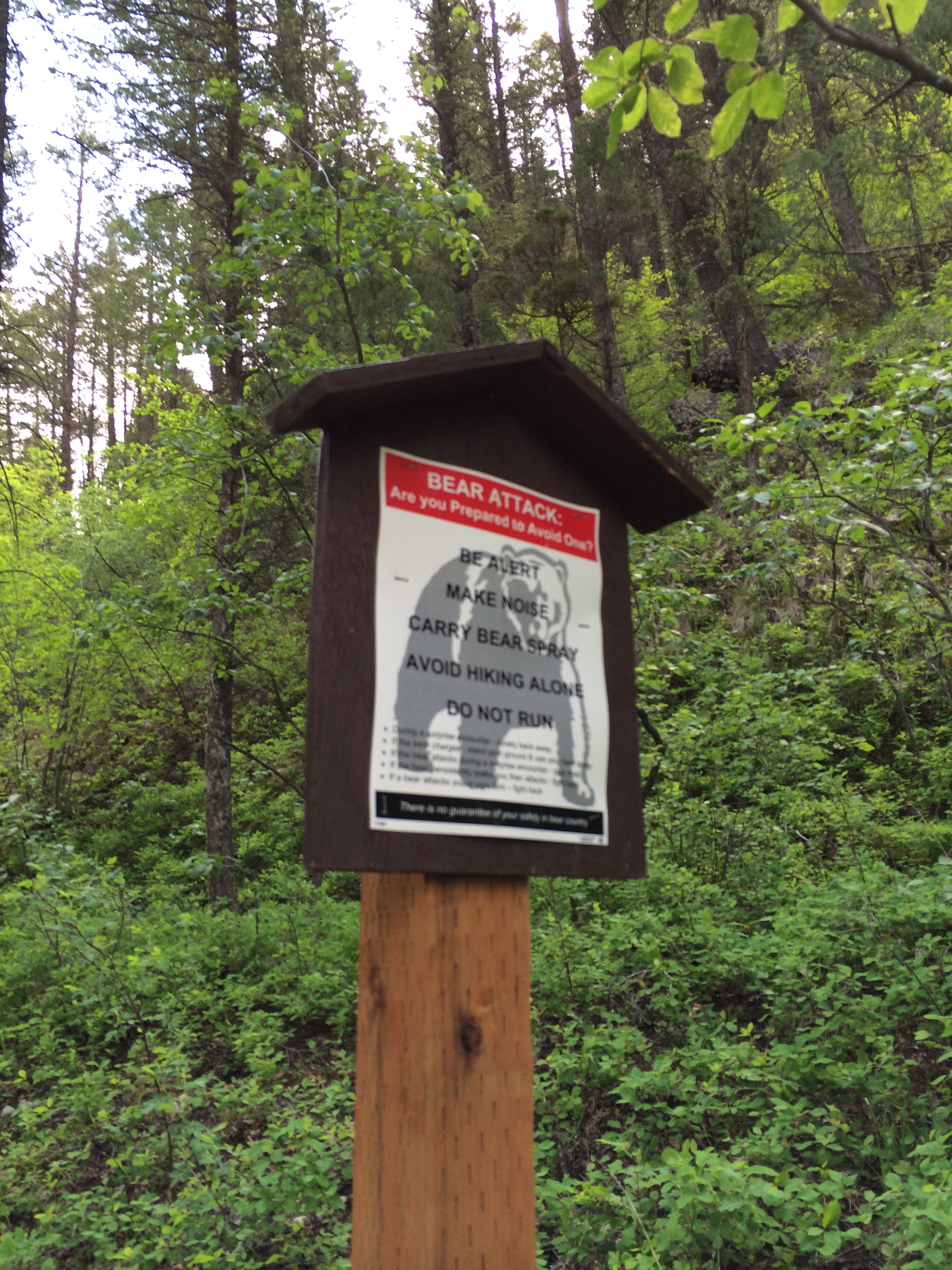
We pull into the parking area at the Canyon trailhead. First order of things: pit stop! I head into the ladies room – this sign is posted over the toilet:

IMG_0043

Huh. Tourists! Are we that stupid? Anyone educated enough to read the sign needs that much instruction in what not to flush down the toilet? What would etc. include? Tinkertoys?

We’re at the trailhead now – trying to figure out the sign.

IMG_0048

Okay, so the trail one way is 1.8 miles. You reach the trail intersection in .5 miles. Except any trail you add on to .5 miles doesn’t add up to 1.8. (???)
Steph, Eric, David, and Victor, all whizzes at math, are involved in this discussion.

IMG_0049

Oh well. Let’s just go! Uh, warning ahead:

IMG_0050

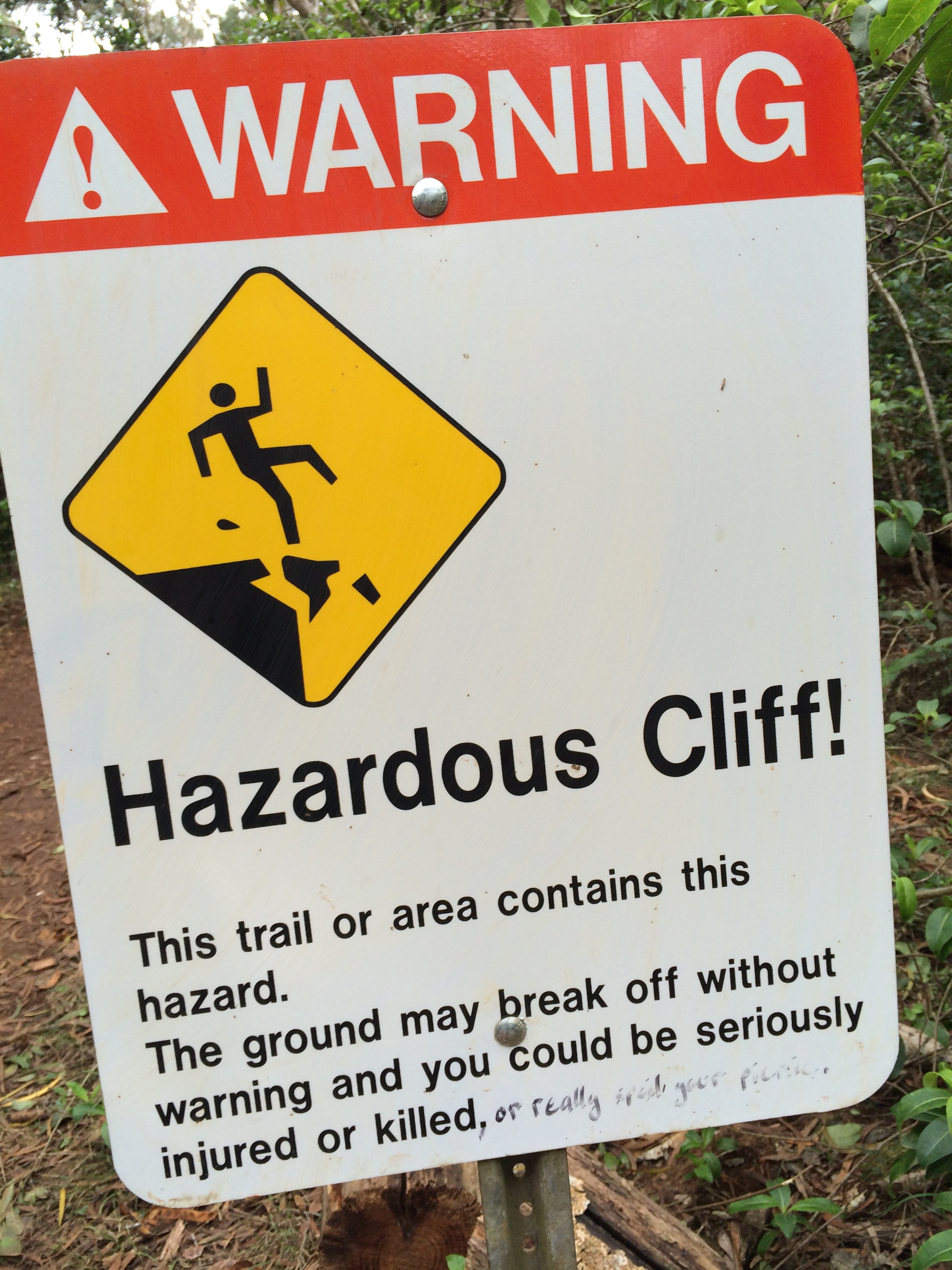
With a visual provided in case you can’t read English. “The ground may break off without warning and you could be seriously injured or killed, or really spoil your picnic.

And more warnings:

IMG_0051

No diving or jumping? Into Wiamea canyon?

We have hiked the first .5 miles now. Tourists have added valuable information to the sign. Turn left to get to the Falls:
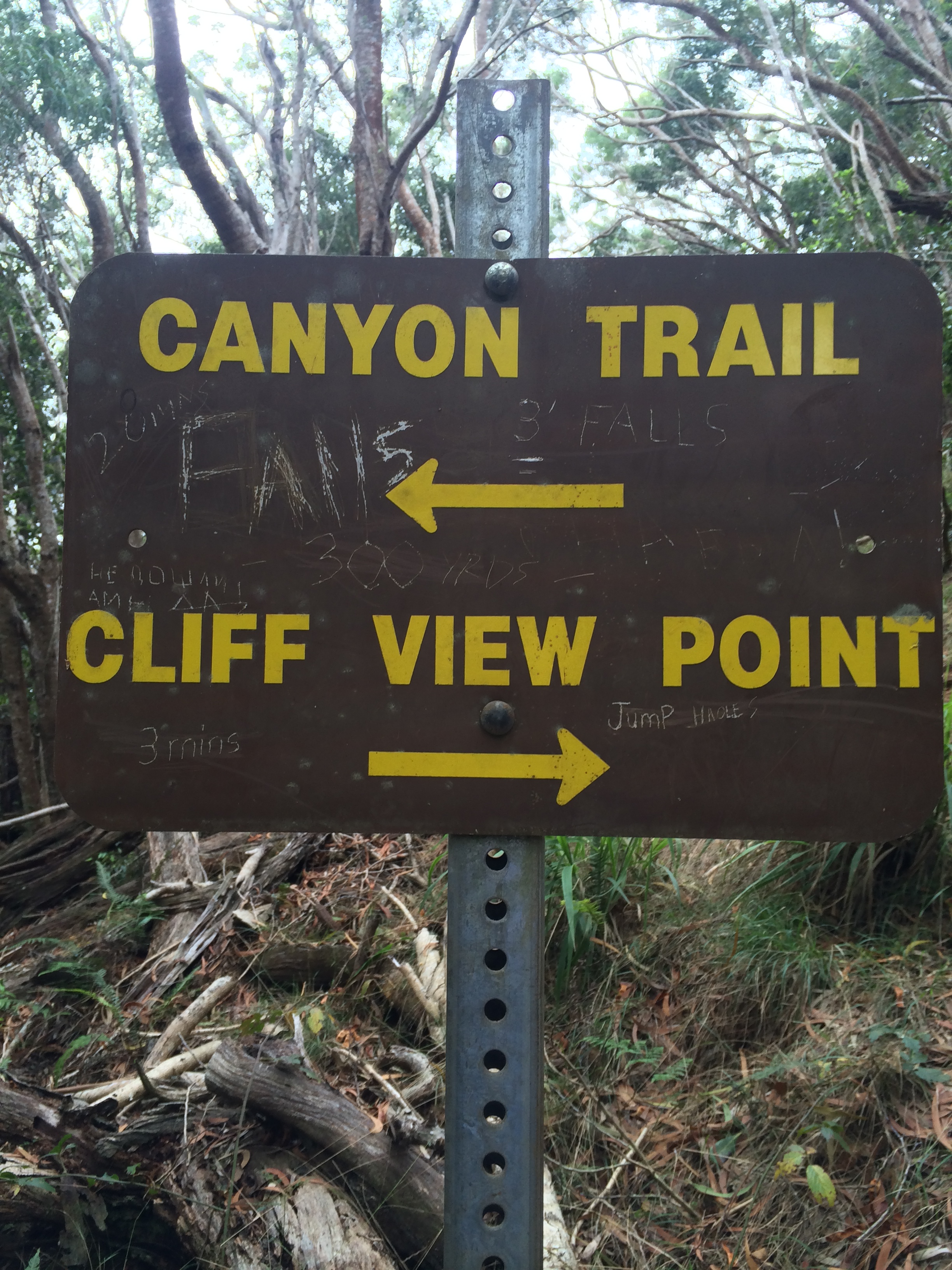
IMG_0052

Turn right to jump.

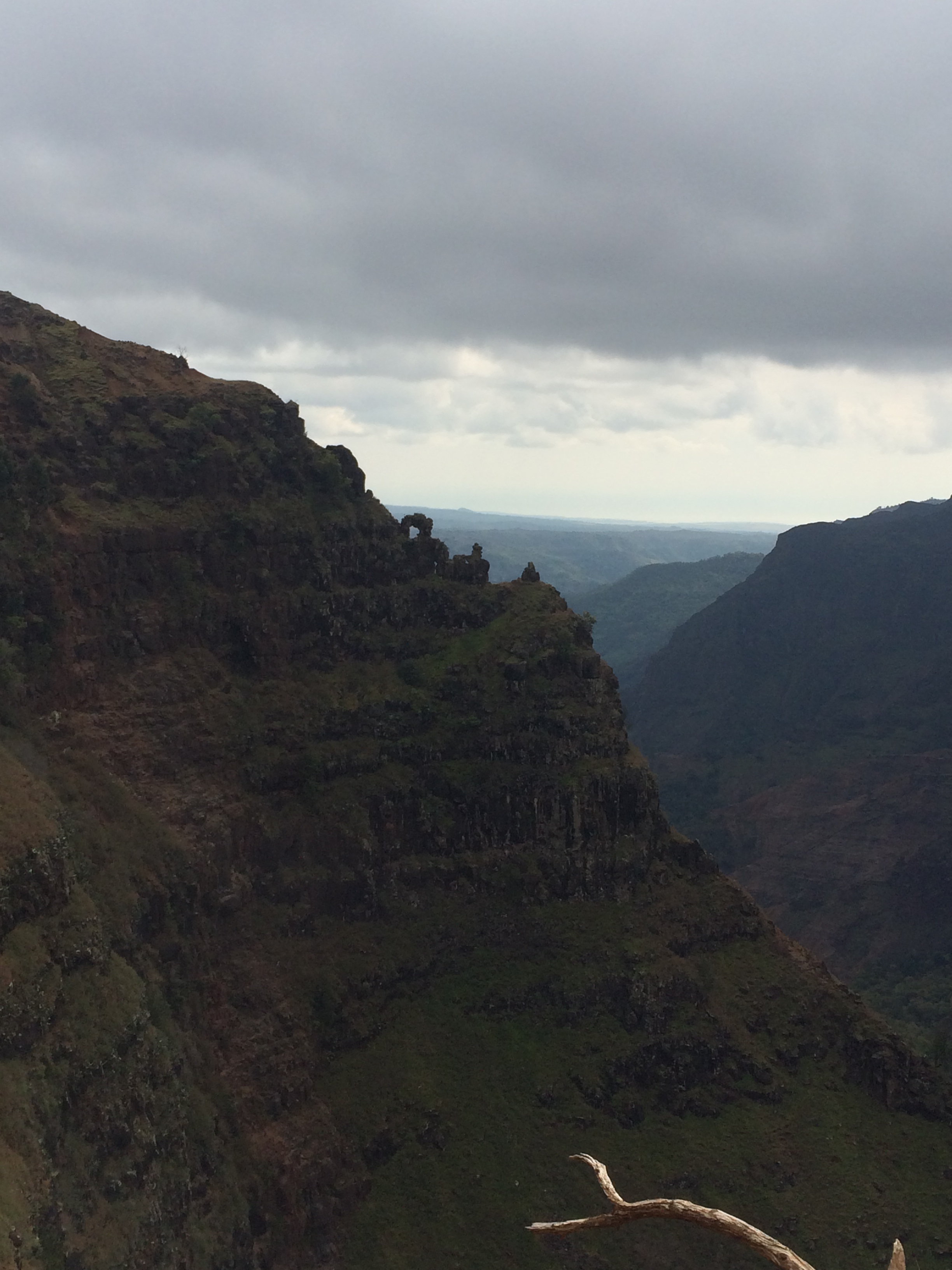
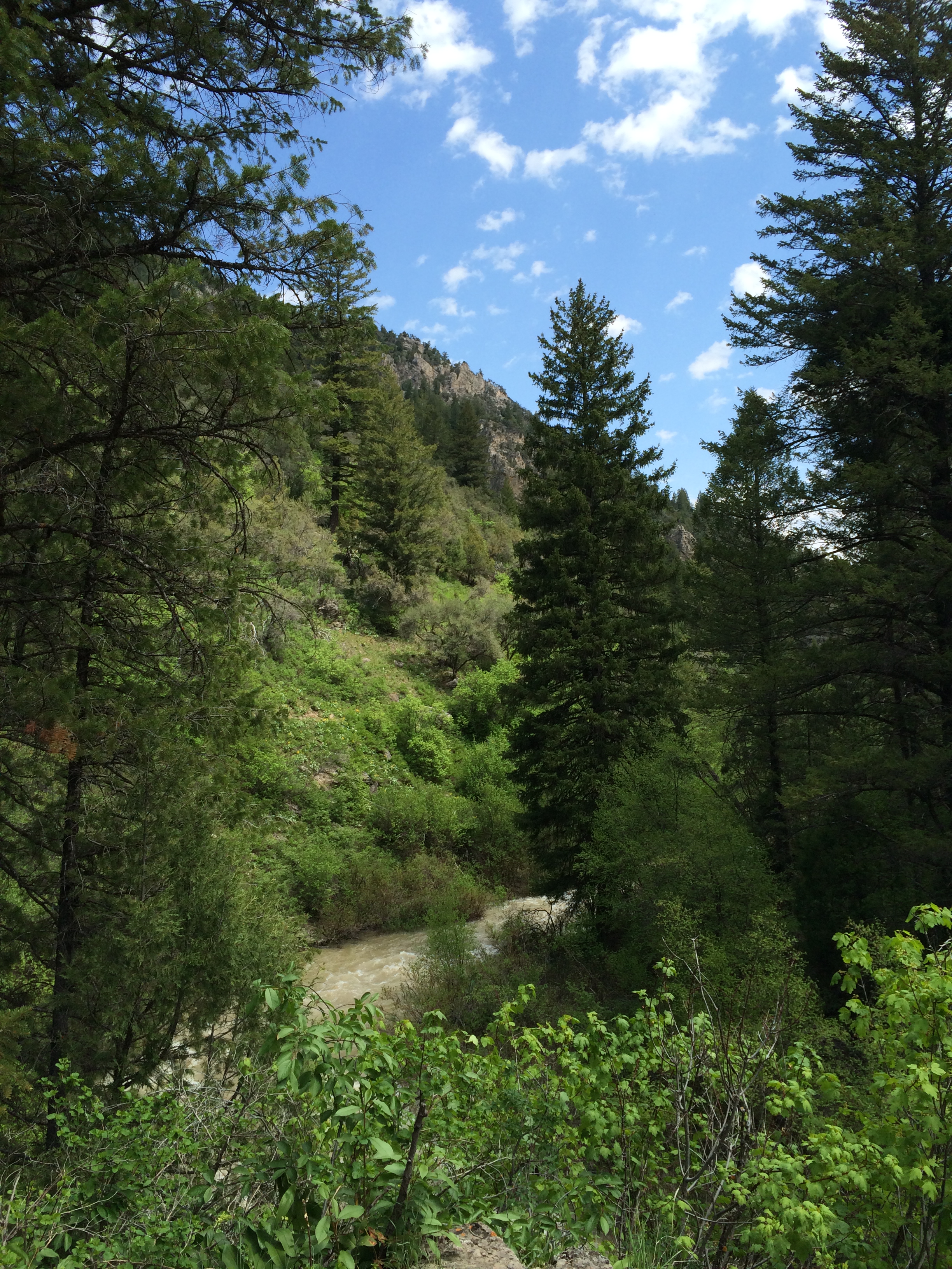
We checked out the Cliff View Point.
IMG_0054

Pretty magnificent!

Back on the Canyon trail we meet this sign:

IMG_0055

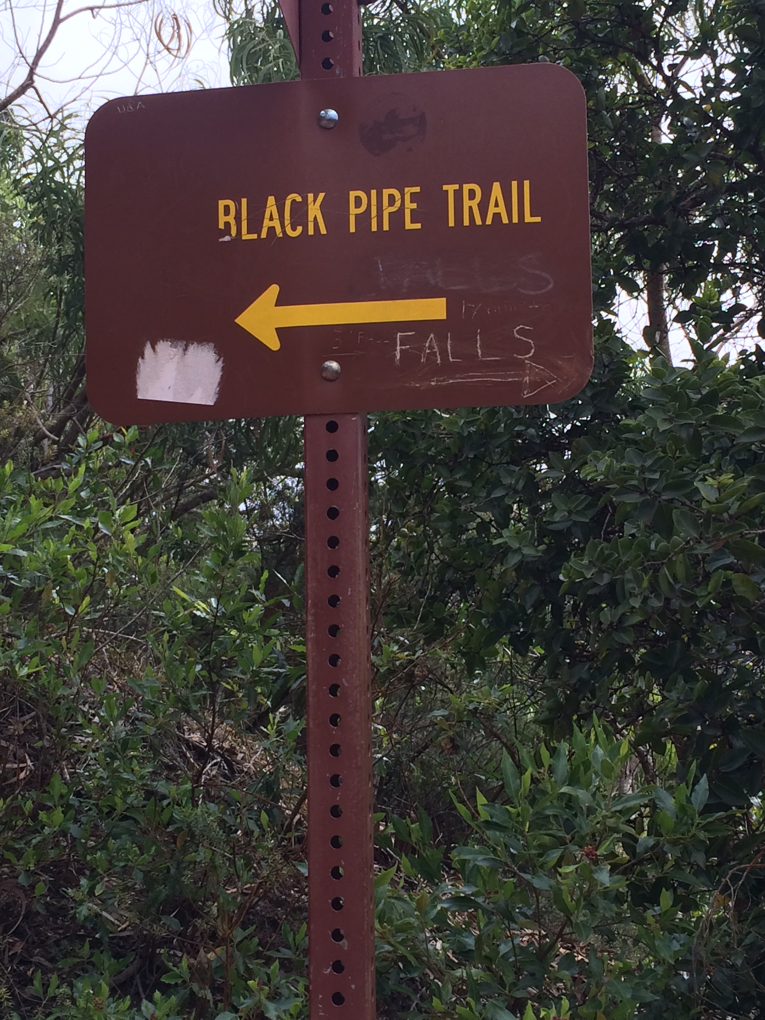
Well the Black pipe trail might be all right, but we really want to see the Falls. (Who put up these signs? Is this some kind of joke on tourists?)

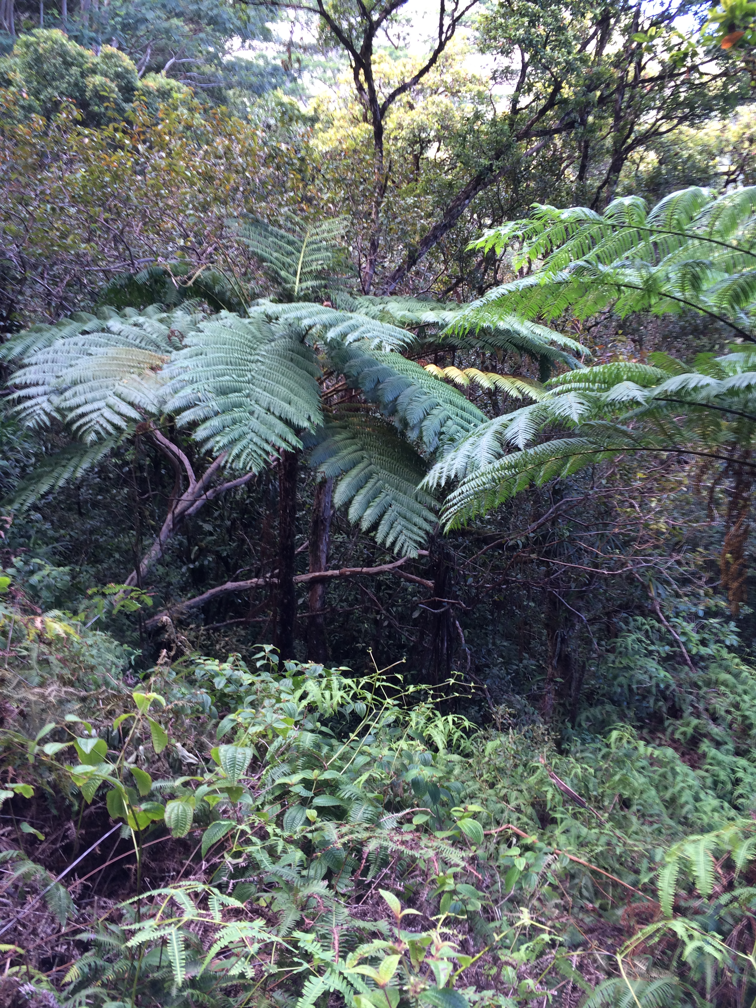
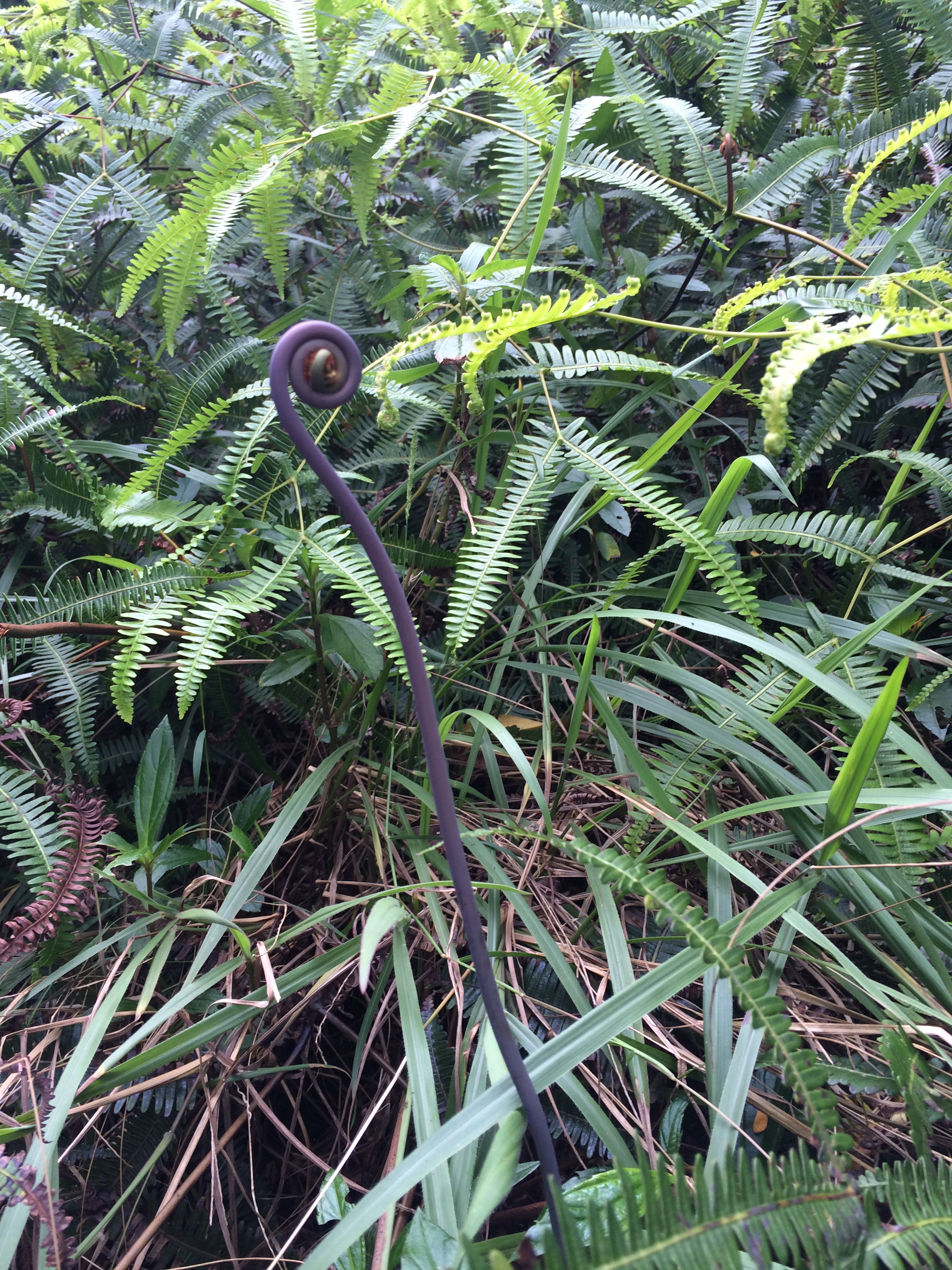
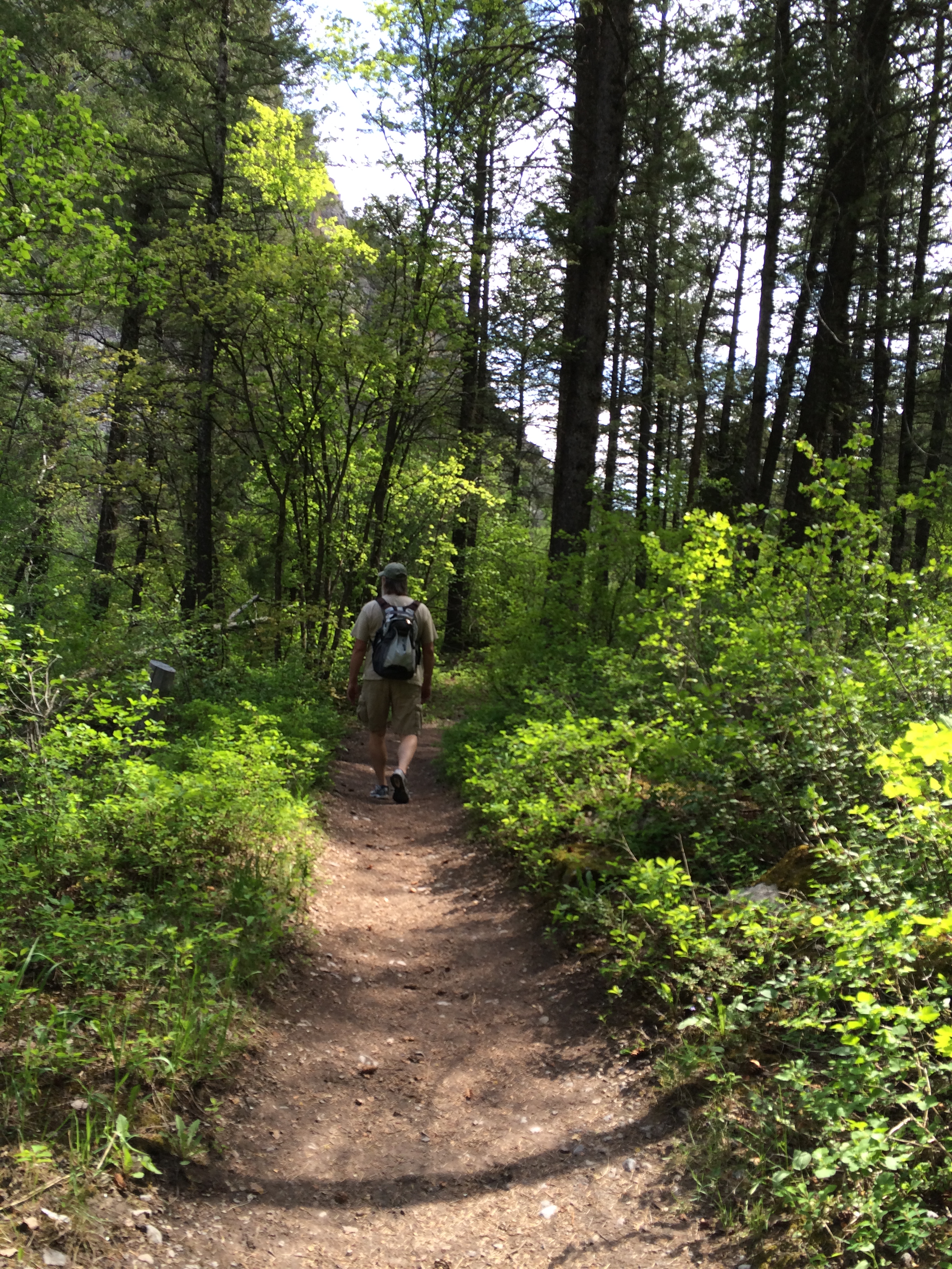
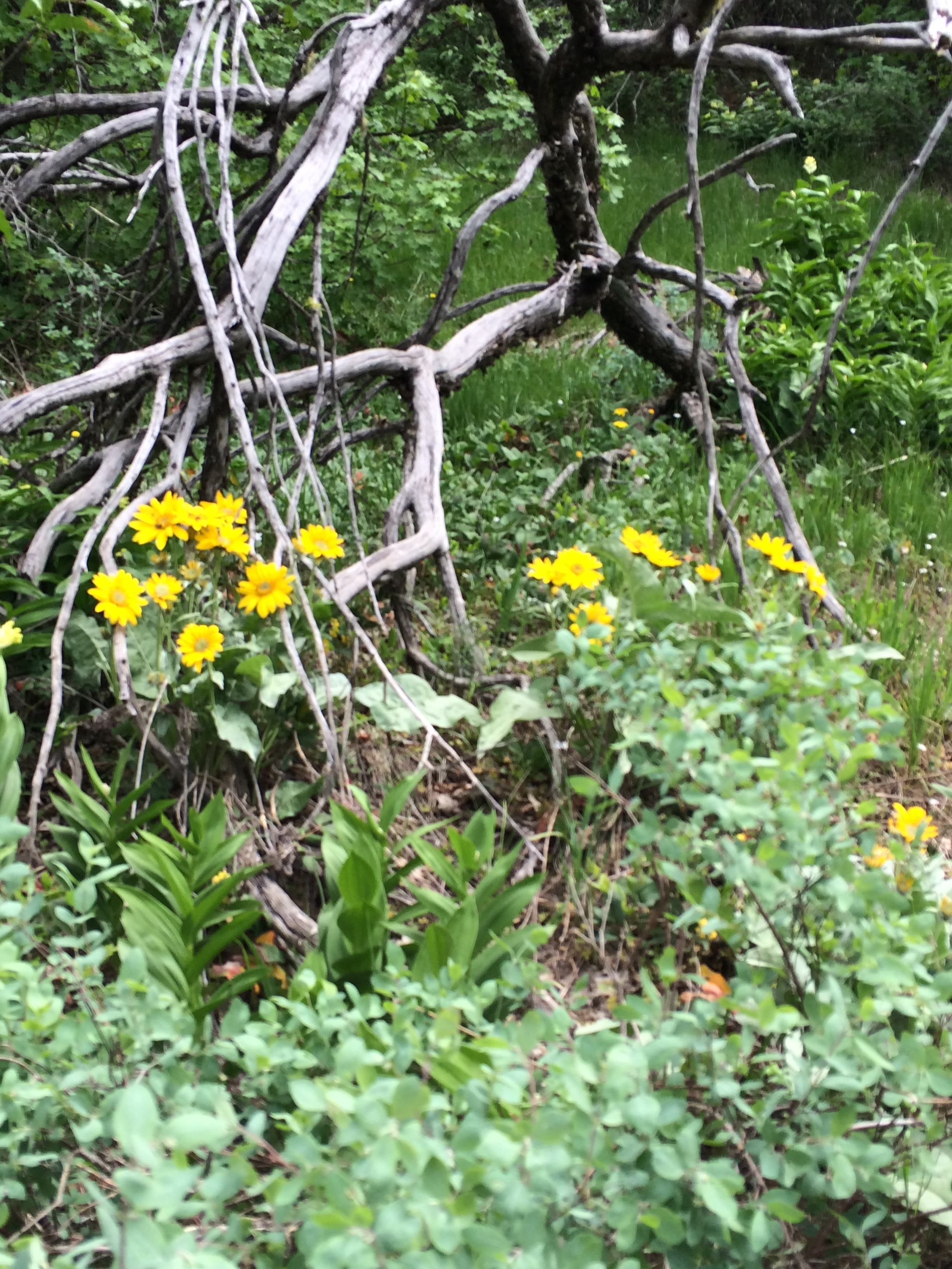
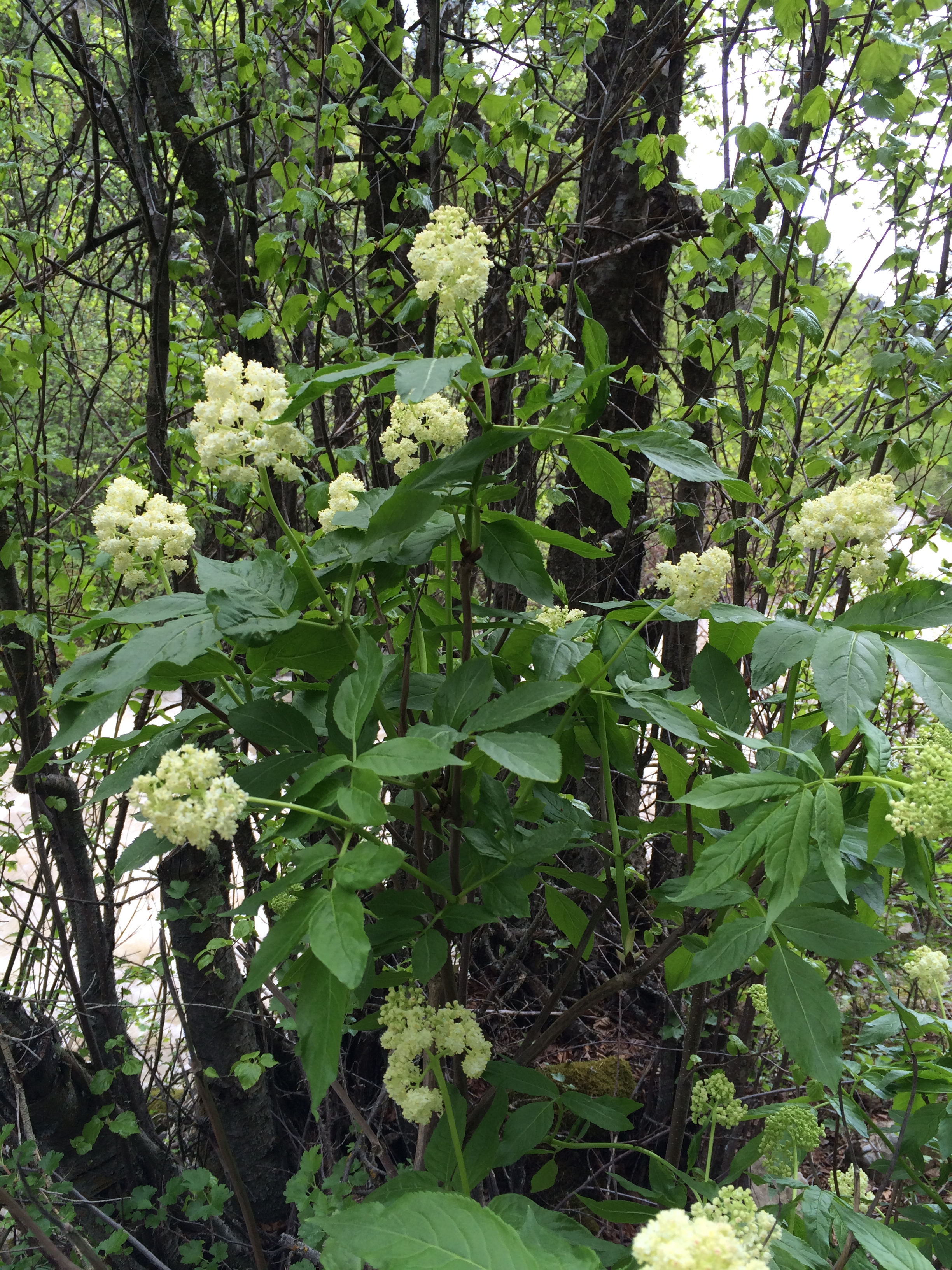
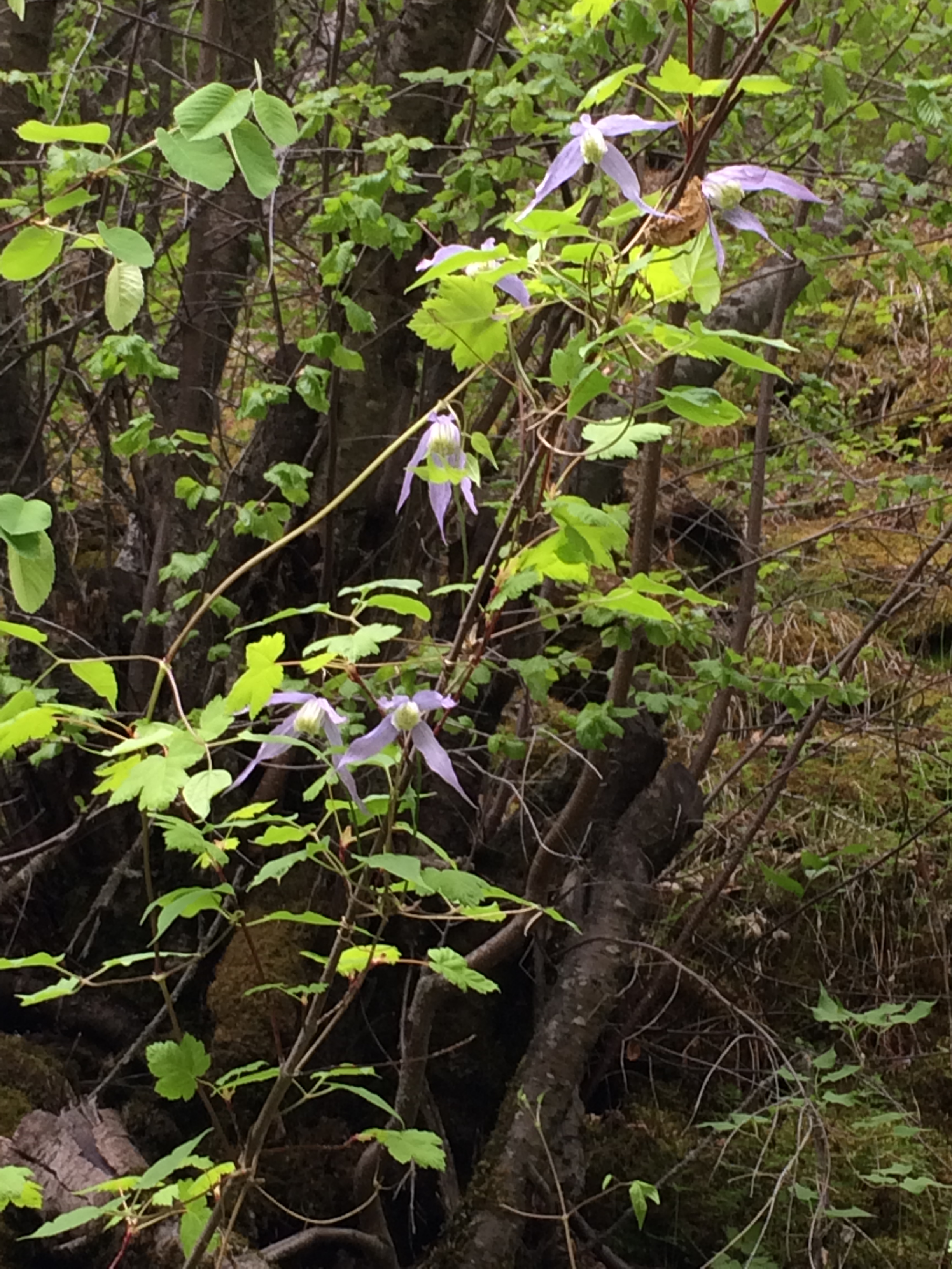
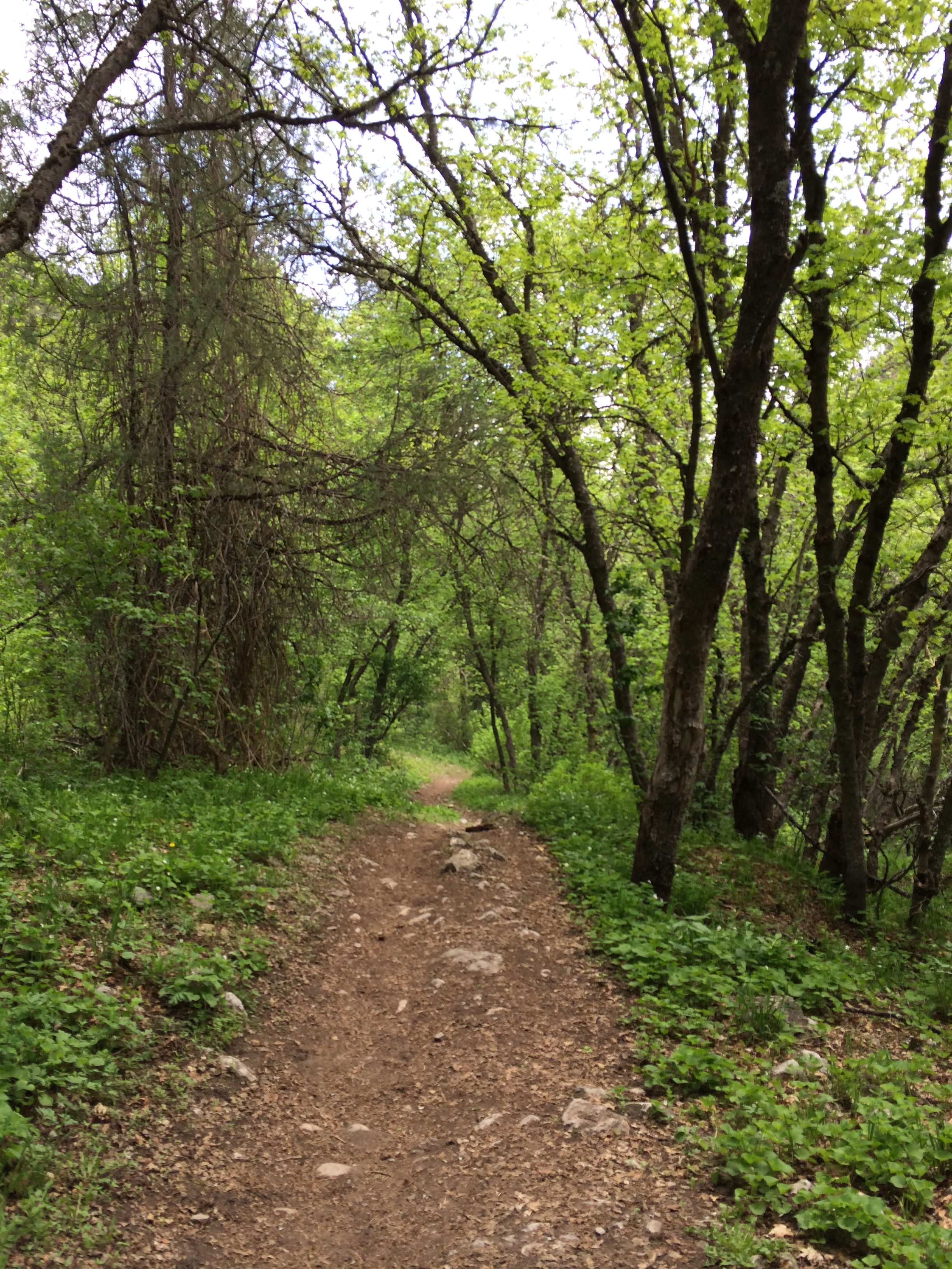
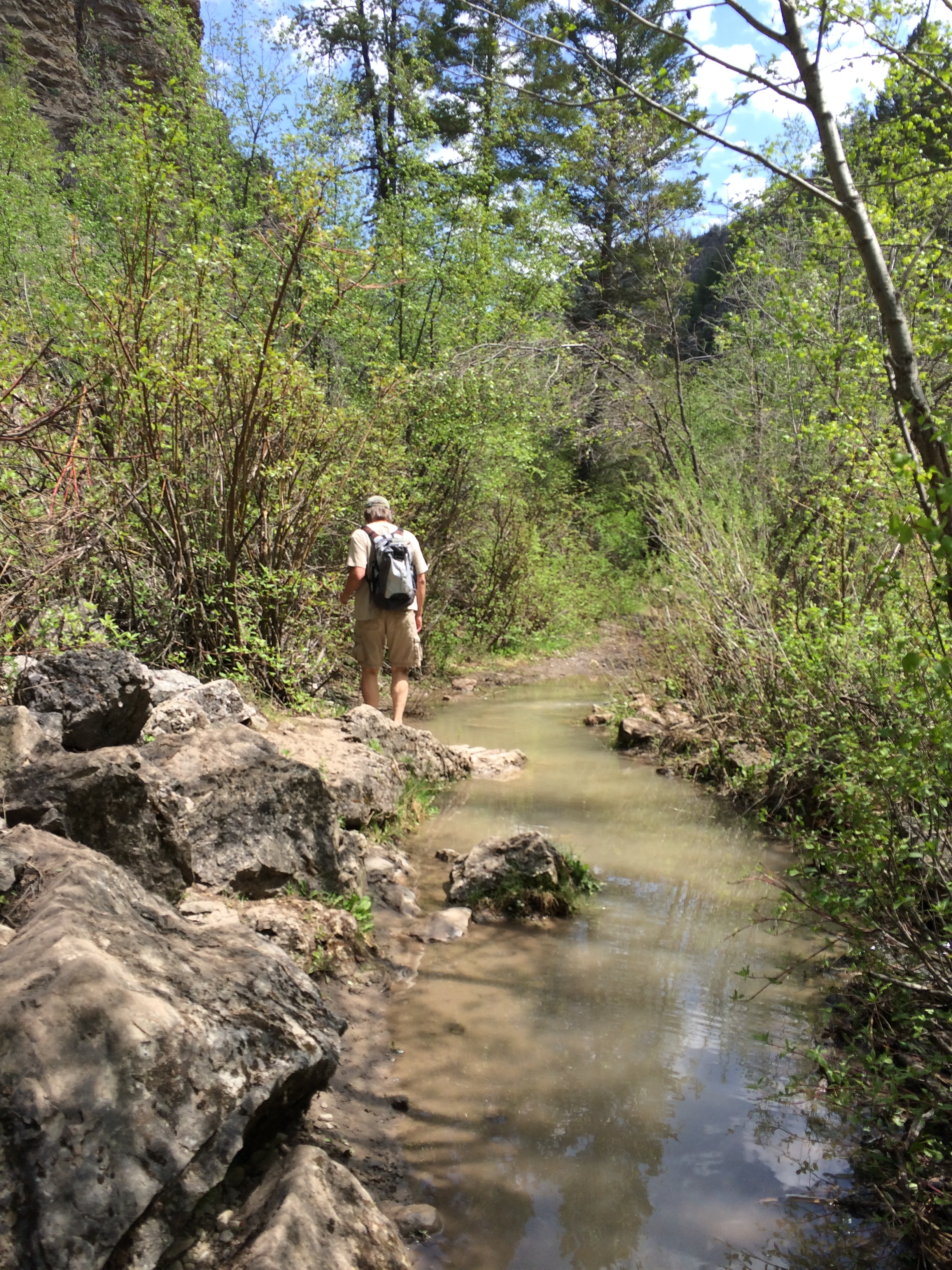
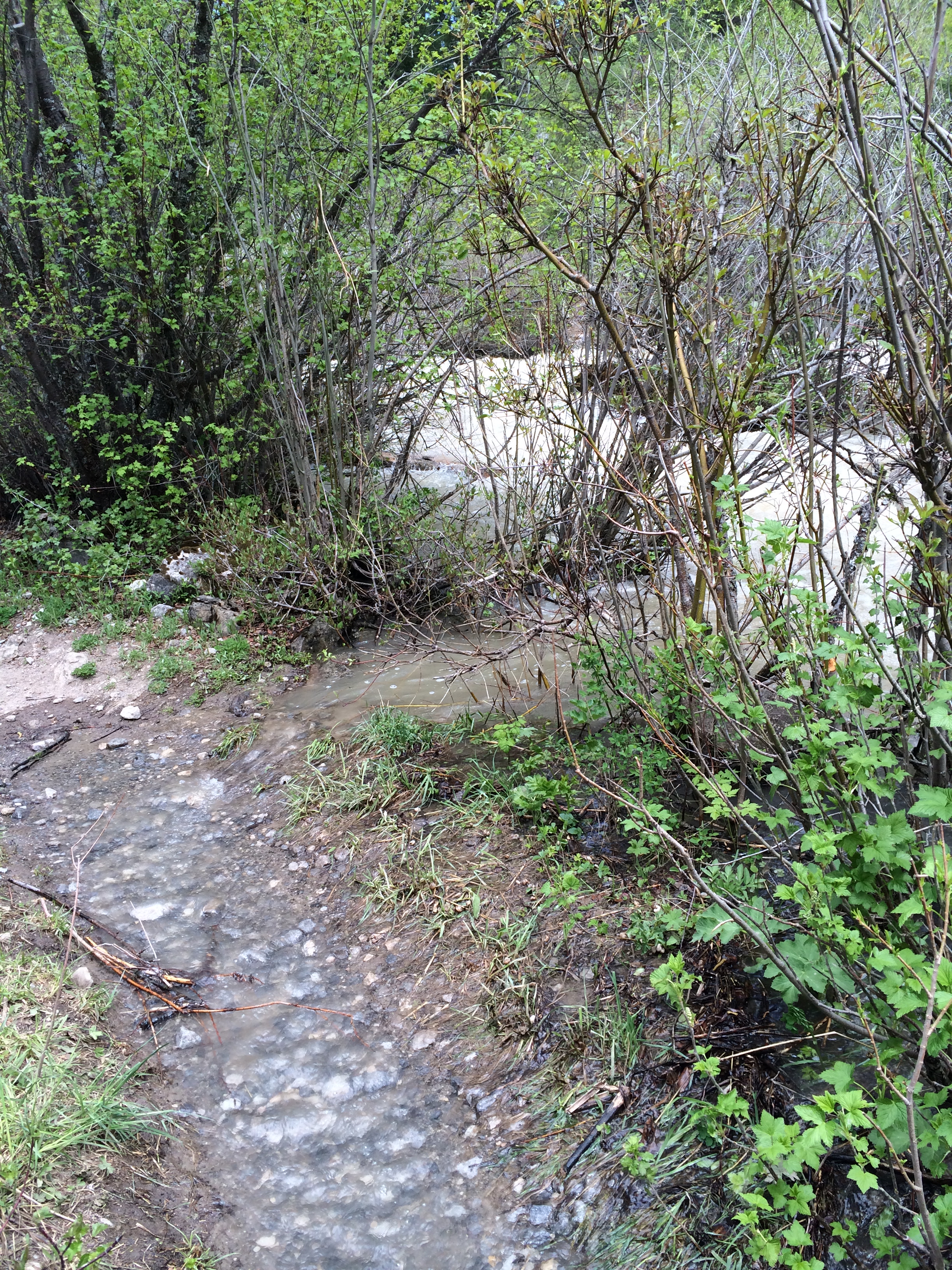
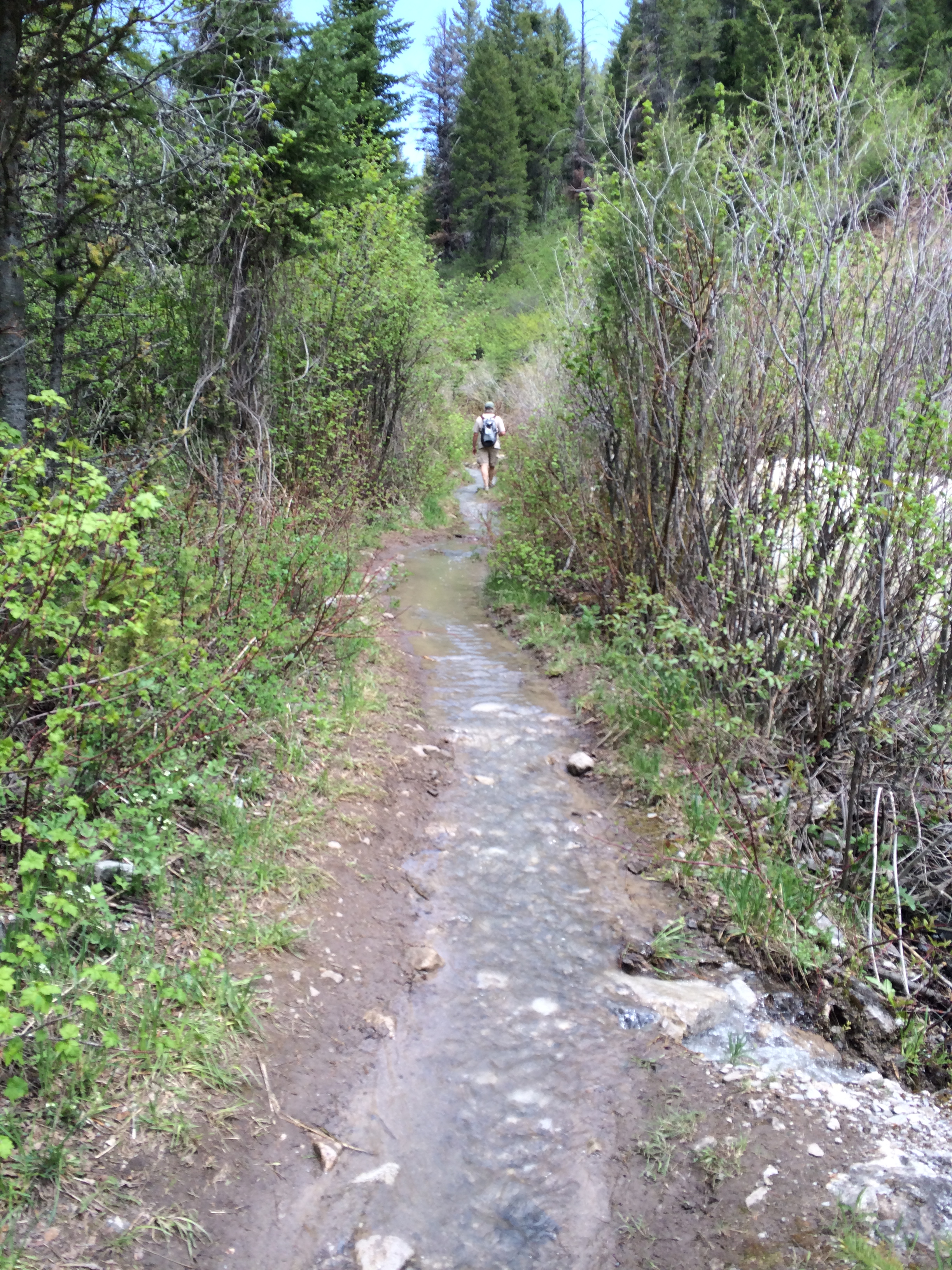
Hiking along the canyon now.

IMG_0057

I guess if you seriously intend to jump, this would be the place.

David took a video right here. Check it out:

You can see there’s a bit of a drop-off from where we are standing.

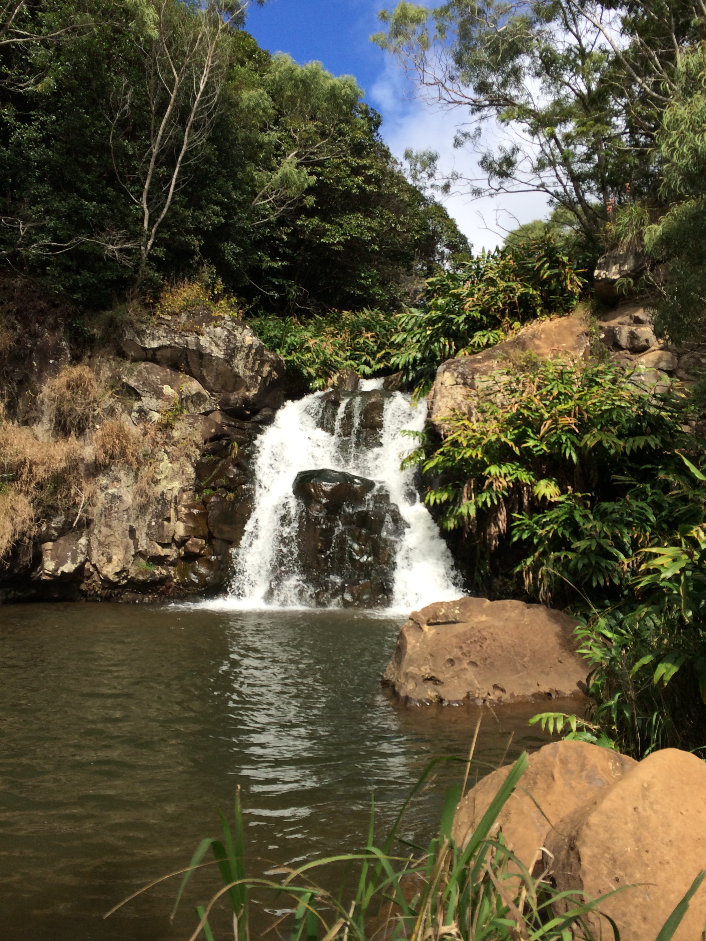
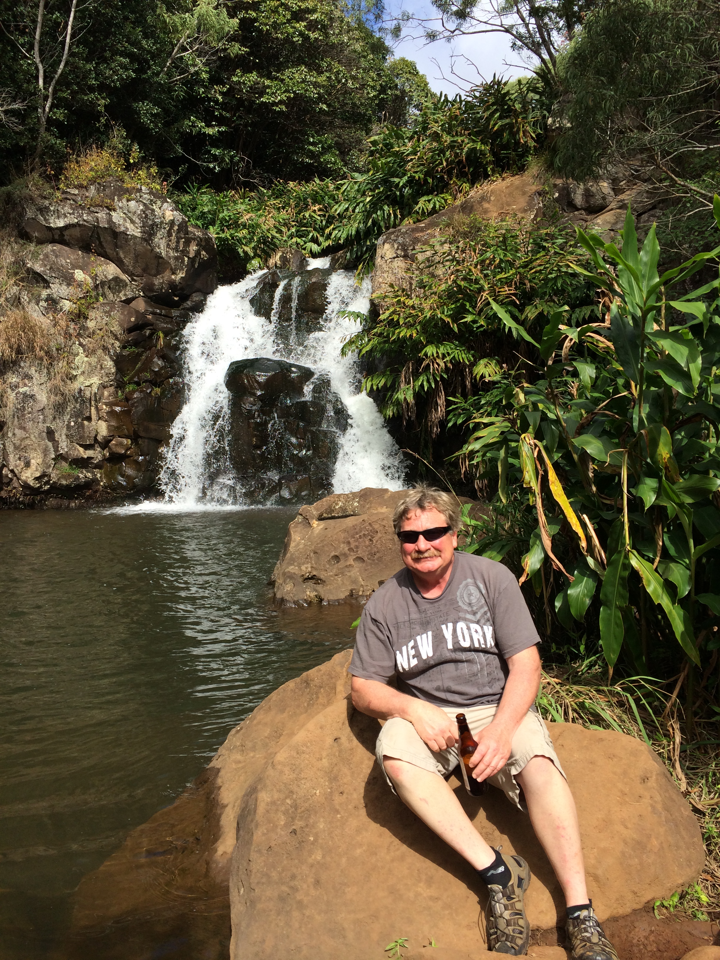
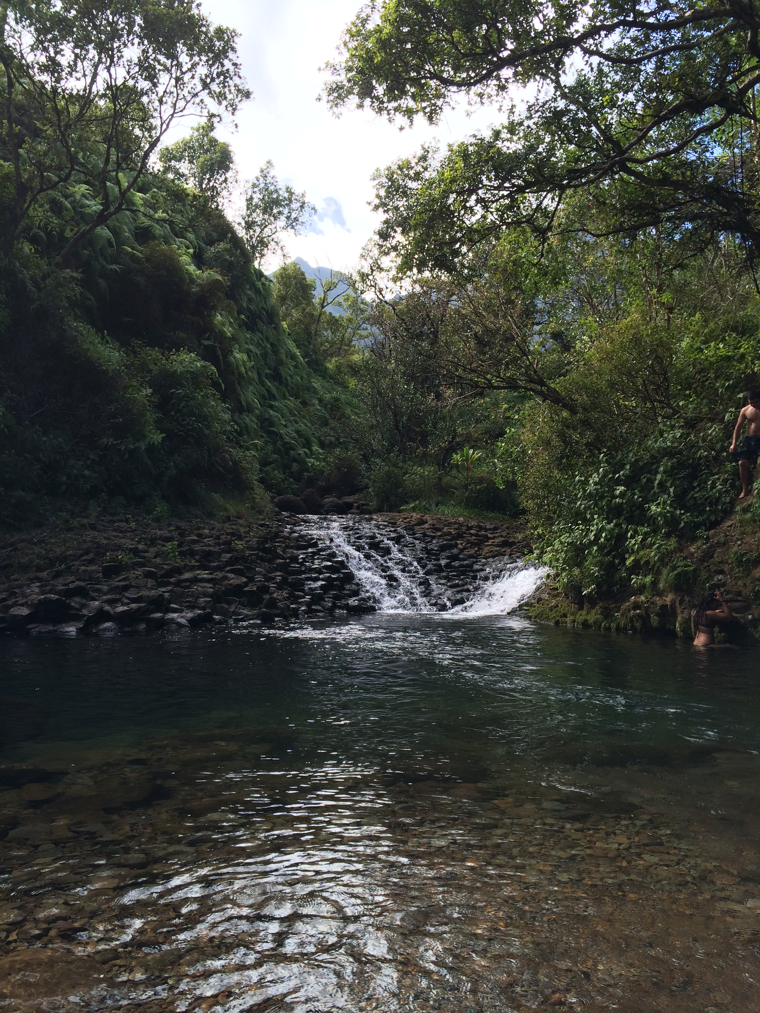
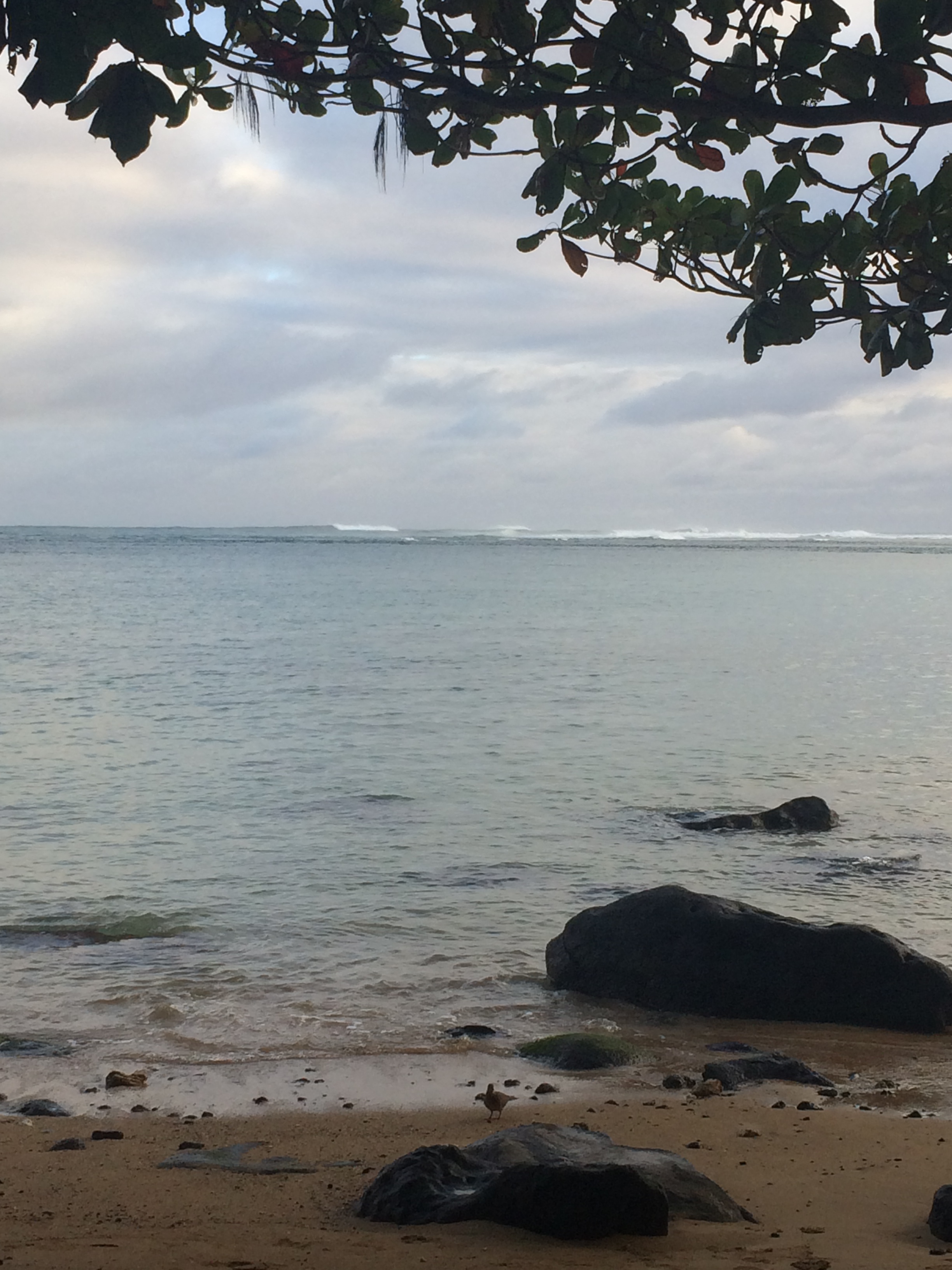
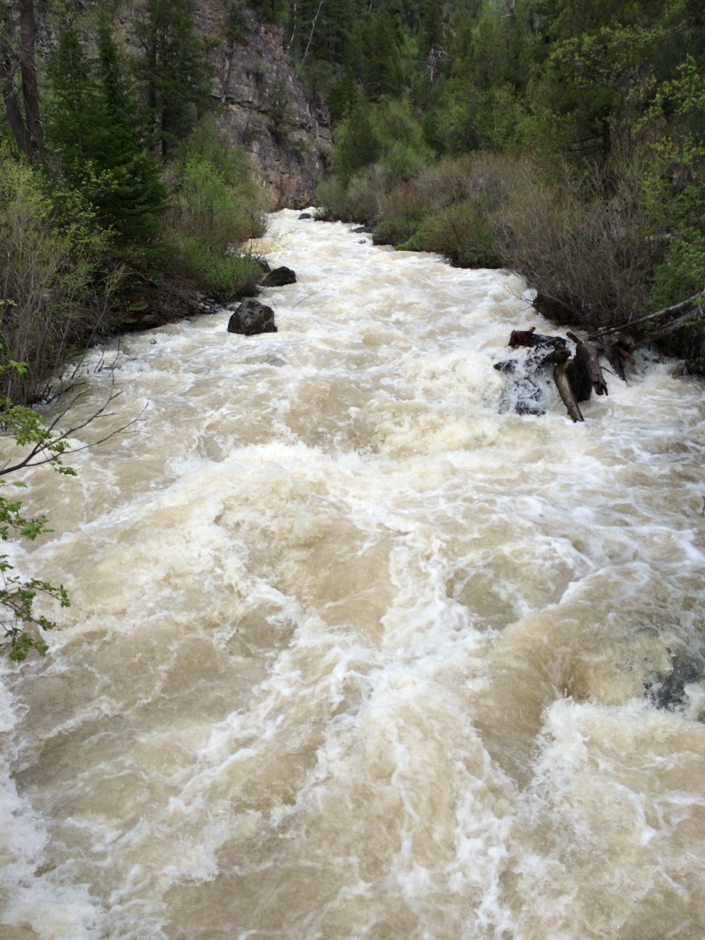
We’re at the Falls now. The Waipo’o Falls:

IMG_0058

We all pose for pictures:

Steph and Vic

Steph and Vic

David and Jody

David and Jody

Eric

Eric

Hiking back now

IMG_0067

IMG_0068

Palm trees will grow anywhere

The lone palm tree

The lone palm tree

Time for a beer break. I took a picture of the great tasting organic beer we were drinking – you know, to see if we can find it back in Idaho:

Beer still-life with limbs

Beer still-life with limbs

Anyway, good thing we took a break, because we had a steep climb ahead of us.
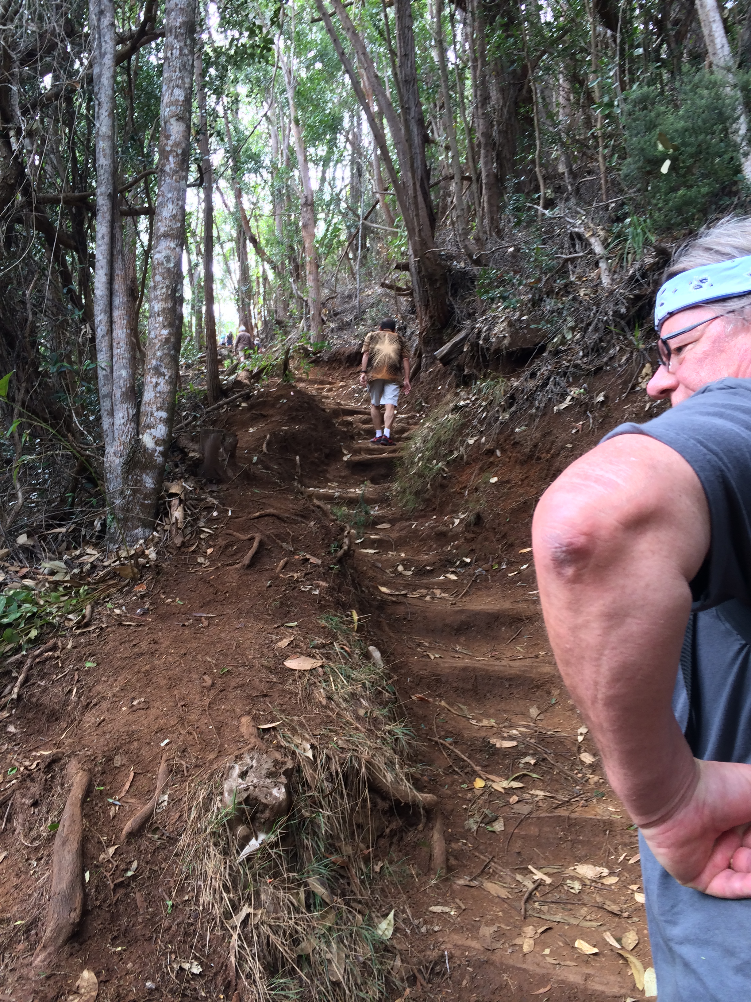
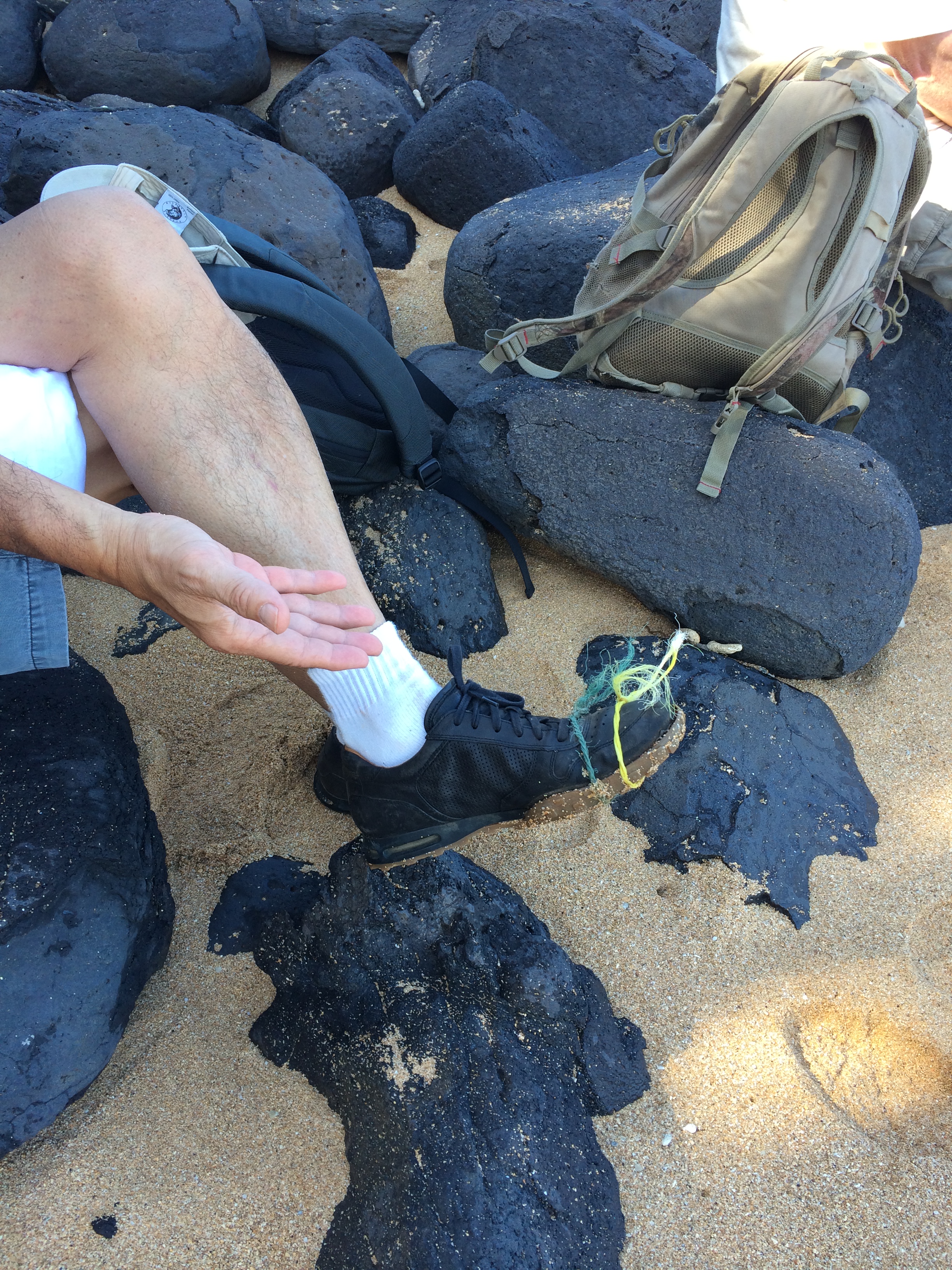
Elbow close-up

Elbow close-up

We’re back out now. None of the tourists that enjoyed the hike during the same time we did jumped, dove, or broke off the edge of the trail into the canyon.

We stopped for lunch at the only place in this area you can buy lunch: The Koke’e Lodge. Here is a photo of the Lodge from my archives, that I posted in a previous blog:

Near the entrance we were met by the Rooster Brigade:

IMG_0072

No matter. We made it in safely, ordered chili with rice and cornbread all around. Although the food here isn’t all that great, I’m starving. You know, on account of back there at that pit stop at the beginning of the Canyon hike, I flushed yesterday’s boxed leftovers down the toilet. Hehe.

Jungle Hike!

February 8, 2015

One very warm and sunny morning David, Eric and I decided to check out the Jungle Hike in the the center of Kauai where you have great views of Mount Wai’ale’ale and surrounding mountains. We drove south from Princeville down the east side of the island through Kapa’a. Soon we were driving alongside Sleeping Giant:

IMG_9955

Somewhere after Sleeping Giant we took a right turn (I’m such a great tour guide). Eric had gotten us all excited about finding the ‘Gate’ that was in the movie Jurassic Park. To get there you drive on Kuamo’o Road past Opaeka’a Falls then over this spillway (where literally, the river runs right over the road.) And then another spillway … The problem is, it’s a rutty dirt road, full of pot holes.

I was being tossed around like a rag doll in the back seat and not taking photos. But no worry. I just happened to find this you-tube movie that actually takes you over the whole route in a Jeep, over the spillways, through puddles, ruts and potholes (at a very fast speed), through the Gate (!) to the end of the road – with relaxing Hawaiian music playing all the while.

I invite you to click on the link and go for the drive, at least to the 2:15 – minute place (where I took the next photo). Also, for full effect, while you are watching the movie, toss your torso rigorously to the right and then to the left in sycopated beat to the music (the road has deteriorated a bit in the years since this video was taken).

Did you go for the ride? – through the Gate? At the 2:15 point the Jeep slowed almost to a stop and then barrelled around a large puddle. Well, I took a picture at that spot. Because we had stopped – at a pond. I figured there was no way we’d get through it. “Turn around!” I pleaded with Eric and David. They pondered it for a minute. We were not in a 4-wheel drive vehicle, but a rear-wheel drive SUV.

Then David jumped out and waded in to see how deep it was.

IMG_9958

IMG_9960

He set the mud line on his legs up to the SUV to see how high it went: Just beneath the passenger door. We can do it! We all hopped back in, he gunned it and we made it through. Whew!

We parked just below the Gate. There it is ahead!

Jurassic Park Gate

Jurassic Park Gate

Okay, so only the poles are still standing. But at least the gate is open!

Entering Jurassic Park

Entering Jurassic Park

Click on his link for a nice map of the whole route you see in the video leading to the Gate and the Jungle Hike beyond. (Eric, you will love this map!)

Wai ale’ ale’ Map

The Jungle Hike trailhead is a short distance beyond the gate. We are just starting the hike … “Hey, David and Eric! Turn around and pose for a photo!”

So well-trained to pose on command. (No they aren't)

So well-trained to pose on command. (No they aren’t)

Now some photos from the hike:

IMG_9970

IMG_9971

IMG_9973

IMG_9972

IMG_9978

IMG_9979

IMG_9981

IMG_9983

The path is a bit tangled in places

IMG_9985

We’re driving back out now. On the route we meet a spirit guide

IMG_9987

An egret. We met it on the road going in and then coming back, exactly the same way – poised right square in the middle of the road. We would slow way down and practically run him over, when he’d fly off – just to land in the middle of the road ahead of us again.

We made it back just fine. Although I wouldn’t want to be in the rental car business in Kauai.

Kilauea Farmers Market

February 5, 2015

At the local Farmers Markets you can find the most lucious locally grown fresh food. We visited the Farmers Markets both in Hanalei and Kilauea. Here we are, pulling into the Kilauea Farmers Market.

IMG_0151

At 9 am sharp. Right when it opens.

IMG_0169

Along with a throng of other eager shoppers.

IMG_0163

I’m suddenly starving for fresh organic vegetables

IMG_0156

and fresh tumeric, maybe…

IMG_0155

You stand there looking at it, vibing it, and just know intuitively, it’s an extremely healthy and therapeutic plant, er, root. A heavy-duty anti-carcinogenic, for sure. You should seriously buy a heap of it. Except, what do you do with it? Here, I googled it: “what to do with fresh tumeric’ Looks like you prepare and use it as a strong flavoring, much like you would fresh ginger. You might find the link helpful (or maybe Google it yourself) if you want to know more about how to use fresh tumeric root and especially if you think you’d like a recipe for Beef Rendang.

Ah, what have we here? ULU?

IMG_0157

Ditto healthwise on the ULU? So I Googled ULU too (say that five times really fast as a brain exercise – an added health bonus for reading my blog). ULU or ‘breadfruit’ is apparently grown in about 90 countries throughout South and Southeast Asia, the Pacific Ocean, the Caribbean, Central America and Africa. It gets its name from the texture of the cooked fruit, which has a potato-like flavor, similar to freshly baked bread. It is a staple food in many tropical regions. ULU, like potatoes, are roasted, baked, fried or boiled. But, actually, since we hail from Idaho I think I’ll stick with potatoes. At least for now. I believe that’s the first time I’ve seen ULU’s in my entire life.

Eric is carrying our spoils

IMG_0166

What uncanny fashion sense he has. In this case, dressed as though he belongs in the basket.

Victor has home-cooked menus planned, lists made, before we hit the Farmers Market. Then he surprises us at mealtime. Like, with his won ton soup for lunch.

IMG_0101

Wontons stuffed with fresh pork and herbs, in a seasoned broth, garnished with fresh chinese bok choy, green onions and cilantro. (I think. I actually tried to make it myself after our last visit and it was a total disaster.)

But aren’t you getting healthier by the minute just reading this blog? The images alone should increase your vitamin, mineral and antitoxicant, I mean, antioxidant levels. And a brain exercise embedded in the blog to boot!

Yes, so we all need balance in our lives, so of course, we also eat lunch out – at the Kalypso in the center of Hanalei.

David's shadow entering Kalypso

David’s shadow entering Kalypso

The Kalypso is a great place for lunch, especially after dragging your body through a long strenous hike, and you need to shower before you can enter your own kitchen. The Kalypso offers a very special drink, you know, to quench your thirst after a long hike, or short hike, or walk on the beach, sunbathing on the beach, buying post cards, etc. It’s called an Inikki.(I may have spelled this wrong – it’s hard to recollect exactly.) Okay so I did spell it wrong – one of my dear readers sent me a FYI with this link as a hint as to how (and why) the drink is spelled: ‘Iniki’- as in ‘Hurricane Iniki’– a category 4 hurricane with 145 mph winds that hit Kauai September 5, 1992. Iniki was the most powerful hurricane to strike Hawaii in recorded history. Damage on Kauai was the greatest, where more than 1400 houses were destroyed, more than 5,000 damaged, and likely just as many chickens freed that still roam the island today. ‘Iniki’ – meaning, “strong and piercing wind.” We ordered four (plus an organic beer for Steph). Since the presentation was so beautiful I just had to take a picture:

Eric having an ecstacy experience

Eric having an ecstacy experience

Uh, news flash, Eric. Those drinks are for four people. Eric does appear to be deriving indescribable pleasure from his drink – I feel a tinge of guilt depriving him of mine. What? No way! Of course I’m drinking mine!

Usually at breakfast we devoured a fresh fruit plate (compliments of the Farmers Markets and Victor) – fresh pineapple, chinese grapefruit, papaya (picked from Steph and Vic’s tree), rambutan (those red spiny balls). Oh, here’s an example

Still-life of breakfast plates with the burned out LED sidewalk lamps Eric was supposed to fix

Still-life of breakfast plates with the burned out LED sidewalk lamps Eric was supposed to fix

We devour every last morsel.

'Victor depositing the last used napkin"

Victor depositing the last used napkin

We’ve got to beef ourselves up, you know, nourish and strengthen our bodies for the Jungle Hike ahead that Eric has planned for us. Does that sound like a potential death march to you?

Annini Beach, Princeville (Kauai-3)

February 1, 2015

We spent a lot of time in and around Princeville where Steph and Vic own their home. Every morning David, Eric and I walked down to Annini beach, you know, to whip our bodies into shape. The path down to the beach is right next to the Westin Resort, just a short cut across the golf course from Steph and Vic’s house. Here is the entrance to the path:

David starts down

David starts down

It’s hard to capture how steep this walk is – but it’s basically like climbing five stories in about 400 paces. It’s extremely treacherous after a rain. Slip and land on your butt just once to experience in full measure the ‘anger us conditions.’

We’re down now, at the beach.

IMG_0146

There’s a huge sand bar so the waves crash very far out. The first time we came here we waded in and caught some sea cucumbers, which, basically look and act like … cucumbers.

I always trailed behind making it back up. I snapped photos of Eric and David ascending the path above me.

Eric is half way up

Eric is half way up

climbing the other half - back to the top

climbing the other half – back to the top

Whew! Check that one off!

You can hardly navigate Princeville without circling this fountain in the roundabout.

IMG_0214

And spotting Layson albatross either circling overhead, doing their courting dance, or nesting. They tend to return to the same place to nest every year. There are two albatross pairs nesting on Stephanie and Victor’s street. One pair is nesting right in a neighbor’s front garden.

IMG_0217

Albatross bond with a mate for life. Their courtship entails especially elaborate dances that have up to 25 ritualized movements.

IMG_0081

They can’t breed until they are five years old. Both birds incubate the egg – the male does so first. There is a 65-day incubation period and the chick takes about 160 days to fledge. To mate and raise a chick requires a big commitment! Maybe that’s why you see a lot of single Albatross hanging around.

IMG_0209

Looking studly and regal.

Albatross live a long time. The oldest known live bird, a female named Wisdom, is at least 63 years old. She recently hatched a healthy chick, believed to be her 36th (to summarize some of the information in the linked article above).

We always try to earn our keep at Steph and Vic’s house to the best of our ability, you know, stay in their good graces so they might invite us back! Although by our second day here, Eric was already getting us in trouble.

“What’s the deal with those chairs you sent, Eric?”

Eric had sent Victor and Steph two antique dining chairs from his store back in Idaho and promised Victor they would arrive the same day (or before) we did – He had shipped them in a single box. Well, they didn’t arrive; not yesterday and … not today either. “You have spider duty, Eric, if they don’t arrive soon.” Victor tells him.

Oh wait! A package has arrived!

IMG_9889

“Is this the chairs, Eric? You just add water to expand them to normal size?”

Two more packages arrive. No chairs.

Victor is also unhappy about a certain detail concerning the antique round oak table Eric had sent two years back. It pulled apart to add leaves but one edge of the seam down the middle stuck up about 1/16th of an inch – it was annoying, and Eric had worked on it last year and declared it fixed.

“The edge is still sticking up Eric.”

Eric fiddled with it. Unscrewing screws underneath, screwing them back in. Adjusting this and that. Finally David, being a physicist, volunteered his expertise.

two hunky dudes

two hunky dudes

Voila! Table fixed.

The chairs did finally arrive. They worked out great.

Eric got out of spider duty. But he had to install the new birdfeeder. Fill it with organic birdfeed.

IMG_9893

Then work on it again to straighten it.

IMG_0202

The birds caught on really fast – “Hey, new hot spot open for lunch!”

Happy birds

Happy birds

Happy birds make happy Steph and Victor. Happy Steph and Victor makes happy world. Jody, David and Eric’s world: Incredibly happy.

I sneak in to capture a picture of the masses of happy birds, including those gathered on the ground around the feeder.

IMG_0193

Oops. No worry. Within 60 seconds they’re all back and everything is happy again.

So ends another day in Paradise.

IMG_0211

Life is good.

Okolehao Trail (Kauai-Part 2)

January 29, 2015

“De Plane, De Plane!”

IMG_9901

As Mr. Roarke from Fantasy Island would say in his suave Mexican accent, “I believe that is the mountain plateau the plane flies alongside to land in Fantasy Island.”

“Smiles everyone. Smiles!”

IMG_9896

You call that a smile Eric?

Okay so we’re gasping. It’s our first hike – on the morning of our first full day in Kauai – and we’re ascending the Okolehao trail. (Why hadn’t I whipped myself into better physical shape for this trip?)

Stephanie settles against a banyan tree

IMG_9900

We got there though. Here we are on a high plateau.

IMG_9905

My brain has implanted itself on my t-shirt.

Another view:

IMG_9903

You are looking at Hanalei Bay on the north shore of Kauai. To get to the trailhead from Princeville you make an immediate left after crossing the Hanalei bridge. Then you drive about a mile and it’s right there. You know, in case you’re in the area of Princeville. Here is a nice link with more photos and information about the Okolehao trail.

David is leading the way down now

IMG_9908

The rest of us are attempting to follow

IMG_9909

On the way back we meet a fiddlehead.

IMG_9911

A furled frond of a young fawn, I mean fern.

We also come upon a very shy plant – a miniature dark seafoam green cousin of the fern maybe?

IMG_0133

Nestled amongst the grasses. It likes to disguise itself as other ferns and vice versa. We don’t really understand this plant; it becomes very closed up and withdrawn when you touch it. Here – in this video you see David touching the leaves:


Does the plant suffer from some sort of reactive detachment anxiety? Is it a carnivore? Maybe a form of Venus fly trap too gentle to capture anything? I Googled “plant in Kauai that folds up when you touch it” and it came right up. It’s called mimosa pudica. Scientists think the plant uses its ability to shrink as a defense from herbivores. Animals may be afraid of a fast moving plant and would rather eat a less active one. (For sure.) Another possible explanation is that the sudden movement dislodges harmful insects (and most certainly scares the crap out of them).

In Kauai the plant is known as the hila-hila plant. Other common names include tickle-me-plant, humble plant, touch-me-not, shameful plant, sensitive plant, ant plant… It is native to South America and Central America but has been introduced to many other regions and is regarded as an invasive species in Tanzania, South Asia and South East Asia and many Pacific Islands. In the USA, it grows in Florida, Hawaii, Virginia, Maryland, Puerto Rico, Texas, and the Virgin Islands.

In other words, you’re probably already familiar with it.

Mimosa pudica protects itself from humans eating it too. I’m not inclined to eat a fast moving salad. I’d rather eat a less active one. Especially after drinking one of Victor’s killer Margaritas.

We’re Baaaack!

January 25, 2015

IMG_9885

What the heck is this, Jody? You fancy yourself some high falutin’ crappy aerial photographer now?

Why yes!, I mean no. I just thought you’d like to come along with us (David, me and my brother Eric) on another trip to Paradise. Pinch yourself! You are now flying over south San Francisco. Why that must be the Golden Gate Bridge ahead!

IMG_9886

Okay so it isn’t the Golden Gate bridge. It’s just some other crappy bridge. Well, snap on your neck pillows, don your eye patches, shove in your ear plugs (or not – but they sure help insulate you from the high-pitched engine noise) – settle yourself in for the five-hour flight to Lihue, Kauai!

Thursday, January 8, 2015, 1PM- we have just landed in Lihue, and are headed up to Princeville – on the northern shore of the Garden Isle – for our 10-day visit with Steph and Victor.

ALOHA, KAUAI!

Not again, you say? NO!! PEOPLE ARE SICK of hearing about our wonderful stupid trips to Paradise. Plus, once I get started I just blog on endlessly. I know. I was telling myself this. I AM NOT BLOGGING. Until … we were back on Larsen’s Beach, had prodded Eric and David past the nude bathers, and came upon a Monk seal napping on the shore

IMG_9928

Then Eric cozied up to a new scaly, thick skinned companion.

IMG_9934

who could likely whip around and bite his head off (don’t piss her off, Eric). Was she laying eggs or something? Why else would the sea turtle be resting up on the sand?

The beach was beautiful

IMG_9930

not a cloud in the sky that day.

We walked to the end of Pakala point – and picnicked by the arch

IMG_9938

Coming back we saw Nene Geese – the Kauai state bird:

IMG_9939

An endangered species. We spotted many more Nene geese in the wilds this year than last, very encouraging.

We climbed over that hill and came across an Albatross Nesting area – I caught this photo of a nesting albatross

IMG_9936

Pretty soon Victor’s shoe started acting up.

The talking shoe

The talking shoe

Like, really complaining.

Eric and David were on it.

Manly men

Manly men

We stumbled right into a pile of fishing rigging that had washed ashore.

IMG_9942

Eric started operating

IMG_9943

We all stepped in to help

Still life with feet

Still life with feet

Fine result!

IMG_9947

Victor’s new look:

Highly paid consultant

Highly paid consultant

Of course the shoe was complaining again before we made it back.

For those with an artist’s bent, here is a still life for you, you know, maybe you can paint it:

Beer with sweaty balls

Beer with sweaty balls

Eric says the rigging is likely Japanese, although I can’t say that that mangled up pile looks particularly Japanese – I guess you’ll have to ask Eric.

Well, to conclude, that evening we’re on the patio at St. Regis.

Eric and Victor

Eric and Victor

Watching the sunset.

IMG_9953

IMG_9954

I dunno. Should I continue with these blogs?

“How many more amateur I-phone photos do you have of this 10-day trip, Jody?”

Boy I’m glad you asked!

St. George – and south to north across Utah – at 82 mph

September 20, 2014

It’s Friday, September 12, 2014, our last day in southern Utah. In the nature of true tourists we decide to do a walking tour of the historic district in the center of St. George, starting with a guided tour of Brigham Young’s winter residence (his primary residence was in Salt Lake City). Brigham Young was the second President of the LDS church. He led followers from Missouri west to the Salt Lake Valley after Joseph Smith (the founder) was arrested and killed by an armed mob. Brigham Young was the most famous polygamist of the early LDS Church. As you can see, his winter home was modest in size

IMG_9129

with a bedroom for him, a bedroom for his ‘wife’, and another bedroom for his ‘cook’ (one had to wonder where any or some of his additional 54 wives would have stayed??). By the time of his death on August 29, 1877, at the age of 76, Young had 57 children by 16 of his wives – 19 of his wives had predeceased him, he was divorced from 10, and 23 survived him. (Check out this link to learn more about Brigham Young.) Our tour guide explained that Brigham Young oversaw the building of the LDS Temple in St. George, which was barely completed before his death in 1877. (It was the first temple built in Utah.) Brigham Young had expressed his disappointment over the size of the original spire – it was too small in relation to the size of the temple. A few years after his death, as the story goes, lightening struck the spire down and they rebuilt it to the current size it is today.

We continued our walking tour to the town square, past several interesting bronze sculptures. Megan gives this very bronze young girl

IMG_9131

a ‘high-five.’

“Hey – Look!!” (I do a double-take…)

IMG_9134

“It’s my long-lost brother!”

We eat lunch at the Painted Pony, a charming restaurant in Ancestor Square. Verses, such as this one, are carved into the tabletops:

IMG_9137

When the going gets tough, the smart get lost. Yeah. (Sigh)

Well, that’s about it with the tour. The daytime temperatures soared into the upper 90’s. We were done with our walking tour.

Saturday morning – September 13 – we hit the road at 9am for the 513-mile drive back to Idaho Falls. Boy, are we anxious to be home. David takes Red Rock Road through St. George – it runs along a high red bluff that overlooks the city. I snap a couple of photos.

IMG_9141

The Temple stands square in the middle of the city.

IMG_9143

(Geez. Why didn’t we think to ride up in a hot air balloon?) Soon the city disappears behind us.

Heading north on I-15 now. Speed limit – 80 – (how fast can you get away with?) David sets the cruise control at 82.

IMG_9145

We sail past the exits to Hurricane, Toquerville, New Harmony, Kanarraville, Beaver… (How did they come up with these names?)

Through Payson:

IMG_9155

… home of a very large Temple.

“Ben!! Are you there?”

IMG_9157

Past American Fork:

IMG_9161

The traffic is solid now – four lanes all barrelling along in tandem at 82 mph. It’s about impossible to capture a picture of Salt Lake City as we sail past, hardly slowing our pace, but I give it a whirl.

IMG_9167

That’s the best you can do? You ask.

Yep. If you look carefully you can see the Capitol building (toward the left in the picture) and the spires of the Salt Lake Temple poking up (next to those twin towers).

We’re zooming along – north of Salt Lake now, there – you see the Layton Temple coming into view!

IMG_9170

IMG_9172

Uh, never mind…

Brigham City!

IMG_9174

“No, Jody. Stop it.” I know – it just strikes me funny. My eyes are on the lookout for temples now and they sure are finding them. ( NOT! ) Recalibrating…

We see the exit to Plymouth – then spot the whole town off to the right – nestled at the base of that mountain:

IMG_9184

Then a neighboring community off to the left – the town of Portage:

IMG_9185

“Hey Megan, you wanna live in that house?”:

IMG_9196

“NO, MOM.”

We sail across the border into Idaho now.

IMG_9186

Hey, so the sign is blurry – Whatdoyaexpect? It’s flying at me at …

IMG_9201

Yep – 80+ in Idaho too. (Can anyone really keep it at 80?)

At 2:20 – after being glued to our seats for four hours and twenty minutes, we make a 12-minute pit stop. You can pull this off in Malad, Idaho, where there’s gas, bathrooms and Burger King all in one building. David gasses the car up, while Megan and I jet to the ladies’ room. Then Megan and I order food, while David uses the restroom: “Double burger, ketchup only, and 2 whoppers, hold the pickles.” I further explained to the young introverted employee behind the register: “Megan likes her hamburgers with only ketchup, we want the 2 Whoppers with everything but pickles. Got that?”

“Yep.”

David joins us as we grab the bag of burgers, jet back to the car, fasten ourselves in – he’s pulling out again while I get out the burgers – I hand Megan her burger in the back seat. Then I pull out ours. Geez they feel awfully thin…

I unwrap David’s burger:

IMG_9187

“What??”

“What did you order?” He inquires from behind the wheel, as we swirl back toward the freeway.

“I said, hold the pickles!” I holler back.

“TAKE OFF THE PICKLES!”

“Okay, honey.” Now I have extra pickles for my whopper, making it hands down the ugliest whopper you could ever encounter:

IMG_9188

“I’m not eating this.” I shove the thing in the trash bag at my feet. And sulk in silence as David reluctantly knaws on his dry bun and meat patty to suppress the growls in his stomach.

A few minutes pass and I turn to David with a revelation:

“Maybe God is punishing me for being such a heathen.”

“No. God is saving you from eating Burger King.”

(What do you think?)

We’re passing through Pocatello now:

IMG_9199

(Beats me.)

Pulled into our garage in Idaho Falls at 4:00 PM. We covered the 513 miles in 7 hours, for an average of 74 mph – you know, because of that 12-minute pit stop.

Zion National Park

September 14, 2014

Last week we traveled down to southern Utah to visit Zion National Park. From Idaho Falls it’s about 500 miles straight south. We stayed in St. George for several nights and visited the park on Thursday, September 11. – ‘9-11’ – We saw a lot of American flags at half-mast.

We’re on Highway 9, close to the park entrance now.

IMG_9090

Visitors used to travel by car to the points of interest along the Zion Canyon Scenic Drive. But because of the crush of traffic, in the year 2000 a shuttle service was implemented. Now you park near the Visitor’s Center and catch one of the many shuttles that give you a guided tour with several stops. You can pick and choose where and when you want to get off the shuttle, and which trails you want explore. (Leave your pets at home if you want to ride the shuttles, by the way.) Here’s a photo of the map with the shuttle routes:

IMG_9210

Shuttles arrive at each stop about every 12 minutes – round trip to the last stop and back to the Visitor’s Center takes about 60 minutes. Easy!

We decided to ride the shuttle to the last stop – the Temple of Sinawava – and work our way back – Here we are on the hike. It’s about impossible to capture the magnificent rock cliffs with an I-phone camera, but I give it a whirl:

IMG_9095

That’s David ahead – with the backpack. You can see the walk is paved – many of the trails and all the shuttles are wheelchair friendly.

There are signs posted everywhere: “Do not feed the wildlife.” Okay, okay… But then we run into this squirrel perched up on a fence post alongside the path. He stops several tourists in their tracks. Including me. Look at him!

IMG_9094

Posing for photos, pouring on the charm; one tourist actually reached over and scratched him on the head. (Stupid tourist.)
We can’t feed him? Are you kidding? Awwwwww. Look how fat he is.

A few steps further and another throng of tourists are stopped in their tracks. Oh, no big deal. Just a really big, thick, hairy, creeping ….

IMG_9093

Tarantula? You’re kidding! In these parts? There was a ranger beside him on the path, specifically to give the tarantula safe passage across the walk. Turns out, it’s mating season for tarantulas, as the ranger explains. This is a male, probably 8 or 9 years old. He has been hanging out in his hole all these past years, molting, maturing, and now that he has finally reached full maturity he has crawled out of his hole to mate. Over the next month he hopes to get ‘lucky’ about 4 times, that is, lucky enough to mate without getting devoured by any of the females he gets lucky with. Soon after he’s done mating, he dies (of exhaustion, one would presume). I Googled tarantulas to verify the ranger’s facts – here’s a link, and an additional link, if you want to read more about tarantulas.

They are actually quite gentle and peace loving critters who are only interested in injecting their venom into beetles, grasshoppers, caterpillars, cicadas and other things tarantulas eat. The venom liquefies the insides of these creatures, concocting a tasty ‘bug soup’. YUM! Although if provoked enough, tarantulas will bite humans, but the bite hurts less than a bee sting and poses no serious hazard. This is why they make such great pets (yeah, right). Females make the best pets, as they can live up to 25 years while males live about ten years. You go, girls!

David was interested in a much more strenuous hike than Megan and I (you go, girls!) so he got off and we rode on to the next stop. I took a picture of the map of the area so I can show you how cool and accommodating this worked out for all of us.

IMG_9096

The destination was the Emerald pools – David got off at the Grotto stop and hiked the upper Kayenta trail, while Megan and I got off at the Zion Lodge, took a bathroom break, sat and shared a big fat chocolate muffin, and a beverage, took a photo….

IMG_9098

then moseyed over to the lower Kayenta trail…. where, sure enough, we very quickly met David. Meanwhile, David had encountered a, uh, 30″ rattlesnake along the upper trail- who slivered away before he got a really good picture. (What? I would have gotten the picture for sure, come hell or high water, and likewise, been bitten and nearly dead by now, so it’s a good thing Megan and I opted for ‘plan B’.)

I took a video of the scenery on the hike to the Emerald pools.

It’s just about impossible to capture the scenery in photos – but I’ll post the best of what I took:

IMG_9103

IMG_9099

IMG_9102

It was difficult to capture the Emerald Pool in a photo, here is my best effort:

IMG_9104

The Virgin River is still flowing fast and muddy today, two days after the biggest rain they’d had in this area in 30 years, associated with tropical storm Norbet. (check out this link). The park was closed this past Tuesday due to flooding and debis on the roads.

IMG_9107

I took one last short video of the rock formations while waiting for the bus back to the Visitors Center.

In our car now, checking out more of the park on the Zion Mount Carmel Highway (pictured on the first map above) –

IMG_9112

crisscrossing up the side of a mountain into a one-mile tunnel carved through the rock –

IMG_9113

and a second, much shorter, tunnel.

IMG_9115

Headed back down again

IMG_9119

IMG_9121

IMG_9122

IMG_9123

One last shot of the peaks as we head out of the park back to St. George.

IMG_9128

We have one more day left in St. George before we hit the road back home to Idaho. David drove like a bat out of hell to get us home and I captured photos through the buggy windows from the front passenger’s seat as the scenery flew by. (Hey, that’s how we roll.) You’re just chomping at the bit to see my next blog aren’t you?

No?

Palisades Creek

June 1, 2014

One of my favorite hikes in southeast Idaho is Palisades Creek. We try to do it at least once a year. The hike is about an hour’s drive from Idaho Falls on Highway 26 toward Jackson, Wyoming.

It’s Wednesday, mid-morning, May 28 – and David and I are on our way.

IMG_7986

We figure the whole trip should take about 7 hours.

Dropping into Swan Valley now:

IMG_7988

The turnoff to the Palisades Creek hike is about 10 miles beyond Swan Valley.

A couple miles beyond Swan Valley we sail right past an eagle’s nest – but then realize there was some activity in it. “Hey, turn around!”

IMG_7989

Eagles are circling overhead, hunting for prey.

IMG_7991

There’s an eaglet in the nest!

IMG_7994

The turnoff to the hike is on Highway 26 directly across from the Palisades Lodge. You can’t miss it! We’ve just turned off and will soon be parked at the trailhead:

IMG_7996

IMG_7997

We’re on the trail now. David explains to me, “It’s four miles to the lower lake, and it should take us about 2 1/2 hours to get there, if we keep a steady pace.” He jets off in the lead.

IMG_8001

Right off the bat, we pass this sign:

IMG_7999

“Bear attack?” I don’t ever remember worrying about bears on this trail. We’ve seen moose before, and I know to watch on the cliffs for mountain goats, but … bears? Okay, so carry bear spray, avoid hiking alone, don’t run … yeah, okay.

My goodness! Wildflowers have sprung everywhere along the trail. Of course, I can’t photograph every species, but I try:

IMG_8027

IMG_8011

IMG_8012

IMG_8014

IMG_8018

IMG_8015

IMG_8022

Hey, wait a minute! Those aren’t flowers! Wha..?

IMG_8023

EWWWWW! (as Jimmy Fallon would say). Tent worms!

Yes, turns out, there’s an abundance of tent worms. Oh how special. They’re hatching!

For your enjoyment, and to share this special event with you, I took these next two action videos. They do have musical soundtracks, well, virtual soundtracks – you’ll have to play them in your head yourself – (since I lack the technological expertise to actually upload the soundtracks onto the videos).

The musical sound track to this first video is “Gimme Some Lovin'” the 1966 smash hit compliments of the Spencer Davis Group. (What? You weren’t born yet in 1966? Oh. Huh? Your parents weren’t born yet either?)

Here we go – Get it going in your head:

“Gimme gimme some lovin’ (gimme some lovin) Gimme, gimme some lovin’ (gimme some lovin), Ev-er-y day – ba ba ba ba boom”

Turn up the sound! (in your head):

Gimme gimme some lovin’….

Are you totally groovin’ with the tent worms, or what?

Okay, retune your heads! This next video rocks to the 1962 debut hit, “Locomotion.”

Get it goin’!-

“Everybody’s doin’ a brand new dance now, come on baby do the locomotion…”

“So come on, come on, and do the locomotion with me – Ooooooo-oo- ooo- ooo- ooo – ooo”

“Enough with the friggin’ tent worms, already.” you say?

Okay.

Guess I sorta got off track with that “keeping a steady pace” thing we were supposed to be doing – taking all these photos and videos. Where’s David? I pick up my pace to catch up but he is no where in sight:

IMG_8060

I would have greeted numerous other hikers on the trail with gusto and gladness. But, so far, there are none – aside from the couple we met coming out as we started up the trail. I keep hearing something behind me, a rustling in the bushes, or something. I turn around to look – nope – no one behind me. Could the sounds I’m hearing be from the sloshing water bottle in my back pack? Or could there be a bear or something off in the brush? Something stalking me, ready to pounce? Geez, where’s David? Uh, let’s see now, what am I supposed to do if I perchance encounter a bear? Don’t be alone, for starters.(Great.) Carry bear spray (the last thing on my shopping list, like, it wasn’t even on my shopping list…) Don’t run. Don’t climb a tree (that one came to me of my own brilliance), don’t make eye contact (are you kidding?), make noise. “ROAR!” But if you don’t scare the bear and he charges after you, then … stop, drop, and roll! No, that’s not it … PLAY DEAD, if you aren’t already. AAAAWWLLLGG! I could get eaten by a bear right here on the spot and David wouldn’t even know, since, how far ahead is he?

I raced forward on the trail, not altogether convinced the only thing chasing me was my water bottle. Finally, with great relief, I did catch up with David.

IMG_8032

Peering at mountain goats through his binoculars. There was a pair of them clomping (one would guess) around on the cliffs above. We both looked at them through the binoculars. Quickfooted, they soon disappeared from sight. I took a video of the cliffs from where we were standing:

That’s the Palisades creek raging by. It empties into the south fork of the Snake River. We follow it almost the whole distance to the lower lake.

We’ve been gaining in elevation.

IMG_8066

David keeps gaining distance on me, period,

IMG_8039

although I argue that with his long legs – I have to take four steps to his three.

We are now traversing pools of water along the path

IMG_8067

and Palisades creek is over-running its banks.

IMG_8082

Our path is also a creek running parallel.

IMG_8080

We cross the roiling creek several times over solid, well-built, bridges. I am standing on a bridge now to take this photo:

IMG_8083

Then this video:

We’re guessing that the creek hasn’t peaked yet. There is still quite a bit of snow on the peaks.

We are near Lower Palisades lake now. Wow. A string of fresh horse manure!

IMG_8123

Now that’s a hopeful sight! Maybe some folks are camping on the lake – rode up the trail on horses packing in all their camping equipment – that sure is the way to go!

Nope. We’ve arrived at lower Palisades lake now, greeted by a very large empty campsite. We have it all to ourselves, and …

From Jackpot to the Magic Valley

April 27, 2014

You probably aren’t panicked about this, or anything, but I never got us (David, Eric, and I) safely home from our weekend get-away to the City of Rocks two weekends (and two blogs) ago. You’ve been worried, haven’t you? No? I do have a few more photos to share, granted, it has occurred to me that, given modern technology, smart phones, and the like – just about every other Joe Blow on earth has photos to share, too. Yeah, but do they have THIS photo:

IMG_7604

of us entering Jackpot, Nevada, a gambling town in northern Nevada sitting on Highway 93 about a mile south of the Idaho border.

Jackpot, Nevada, middle of no-where. Population: 1200 – of which, save a few stragglers out on the nearby golfcourse, I’ve likely about captured the entire population in this photo.

That tall tower on the left is Cactus Pete’s Hotel and Casino and off to the right is the Horseshoe Inn and Casino (owned by Cactus Pete’s). Otherwise you can stay at the West Star Resort on Poker Street or the Four Jacks Hotel a bit further south on Highway 93.

We had reserved a room at the Horseshoe for Saturday night (April 12) on account of to consider this a ‘weekend’ get-away we had to be away at least one more night. Jackpot is about two hours south of the City of Rocks. Cactus Pete’s brings in respectable entertainment from time to time, too, and I was game to see a show. Eric and David were game too – for about any show, really. Oh WOW! The Chippendales 25th Year Anniversary Show is in town! – an all-macho-male erotica troupe of ten hunky guys putting on a big sexy strip show! Check out the link here. (Great photos! You could piece them together for your own virtual show. Gr-oww-lll!!!)

“The Chippendales dancers’ distinctive upper body costumes include a bow tie and shirt cuffs worn on an otherwise bare torso.” Whoopee! “Established in 1979, Chippendales was the first all-male stripping troupe to make a business performing for mostly female audiences. Through the quality of its staging and choreography, Chippendales also helped legitimize stripping as a form of popular entertainment.”

“We’re not going.” Declared Eric and David.

“AWWWWWWW.”

They played poker instead, which was fine with me. I was exhausted anyway, from all that hiking in the City of Rocks we did earlier today, and I fell straight into bed after dinner. As for Eric and David’s success at the Poker tables, let me just say, they were both back in the room before midnight and neither one are furthering their fantasies about quitting their day jobs and becoming professional poker players.

It’s Sunday morning now, and we’ve hit the road north back toward Idaho Falls, through Twin Falls, or the area known in Idaho as the “Magic Valley.” It’s magic all right, with the smell of concentrated cow manure strong enough to burn out the insides of your nostrils. We must have passed about five enormous cattle feedlot operations. I tried to just ignore them at first but finally snapped a photo of one.

IMG_7601

In these operations the cattle are fenced in – in a big mud-shit hole (surrounded in the fenced area by huge mounds of collected manure) and the rancher just sets the hay bales along the outside perimeter of the fence – with holes in the fence barely large enough for the cows to stick their heads through to get the hay. We passed the largest feedlot you could ever imagine, which was back from the road about a half mile. You could barely see it; we gasped to glimpse the size of it – you could surely smell how large it was. I have now solemnly sworn to serve only pastured beef raised in humane conditions at our house (and I’m sticking to it). The images and smells of those feed lots still make me sad, and sick!

The feedlots aside, (YUCK YUCK YUCK) there is a very magical place in the Magic Valley, Shoshone Falls – a waterfall on the Snake River located about five miles east of Twin Falls. At 212 Feet high and about 900 feet wide, they are known as the Niagra of The West. The Shoshone Falls are actually 45 feet higher than Niagra Falls.

Depending on the volume of water present in the falls it may take on many different forms. When the water is high it will rage over the cliffs in a solid broad wall of water, and drop low enough (depending on time of year and diversion of the Snake River for irrigation) to where three or four delicate streams braid down the nearly dry cliffs. (Check out this great informational link about the Falls)

A park overlooking the waterfall is owned and operated by the City of Twin Falls. Here we are, standing on the overhang checking out the falls and the canyon. I see Eric is wearing his bomber hat and another one of his fashionable t-shirts:

IMG_7620

offering invaluable care-for-the-liver advice.

Here is a picture of the canyon below the falls (taken on Sunday, April 13, 2014.)

IMG_7625

Gorgeous! With a beautiful sky to match.

In 1974 daredevil Evil Knievel attempted to jump the south ridge of the Snake River Canyon – about 2 miles down that canyon from where we are standing.

And here are pictures of the falls:

IMG_7622

IMG_7624

“Braided streams.”

Okay, so today the water level is low and although it’s still beautiful, it’s a bit underwhelming compared to the experience we had here three years ago, June 11, 2011. Granted, we were standing here at the same time the Snake River in Idaho Falls was overflowing its banks, flooding the riverside parks. But hey! We took photos and videos of it then. And I still have them on my i-Phone. Of course. Here they are:

The canyon:

IMG_0648

The Falls:

IMG_0643

IMG_0642

IMG_0640

IMG_0645

My video of the falls:

David’s video of the falls:

And one last shot of a very magnificent rainbow.

IMG_0639

Yeah. The ‘Magic Valley’ in south cental Idaho. You really gotta see it to believe it.