Archive for the ‘Idaho’ Category

April Skies, Moonscapes and Albino Rock Stars

May 3, 2014

IMG_7608

“Uh, let me guess … you’re still blogging about your April 11-13 weekend get-away.”

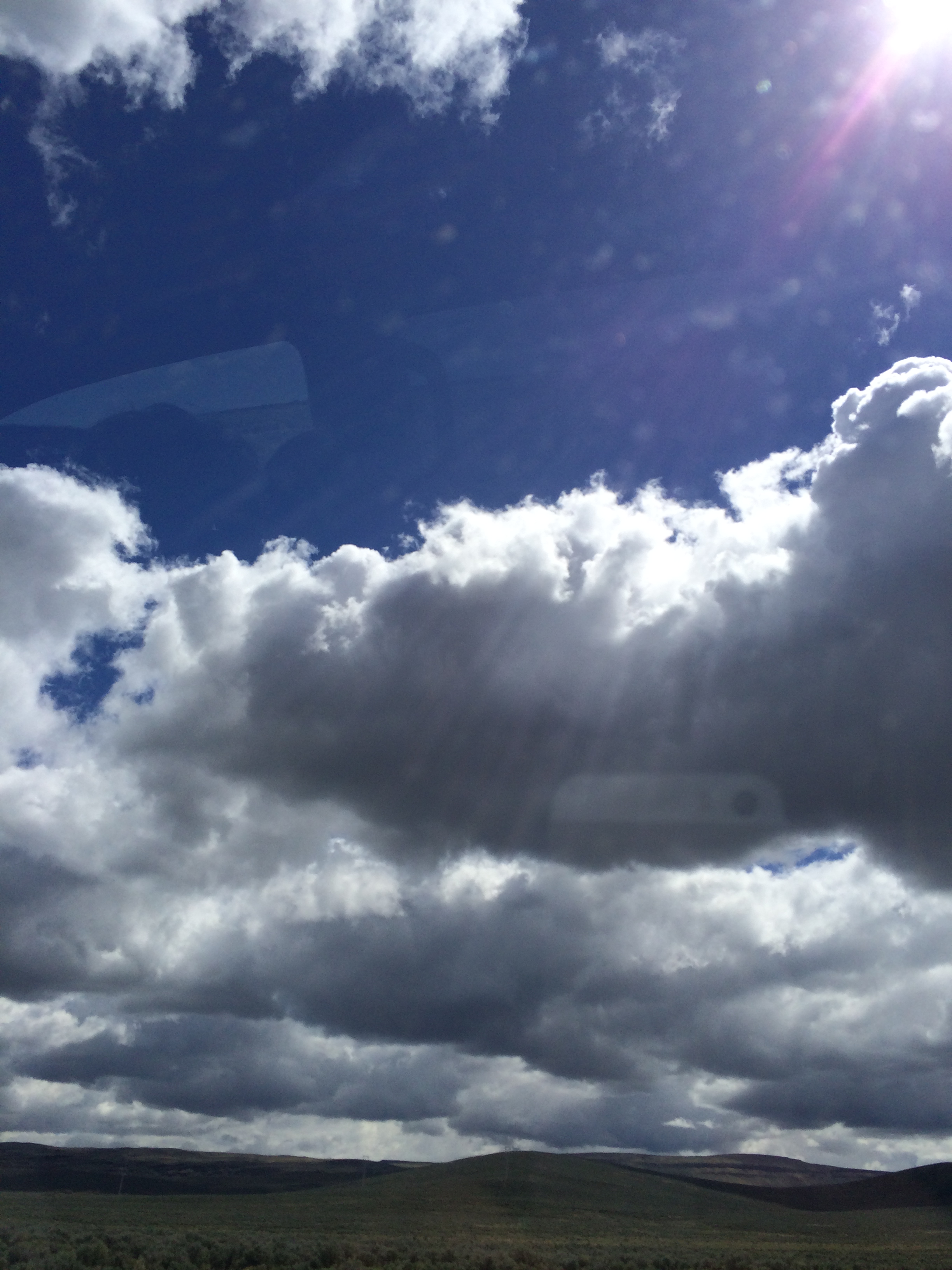
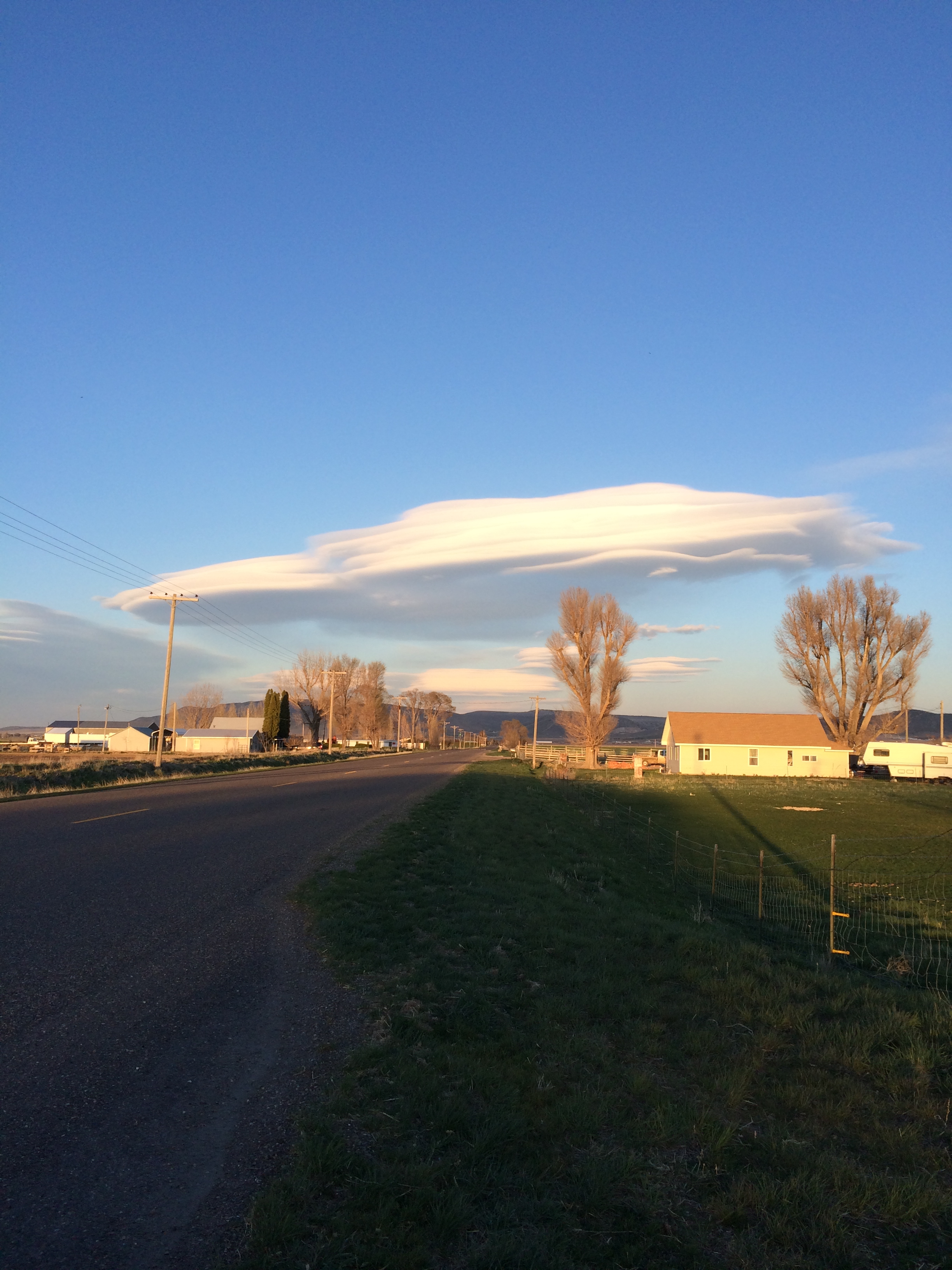
Why, yes!! Could I really NOT share my photos of Idaho’s magnificent April skies?

IMG_7628

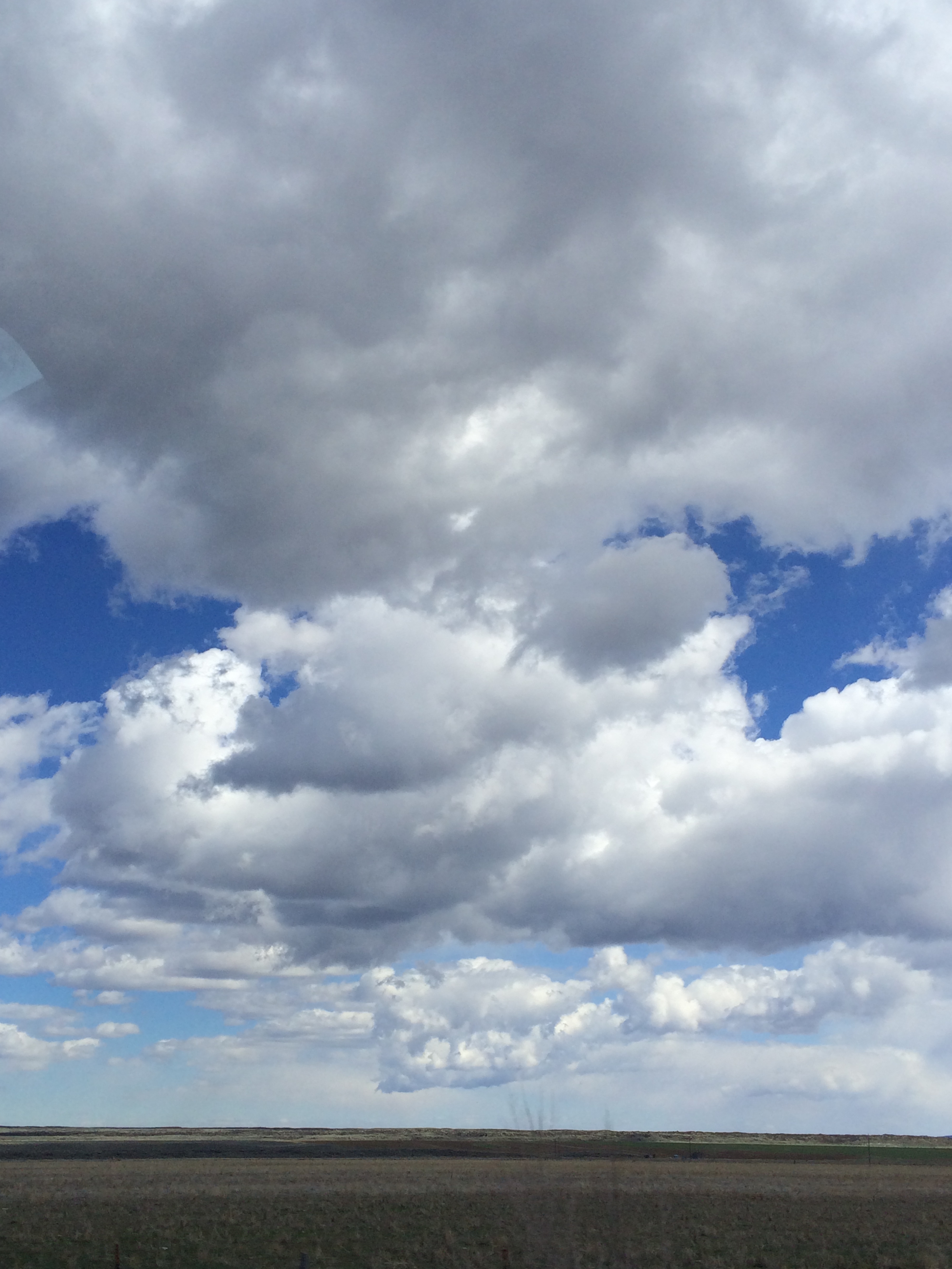
Behold divine inspiration and energy exploding before your eyes.

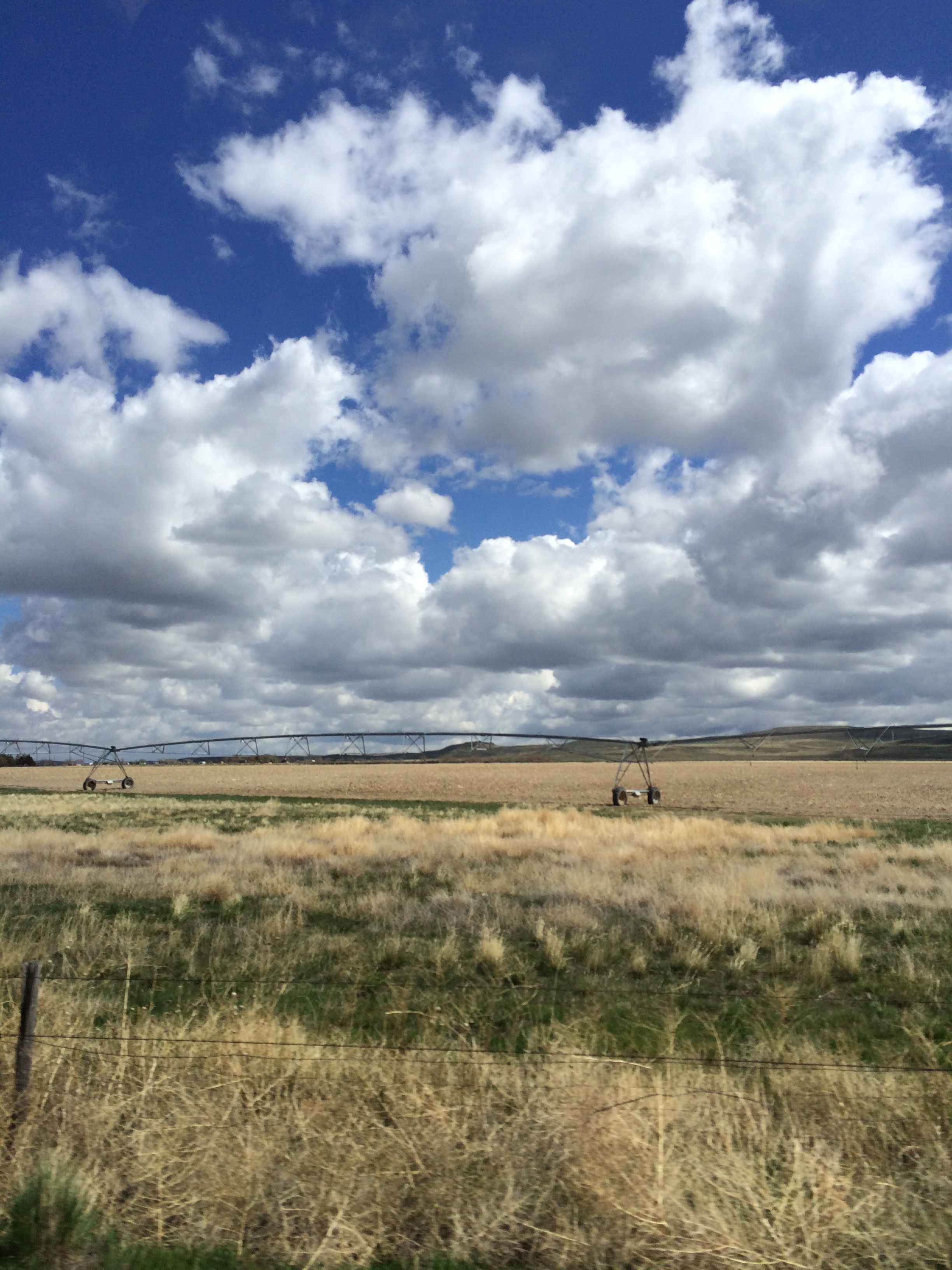
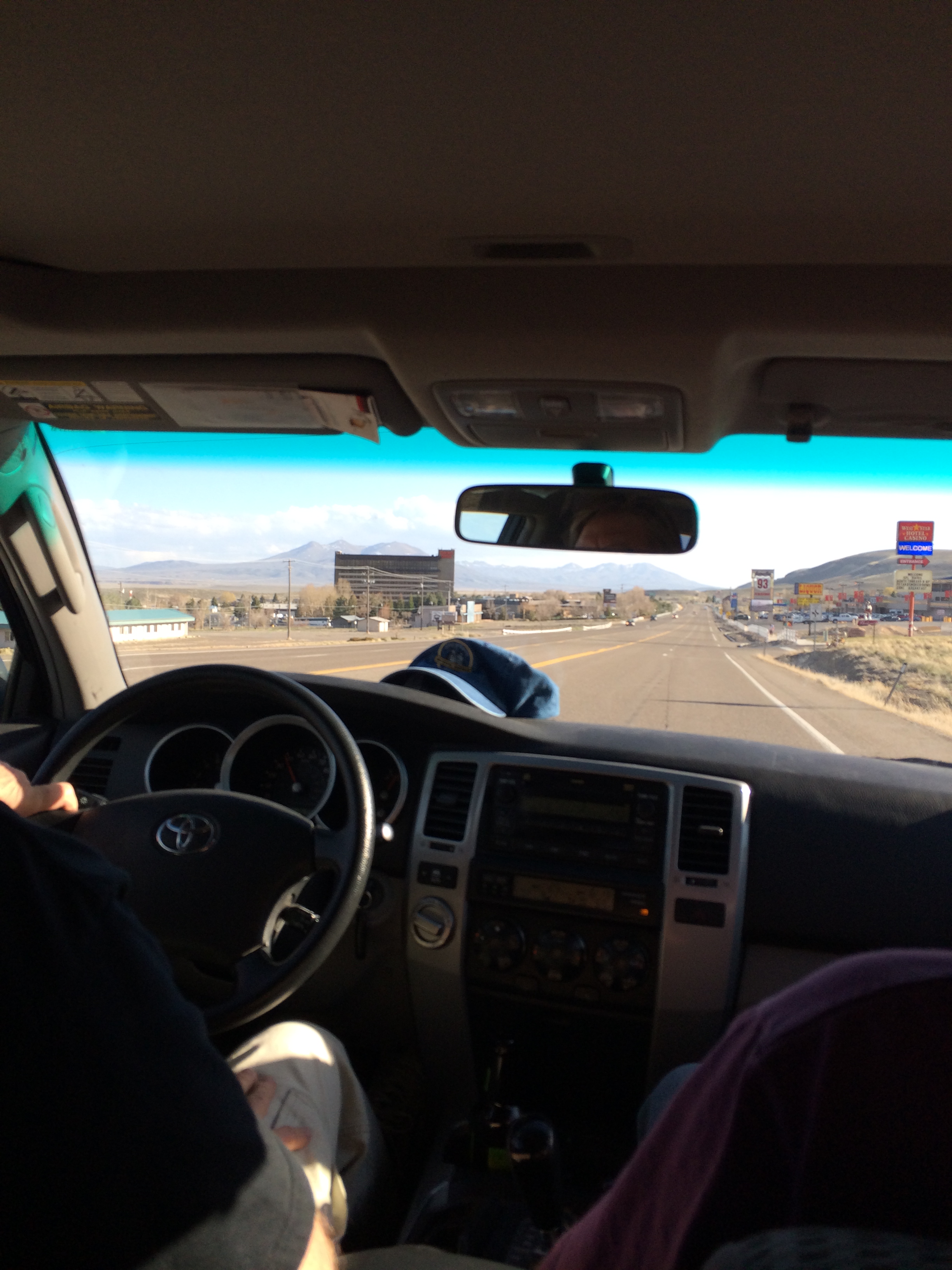
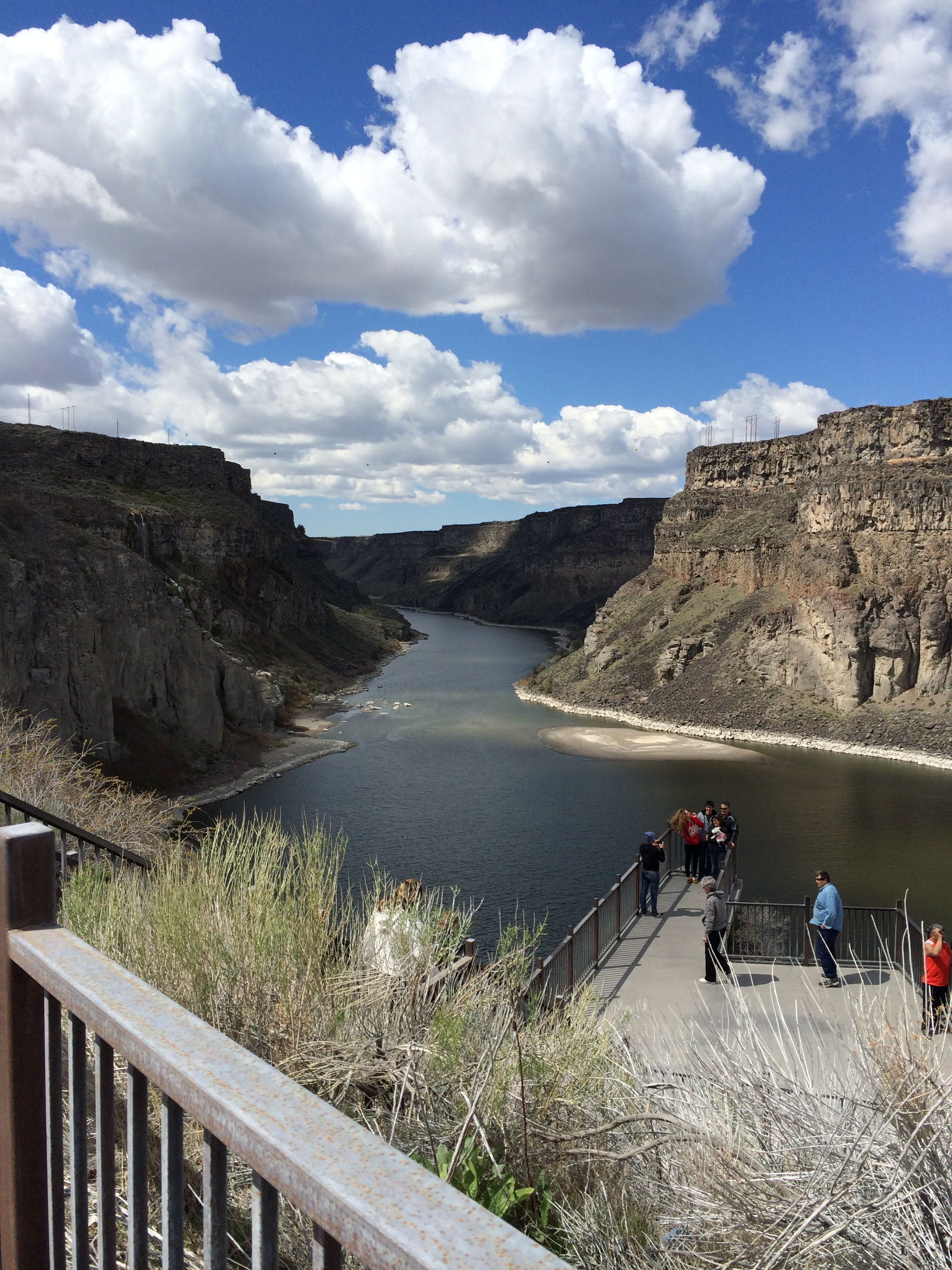
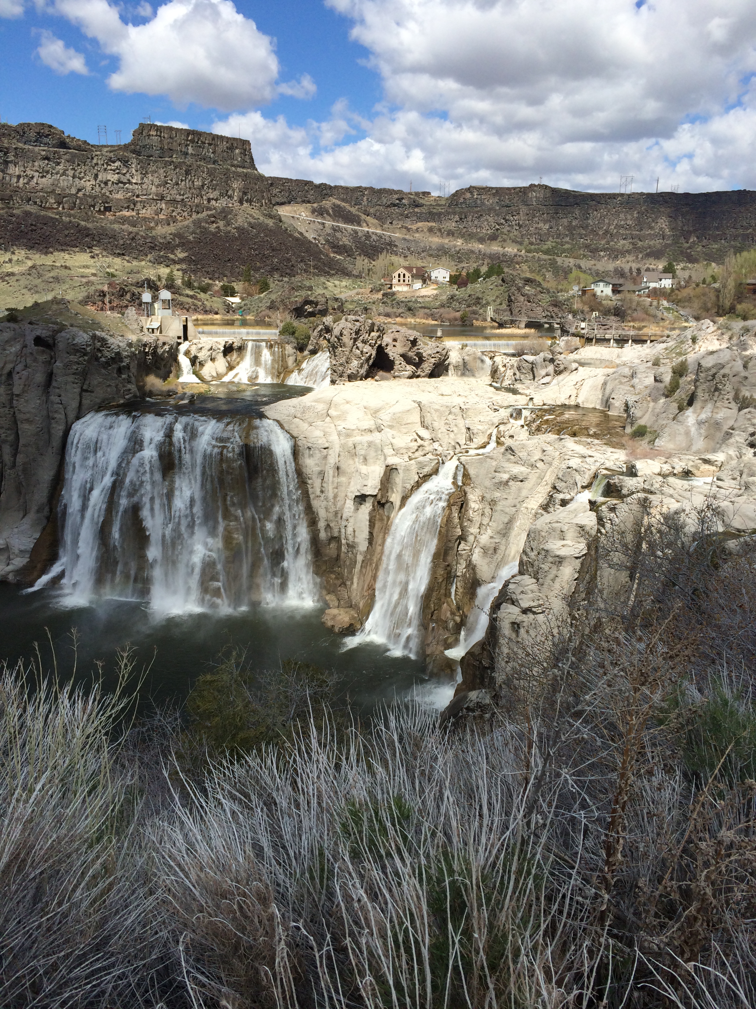
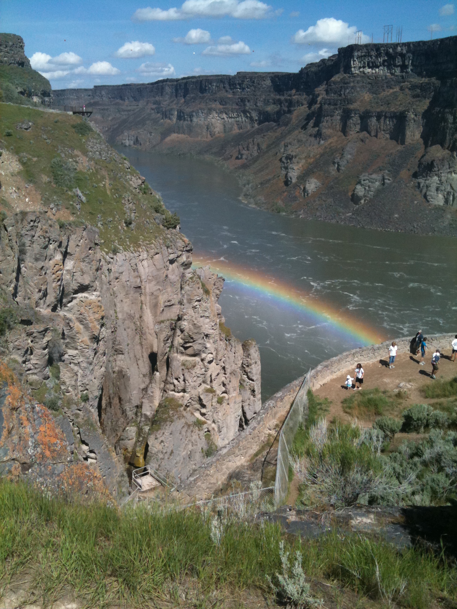
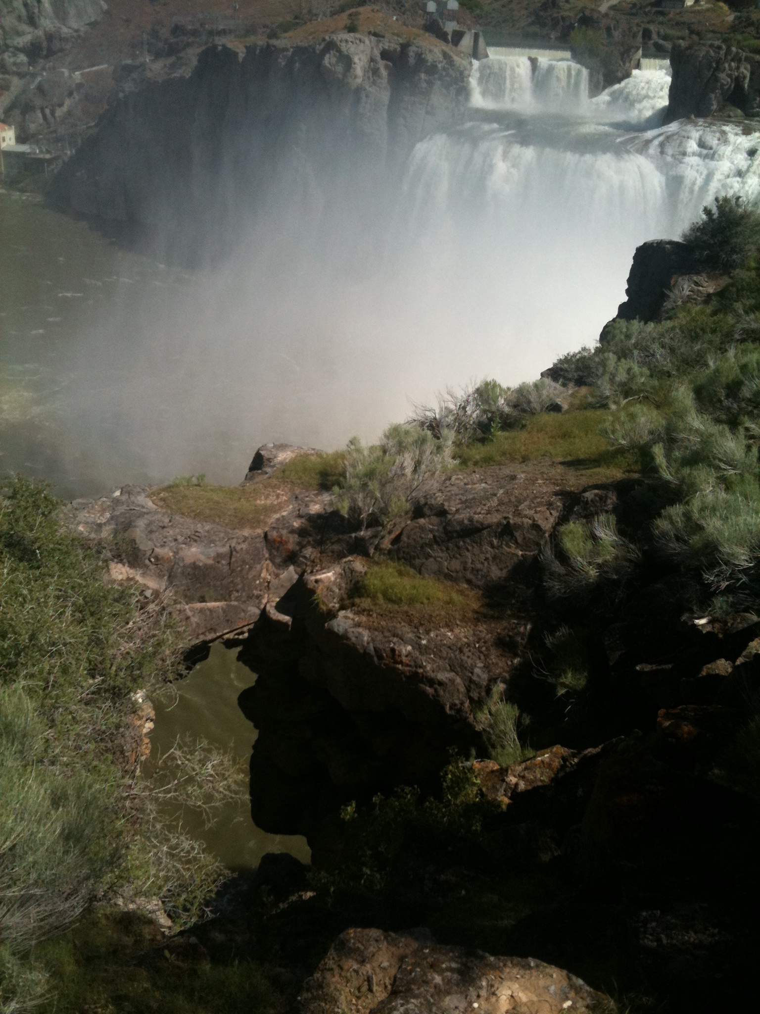
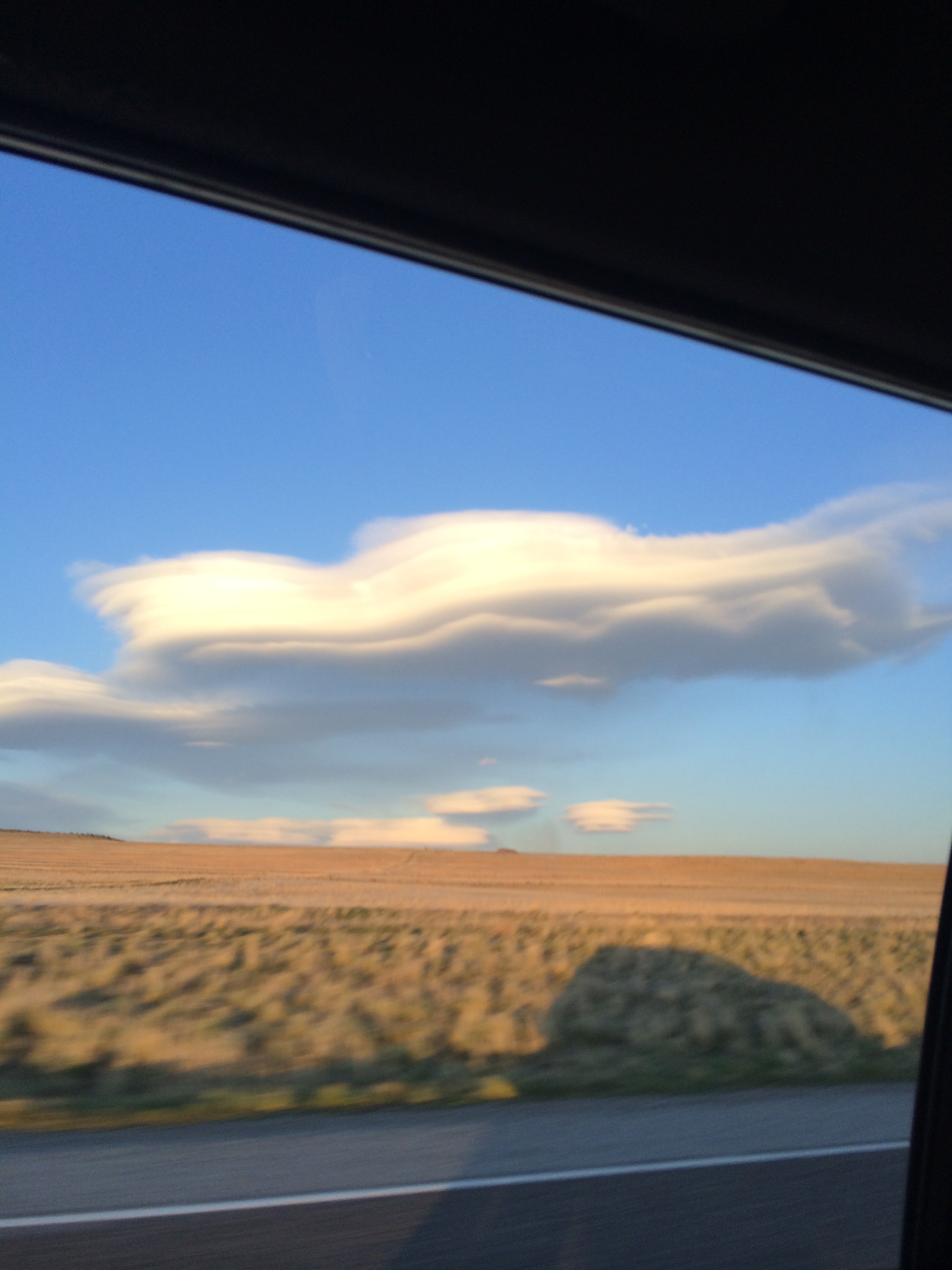
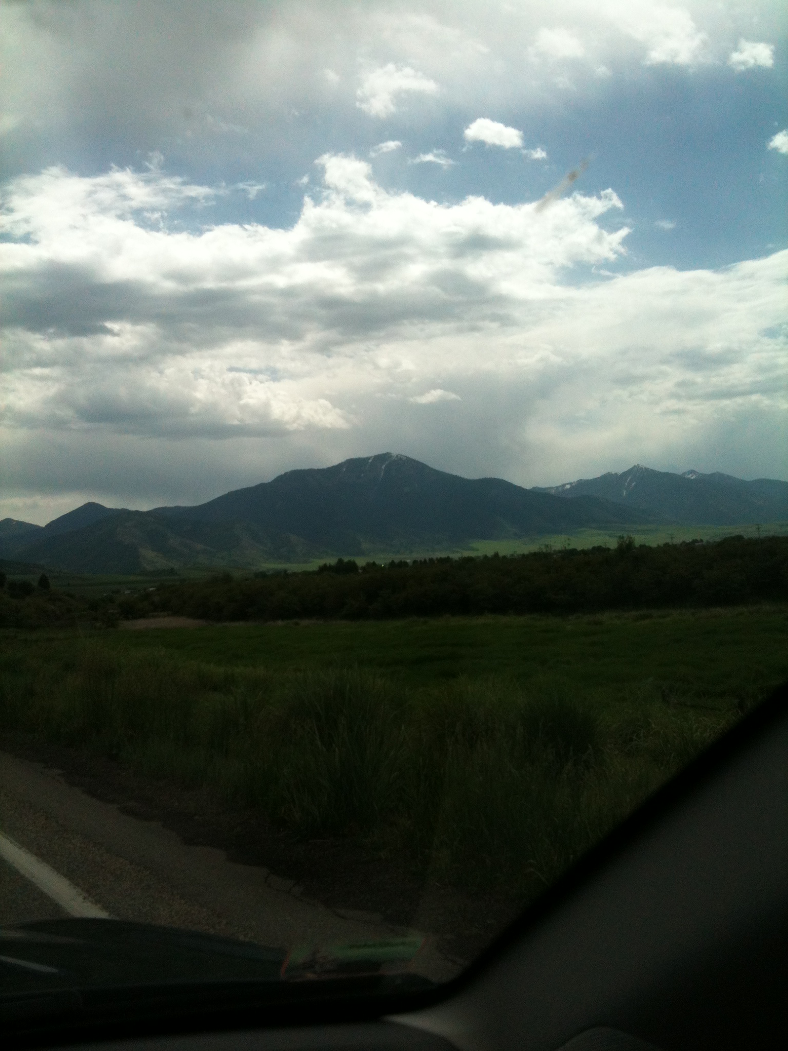
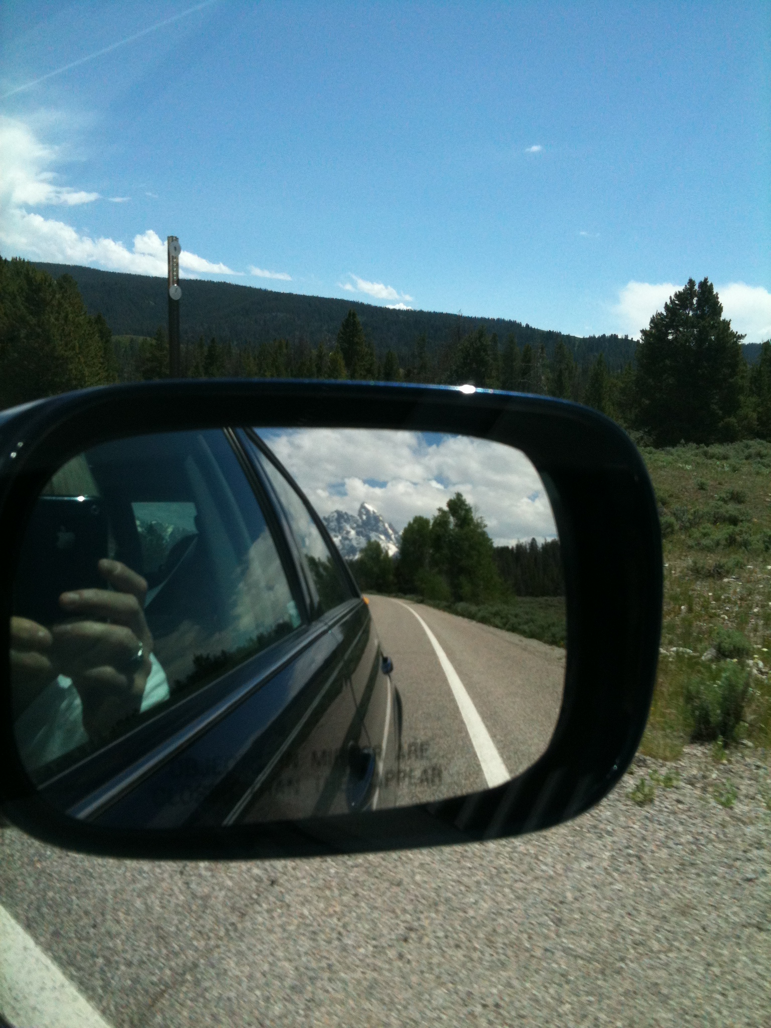
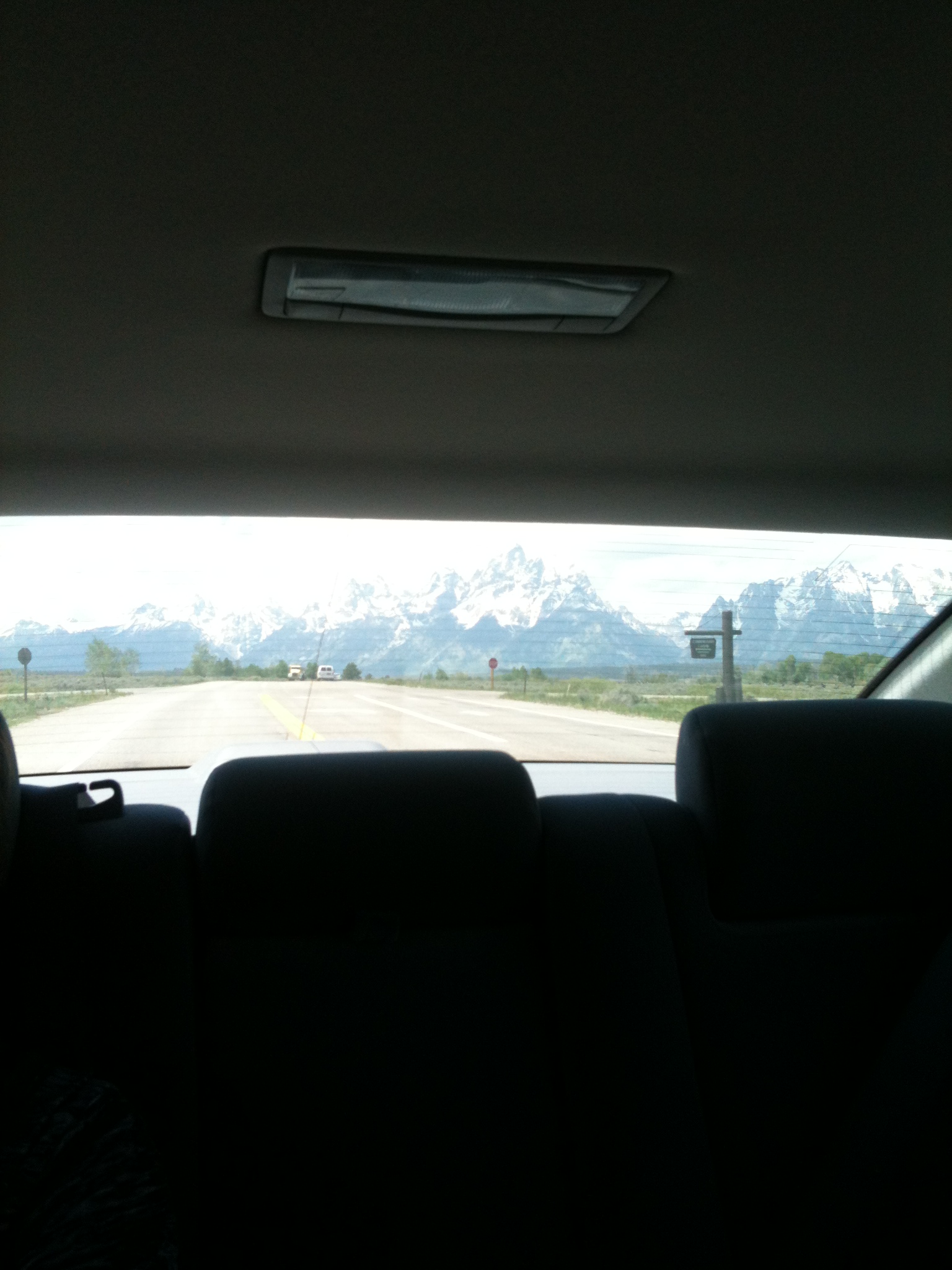
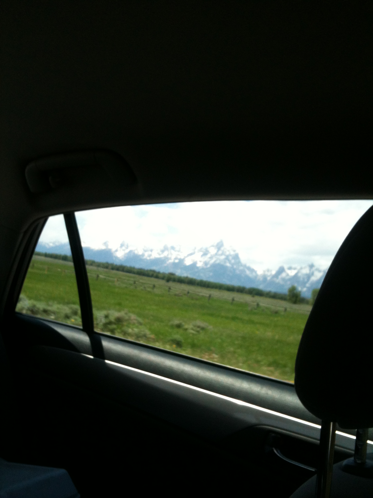
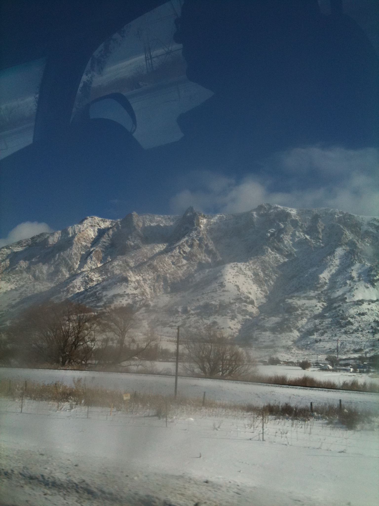
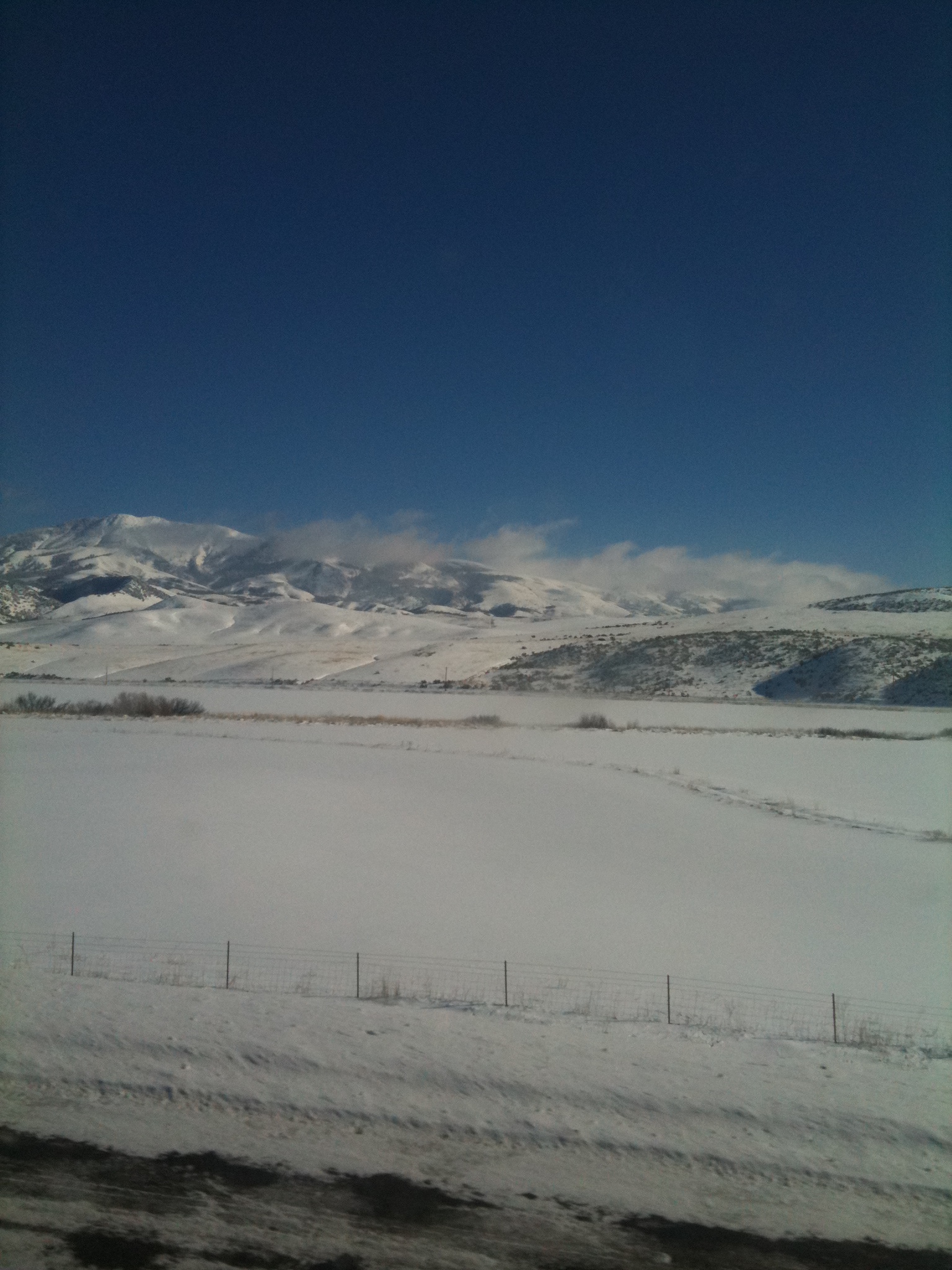
Sunday, April 13, 2014. We are headed on Highway 20 toward Idaho Falls now after our stop at Shoshone Falls. David is driving, Eric is navigating, and I’m in the back seat mesmerized by the sky.

IMG_7613

IMG_7616

Good-bye Magic Valley! I snap this photo:

IMG_7664

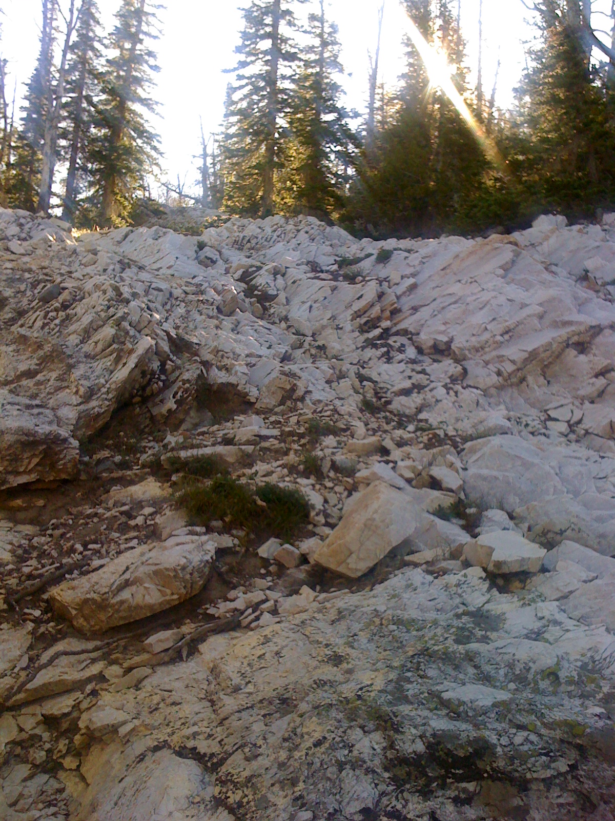
“Uh, let me guess. You’ve maneuvered your way into a cattle feed lot and captured a close-up of a gargantuan pile of manure.”

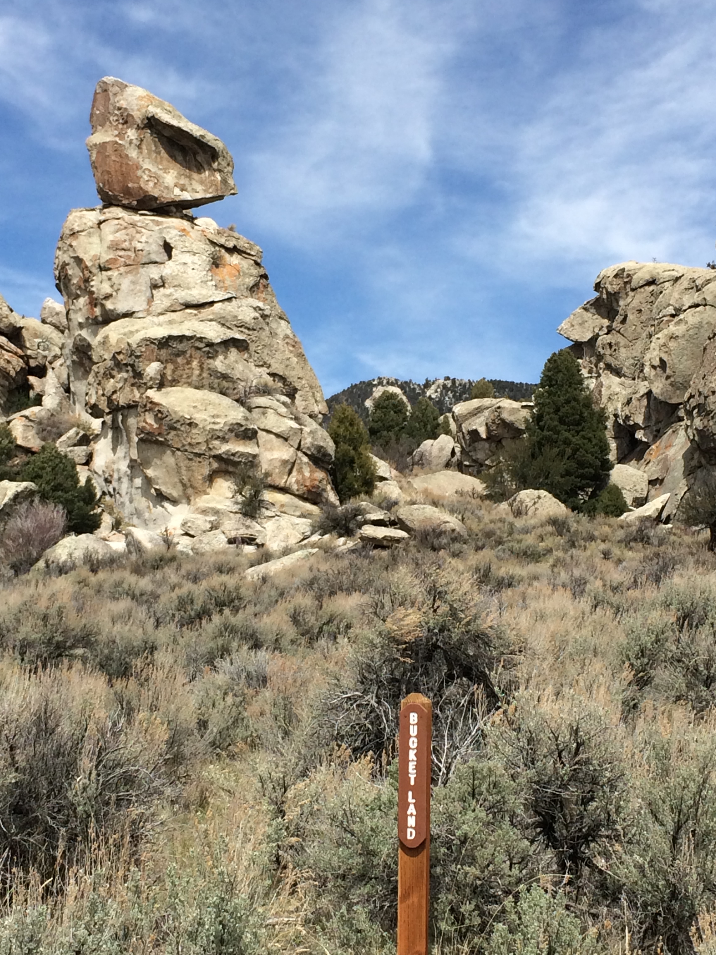
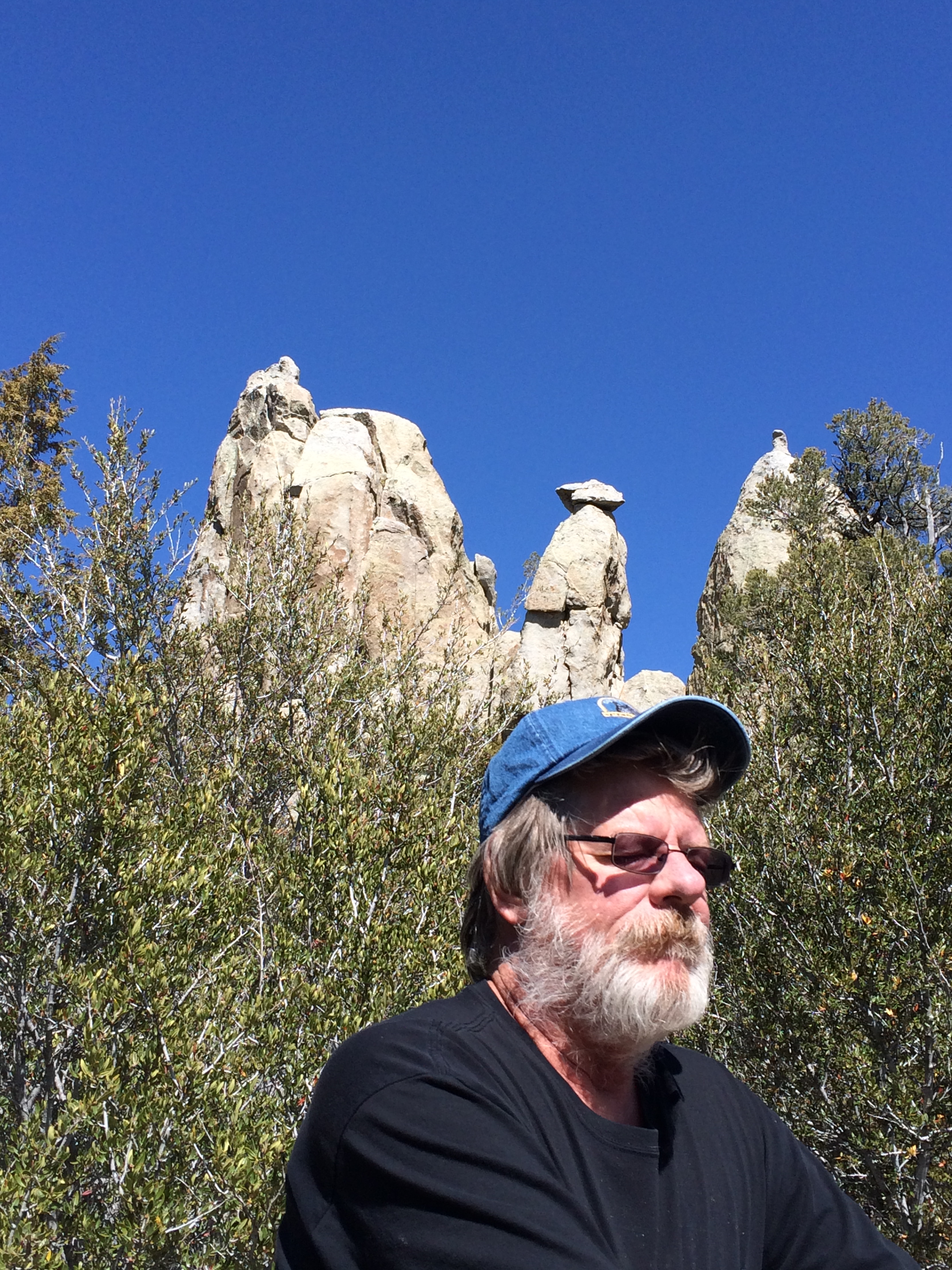
No, actually! … we’re at the Craters of the Moon National Monument, which lies along highway 20 between Arco and Carey, Idaho, or, if, perchance, you haven’t heard of the tiny towns of Arco and Carey, halfway between Boise and Yellowstone Park.

Craters of the Moon is the spot along Idaho’s Snake River plain where the earth had one of it’s biggest bowel movements from 15,000 to just 2000 years ago. Well, or actually, one early traveler called it “Devil’s vomit.”

IMG_7653

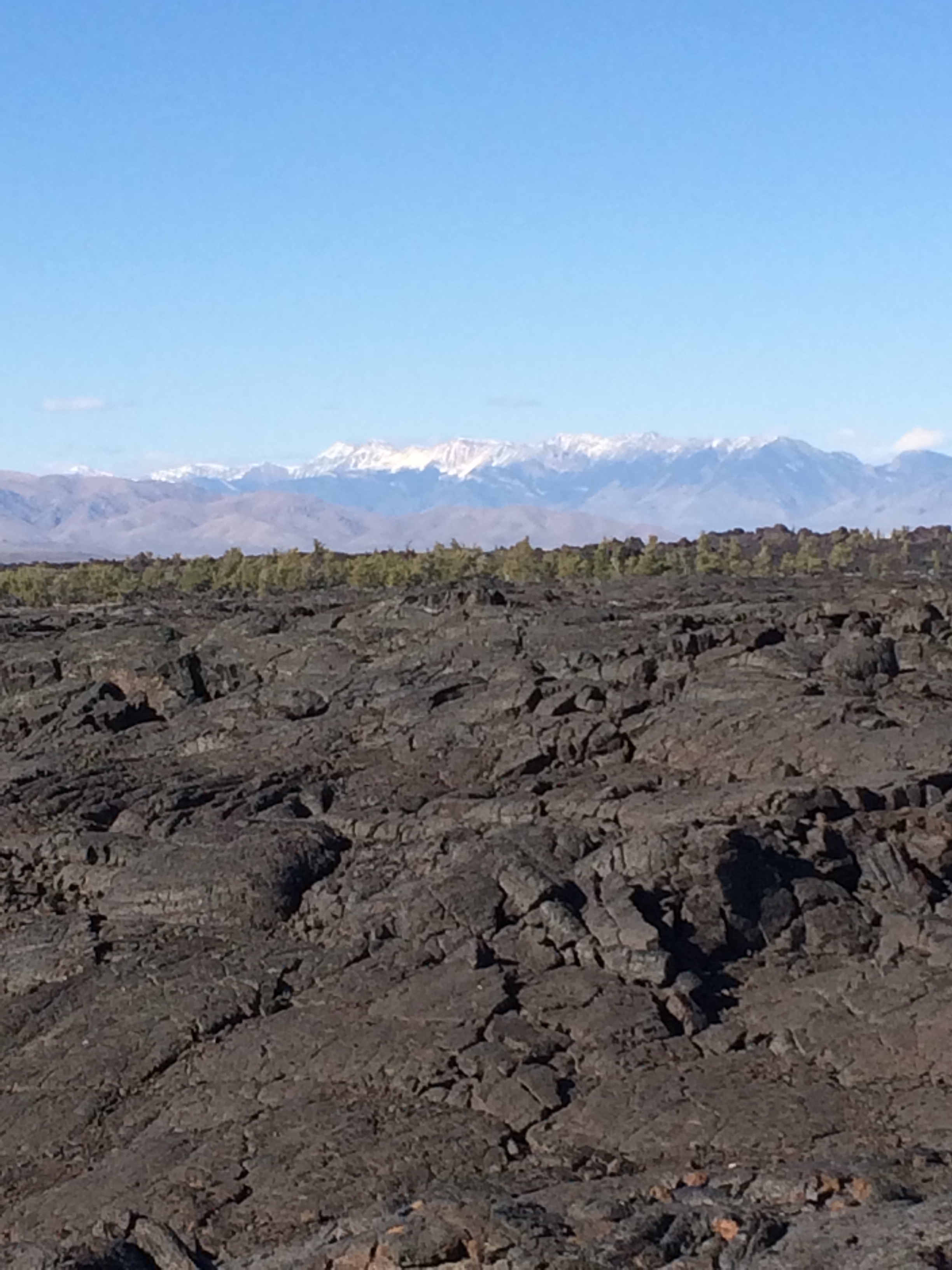
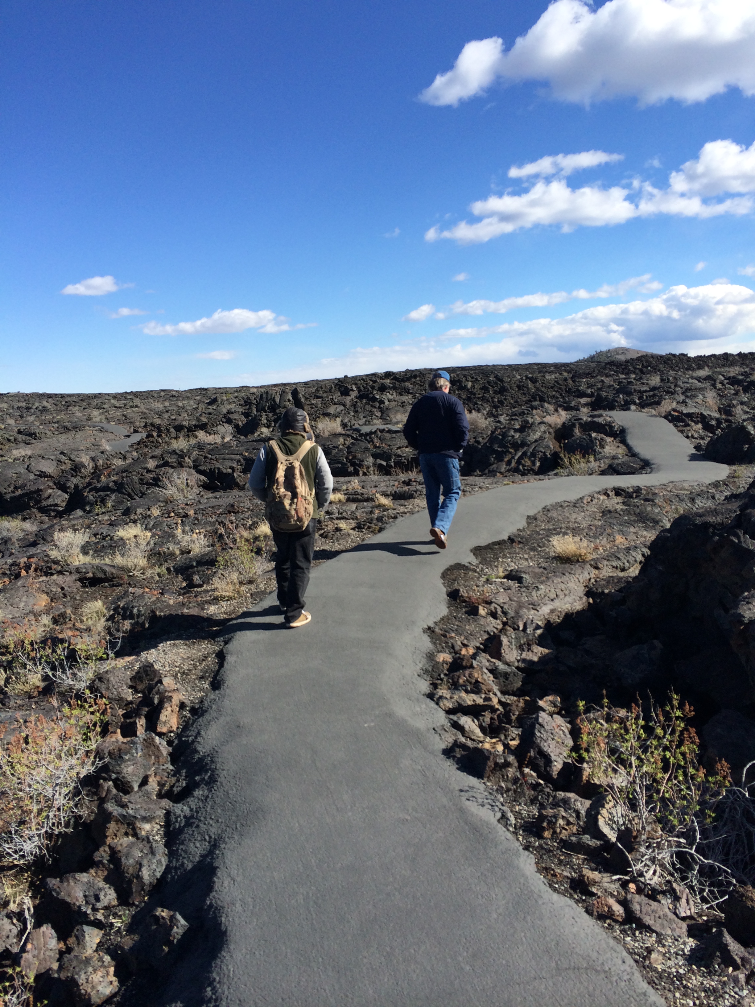
The lava field spreads across 618 square miles, southeastward from the Pioneer Mountains. It is part of the Great Rift volcanic zone that extends across almost the entire Snake River Plain. The rugged landscape is still remote and undeveloped with only one paved road across the northern end, where visitors enter the park.

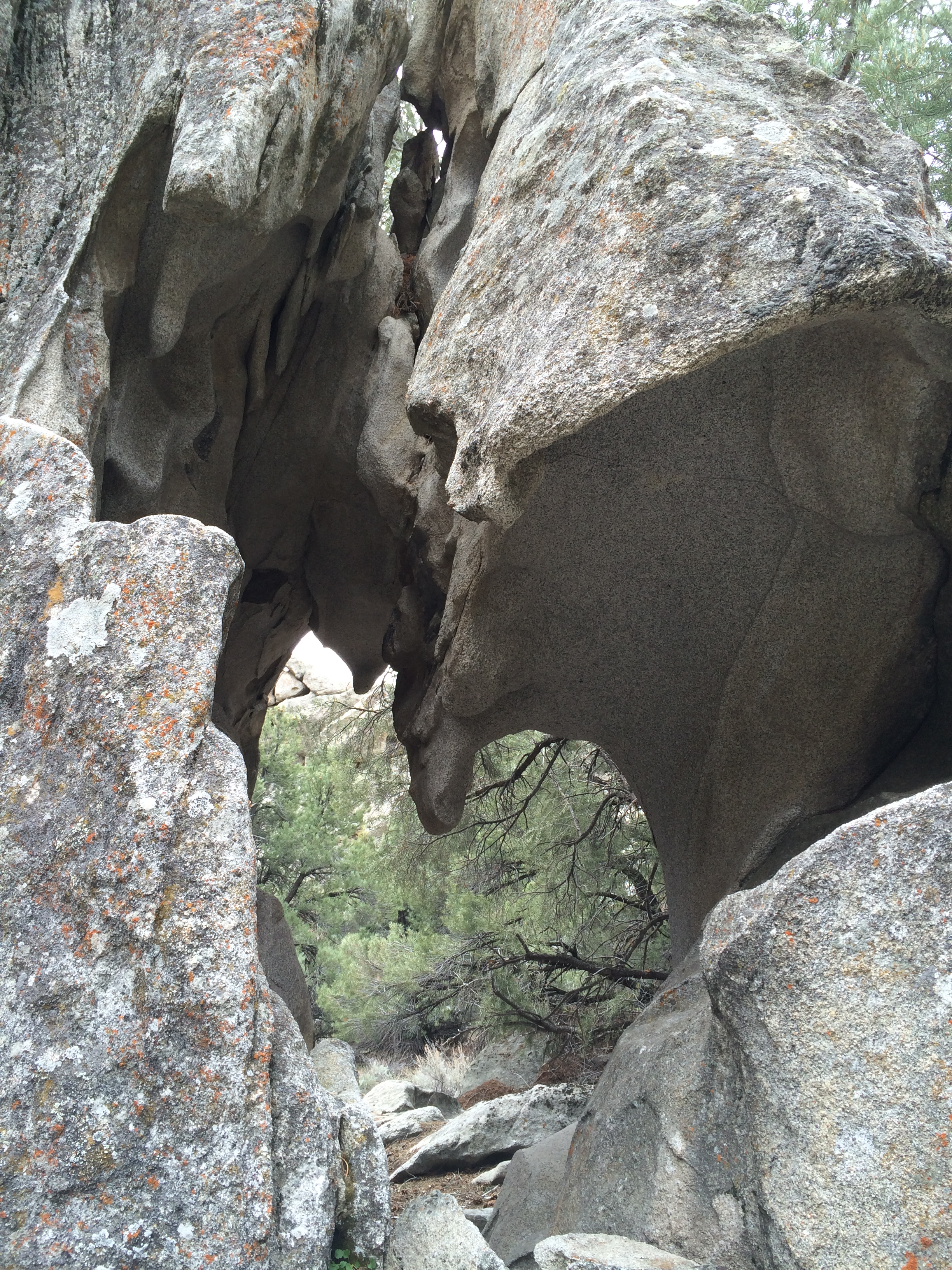
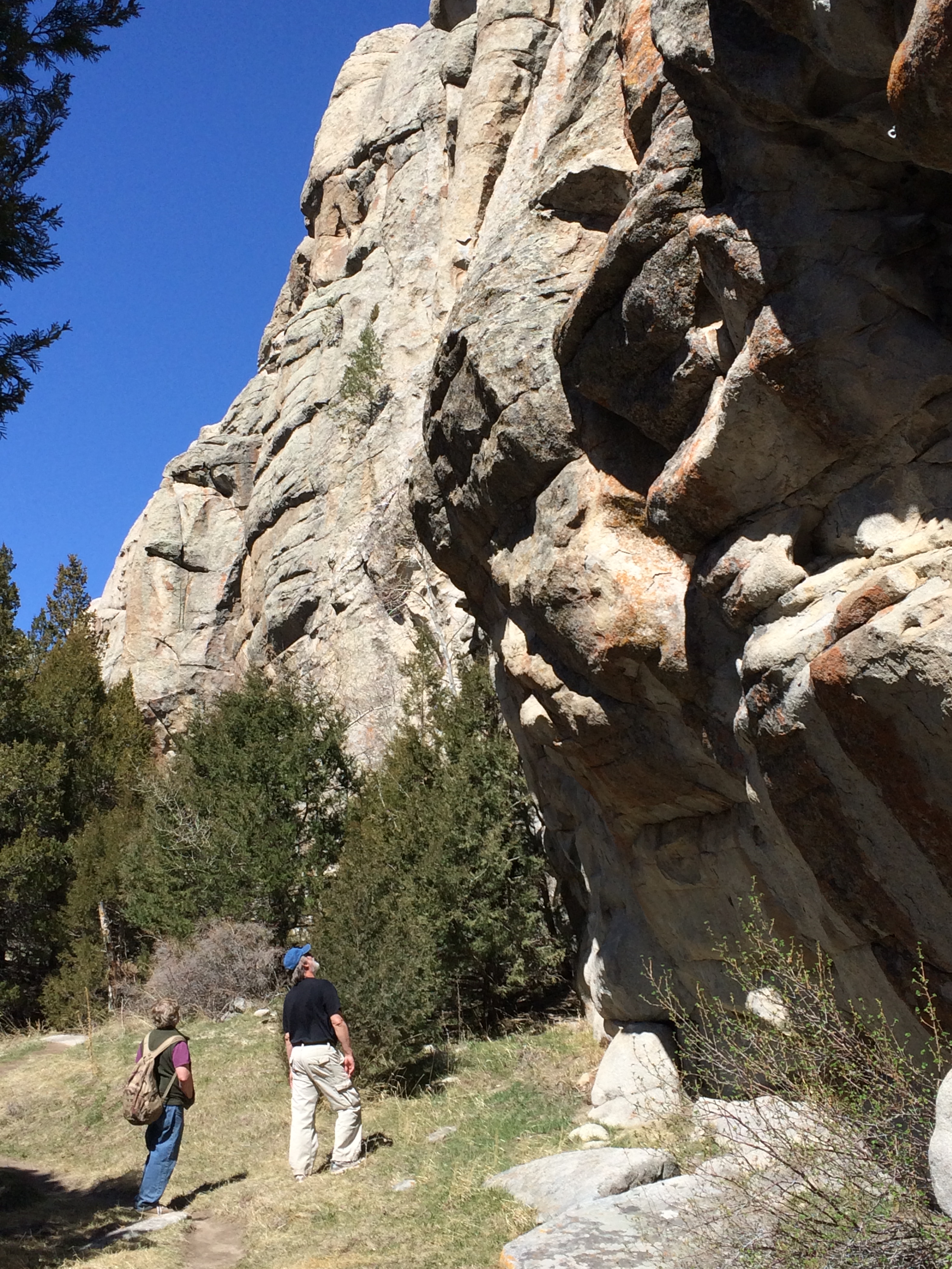
You can hike on paved trails and explore tunnels and caves.

IMG_7634

IMG_7669

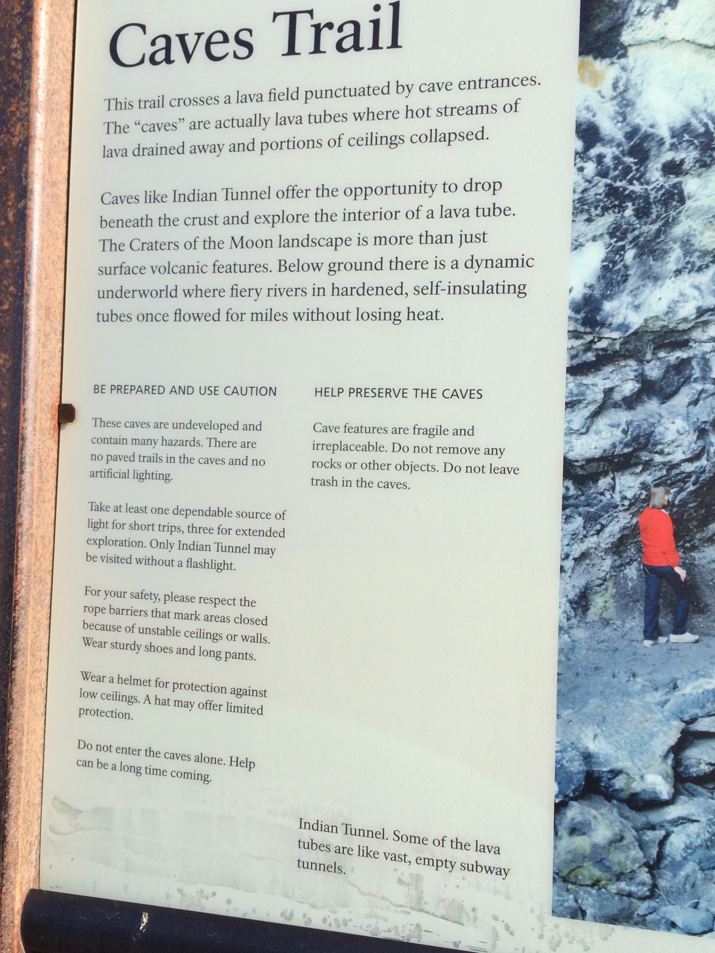
Deeming it best to heed the signs and stay on the trails, we head off on the trail to Indian tunnel.

IMG_7633

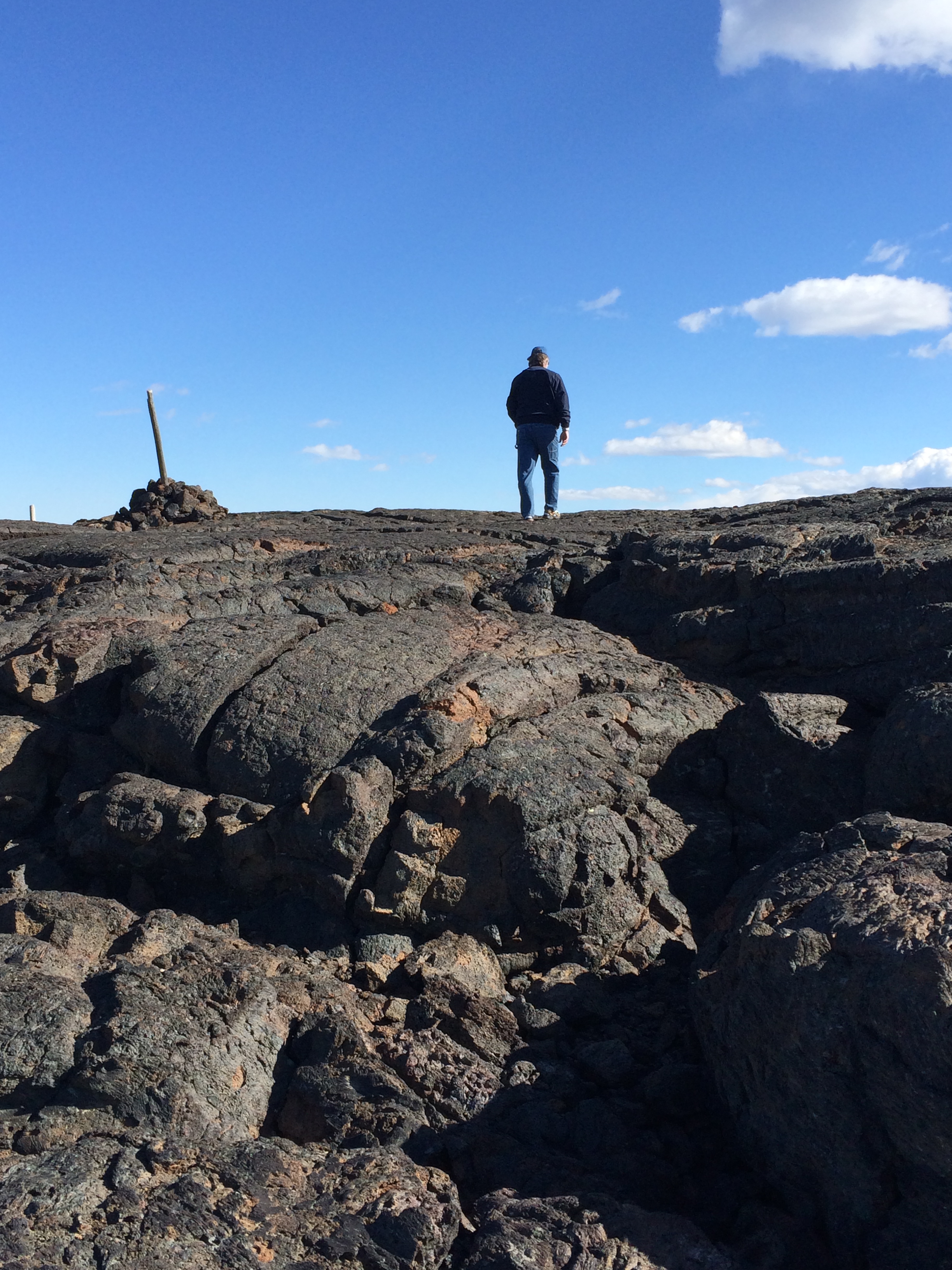
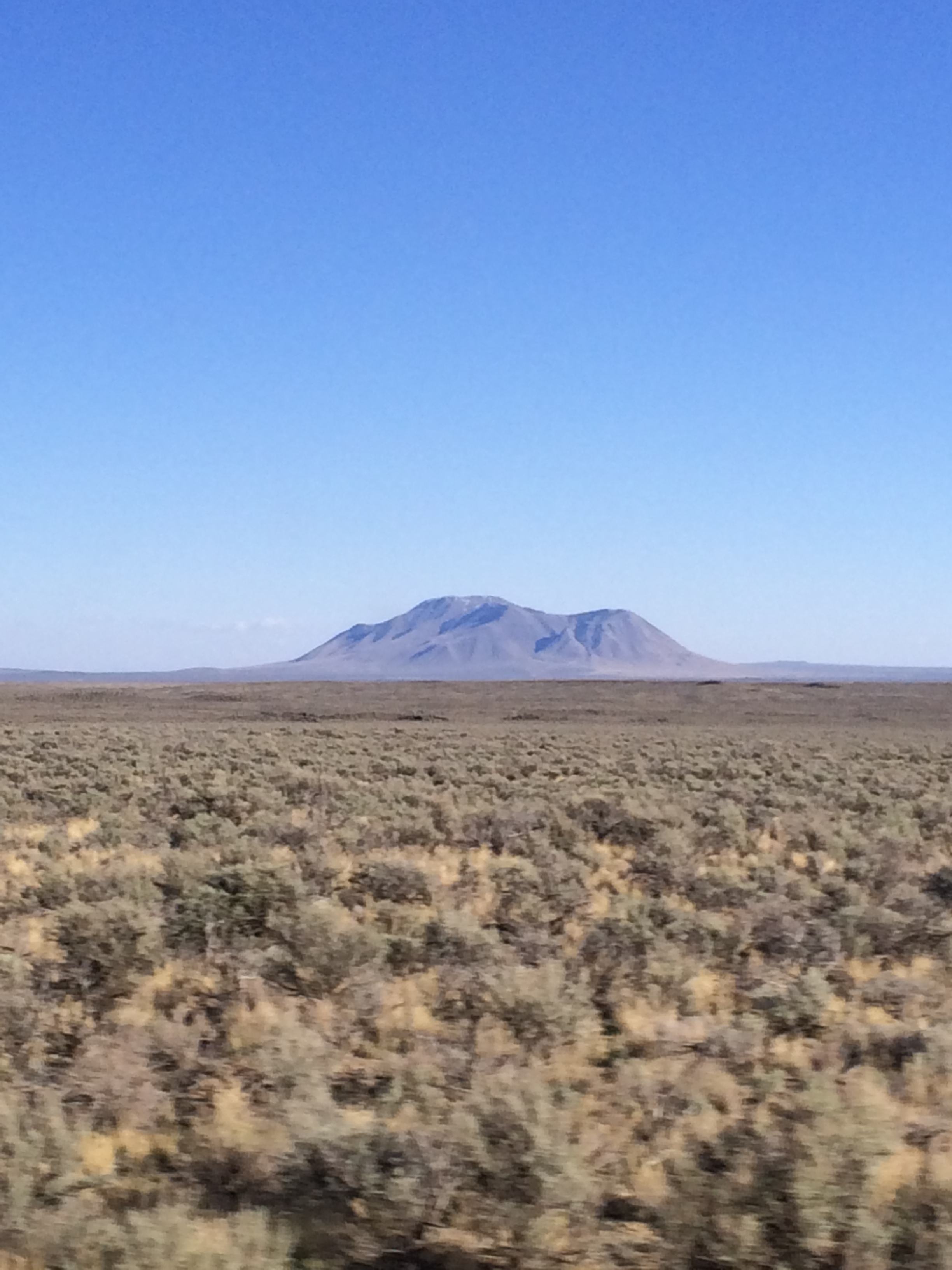
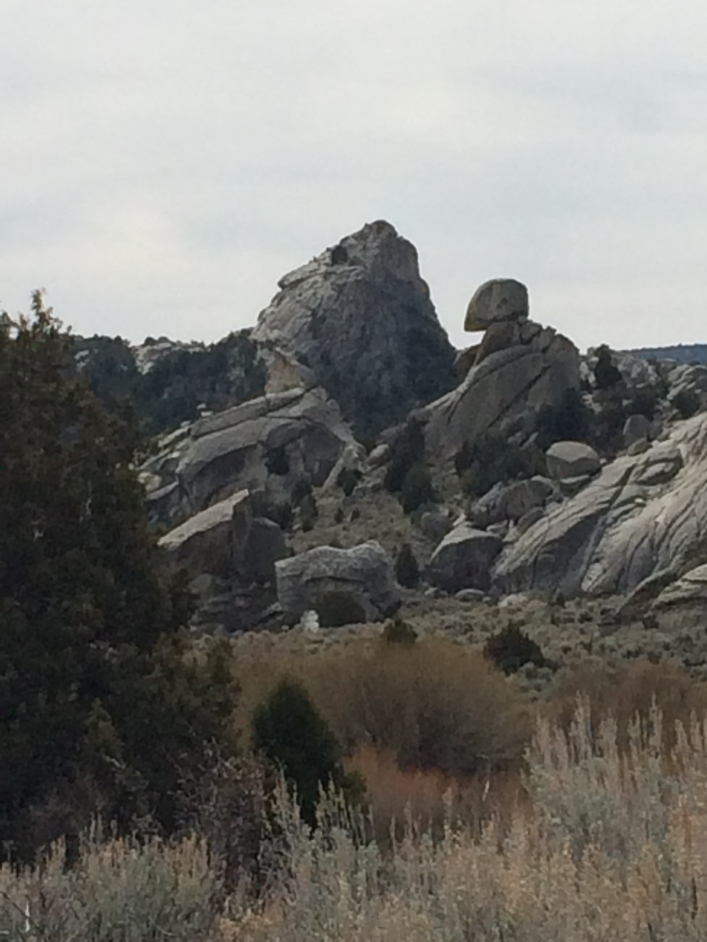
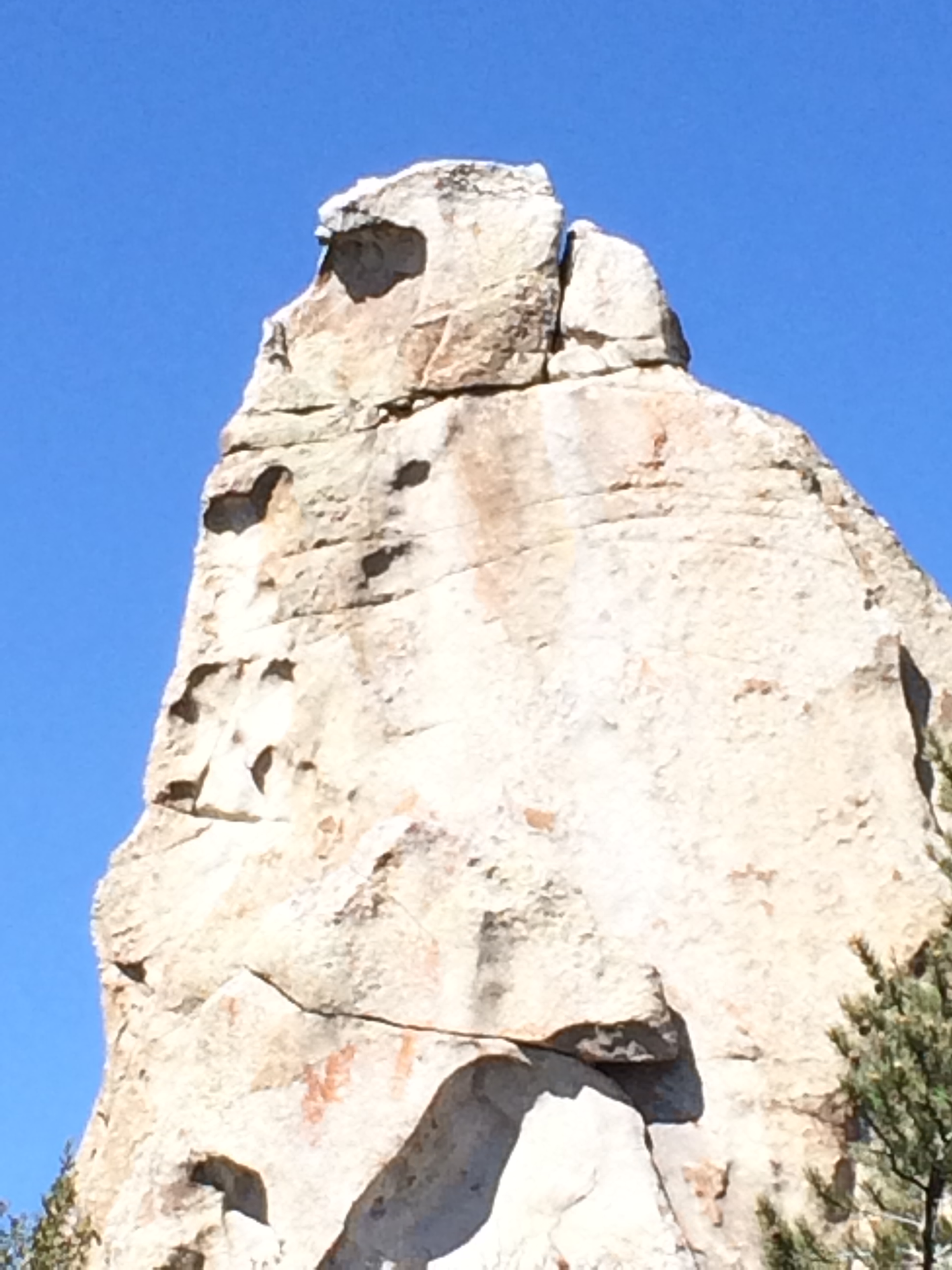
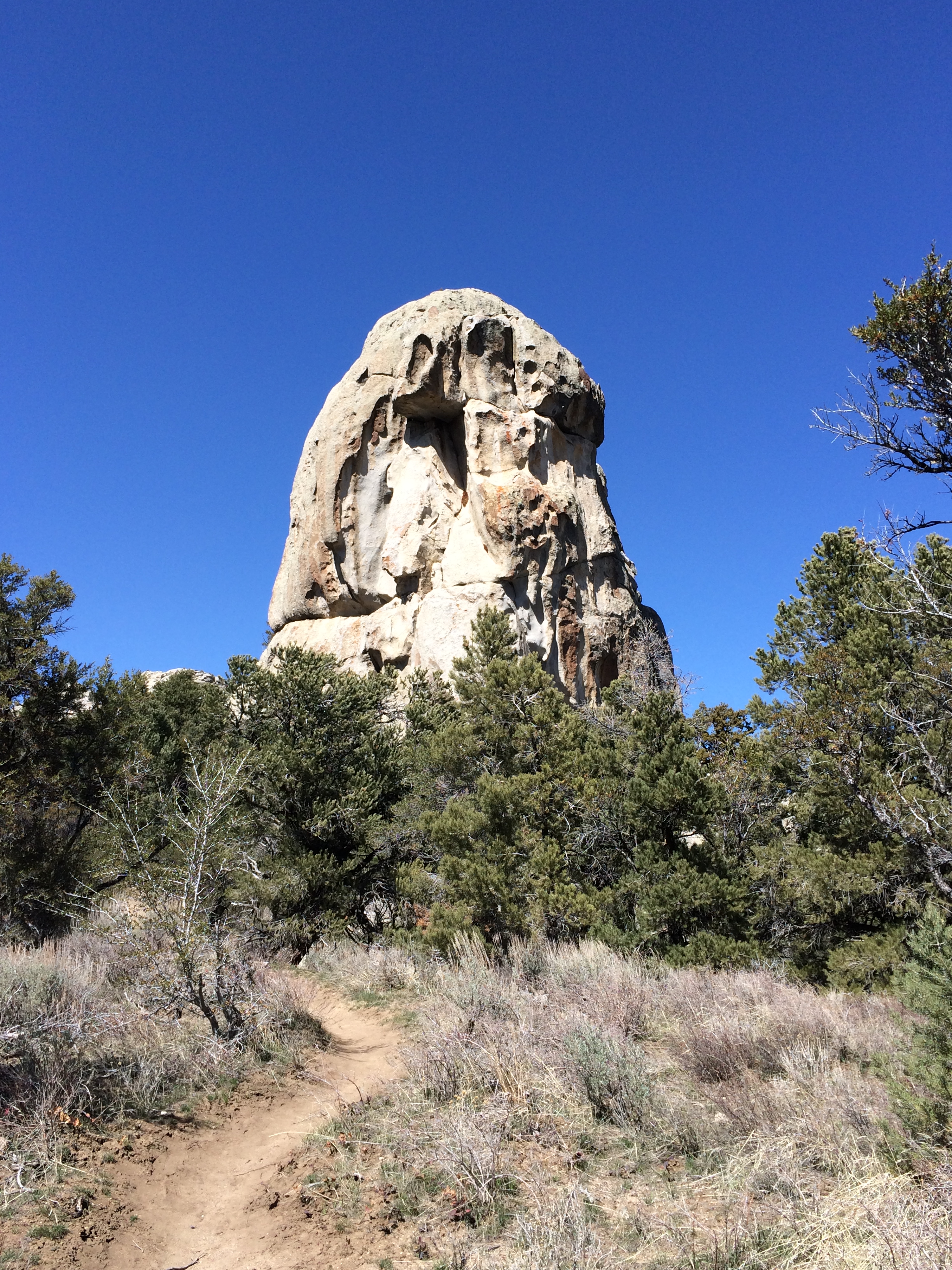
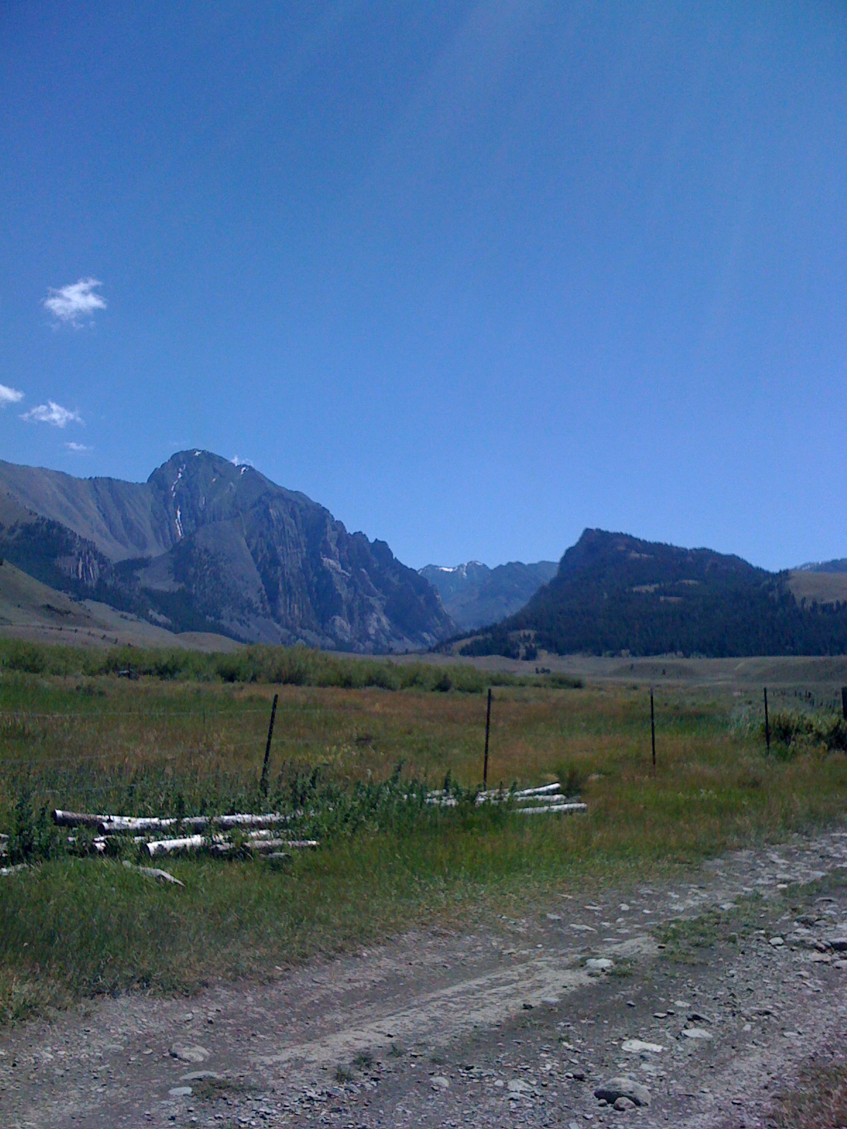
Not exactly a photographer’s paradise. I snap a photo toward the Big Southern Butte. Ah… how does that Easter verse go?.. (by Thomas Blackburn)

IMG_7654

“Awake, thou wintry earth
Fling off thy sadness!
Fair vernal flowers,
Laugh forth your ancient gladness!”

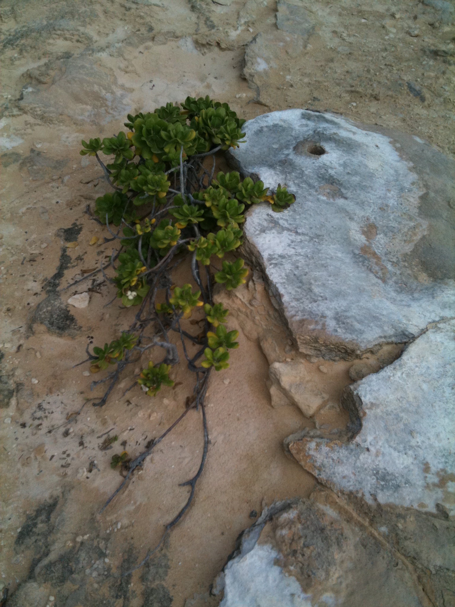
Yeah, well, these plants are trying. What a hardy, willful bunch! If the weather conditions are favorable (moist and cool) for the next several weeks, then there could be an abundance of flowers blooming toward the end of May and early June – prickly pear (cactus), red Indian paintbrush, and the sego lily.

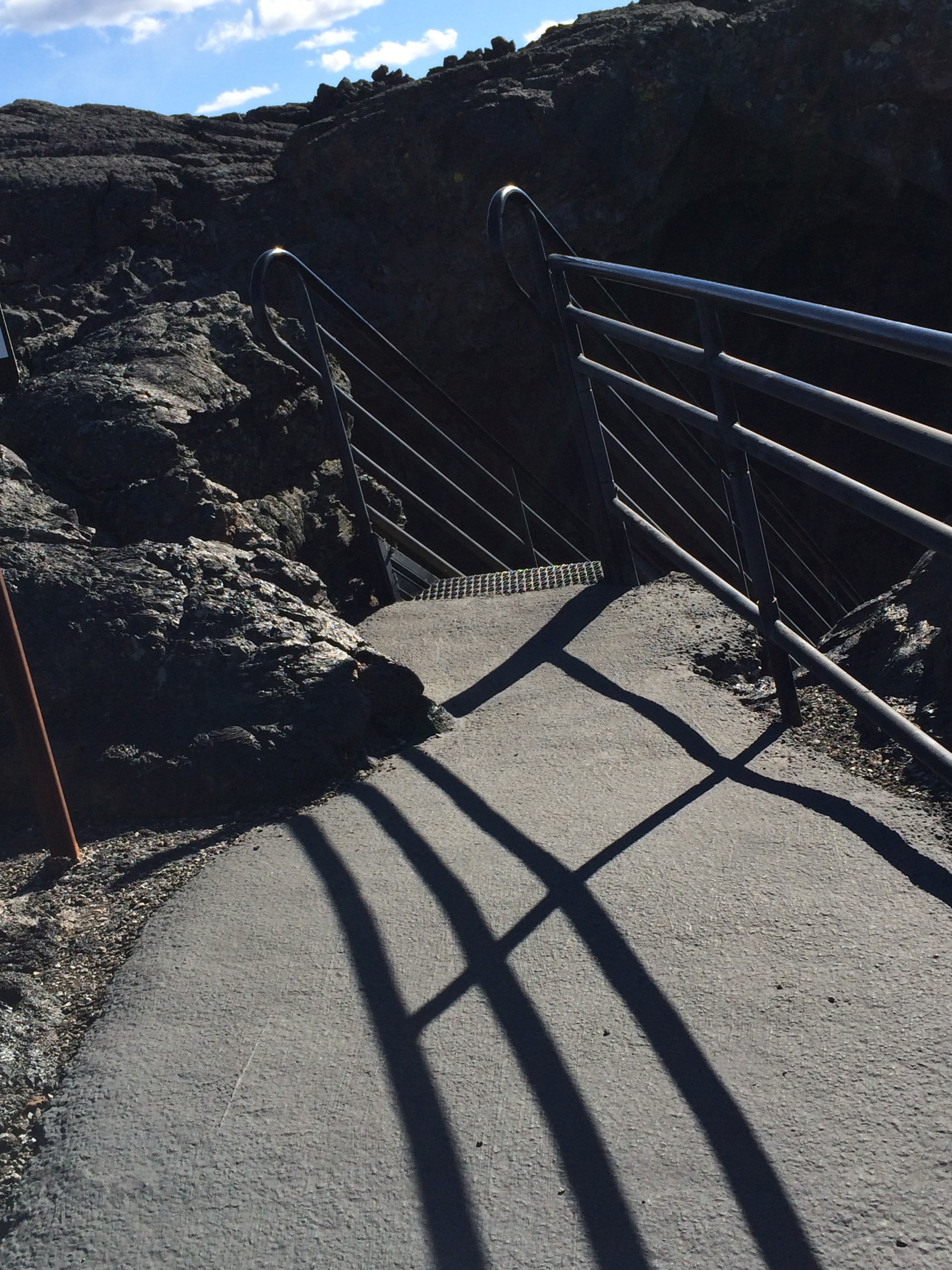
We’re at the entrance to Indian tunnel now. It is actually a lava tube, which, the way I understand it is, the lava cooled on the top while it kept flowing out underneath, leaving a hollow space. “Let’s do it!” exclaims Eric. David decides not to – he is wearing sandals. But he will meet us at the other end.

IMG_7635

Eric and I entered the cave down this handy flight of stairs:

IMG_7650

IMG_7651

and then tried to keep an eye on each other-

IMG_7640

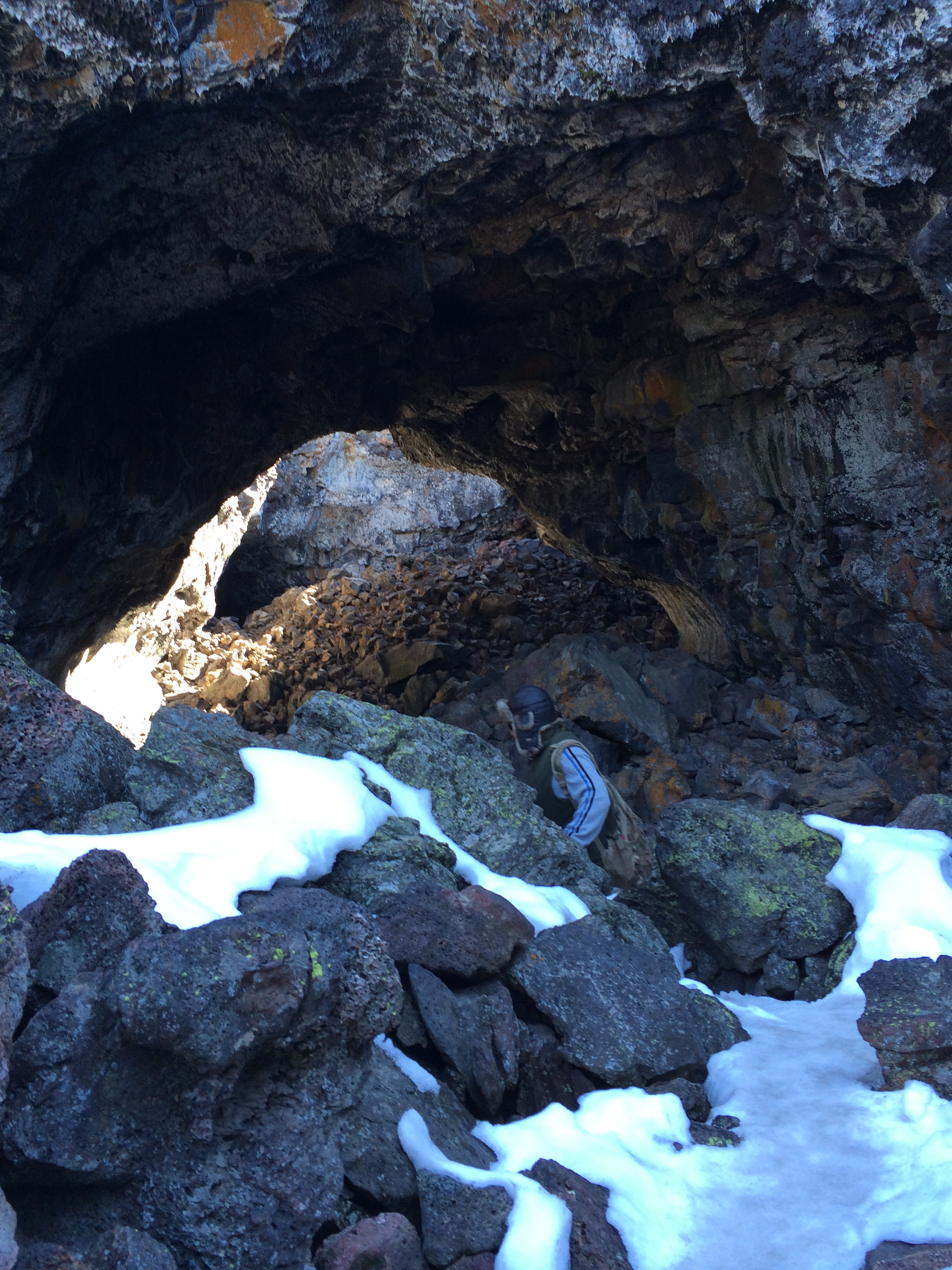
Do you see Eric ahead? One of the rules is to never enter a cave or tube alone.

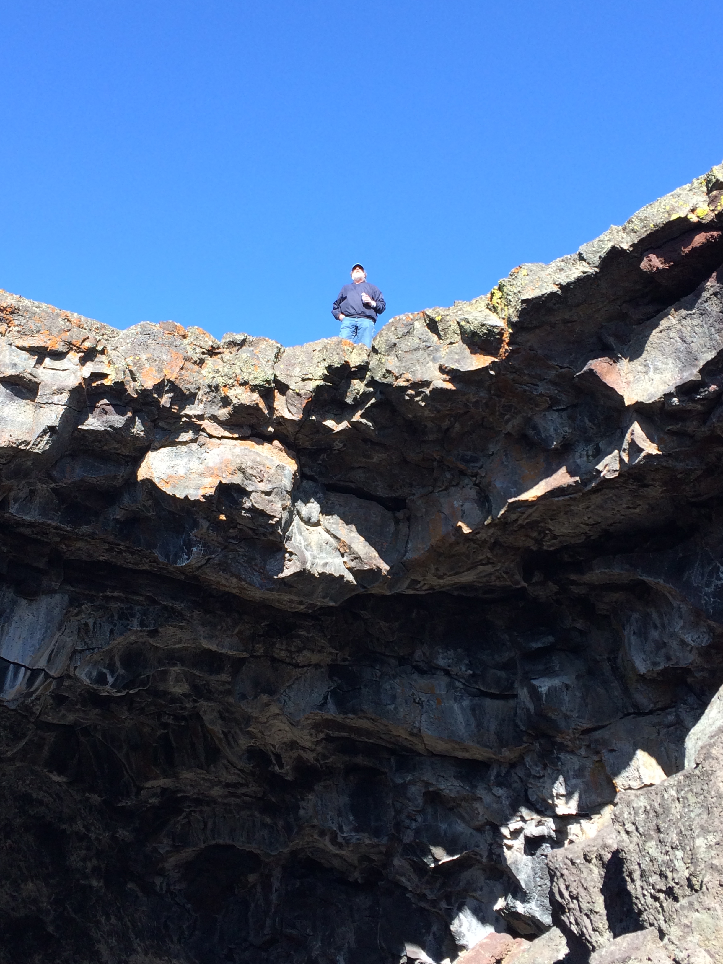
Half way through we greet David peering down at us from on top.

IMG_7638

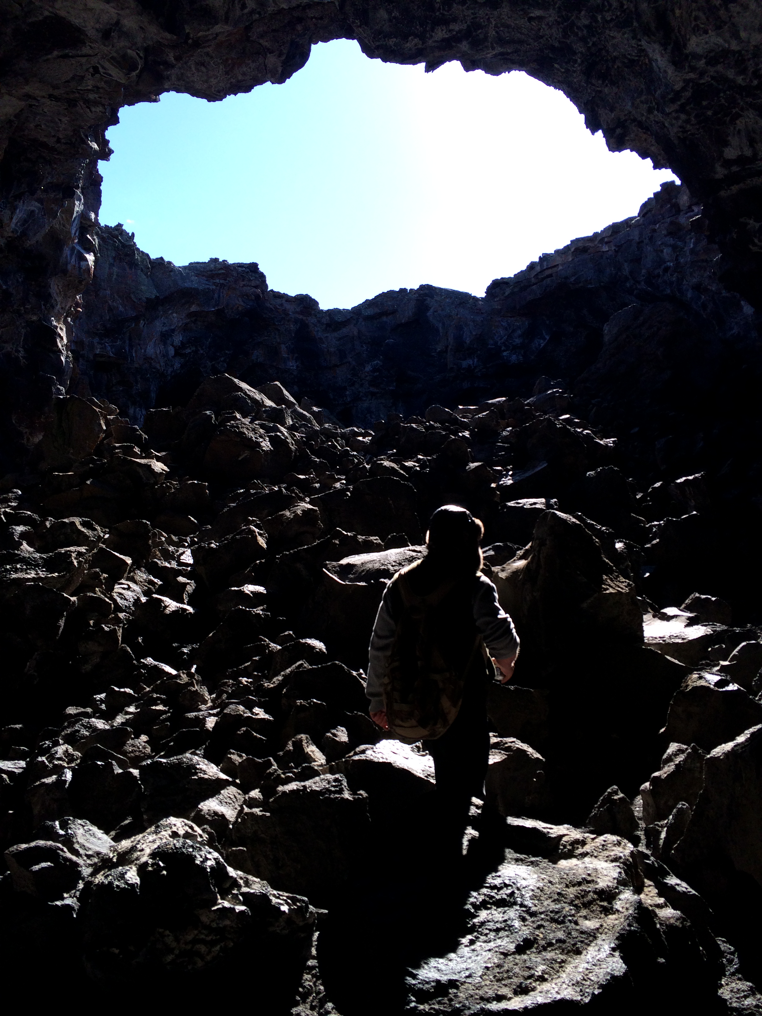
The lighting isn’t exactly conducive to capturing photos, but I do have a flash on my i-Phone. Here, behind Eric, I think we are coming out, but it turns out we are just entering another chamber …

IMG_7641

But we have reached the far end now:

IMG_7637

“Born again, Ma!”

David is waiting for us.

We follow the cairns back to the cave entrance.

IMG_7644

And head back to the car on the neatly paved trail.

IMG_7663

To view about every photo imaginable of the Craters of the Moon, check out this site!

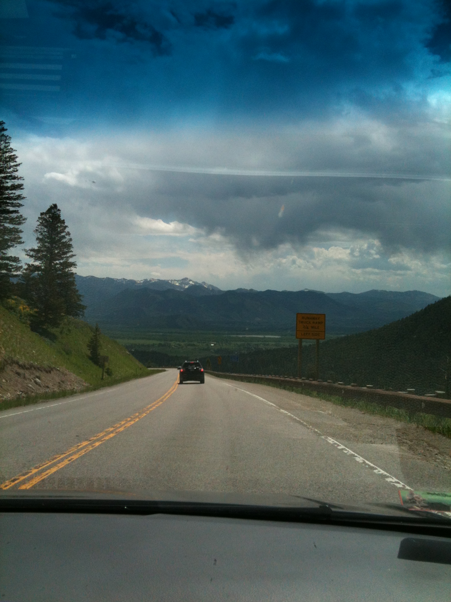
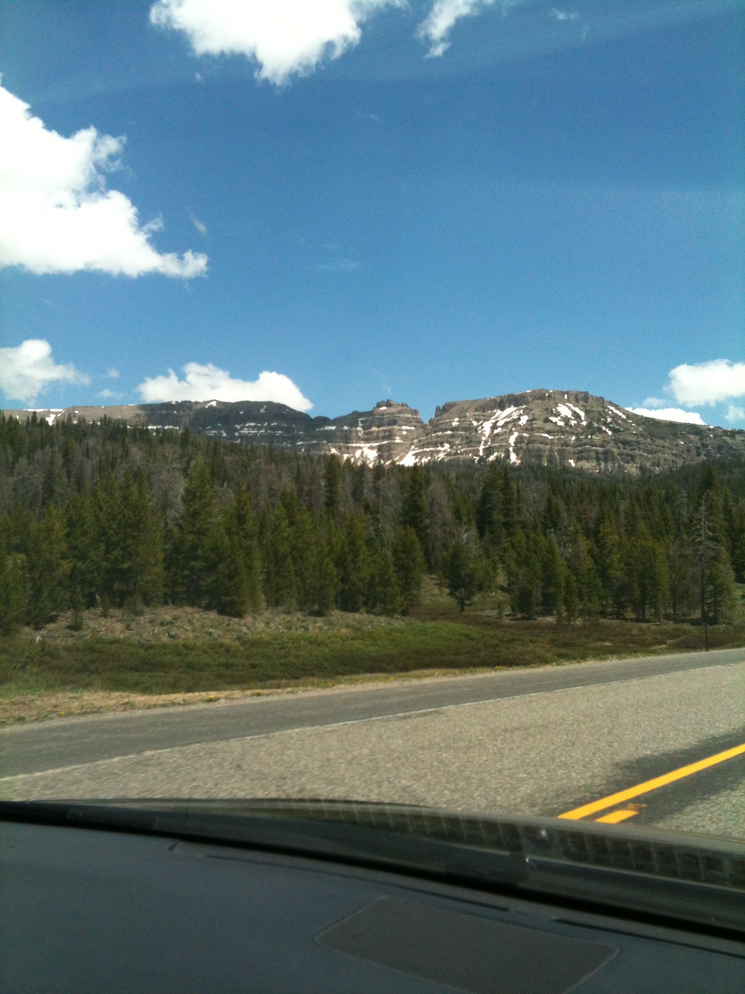
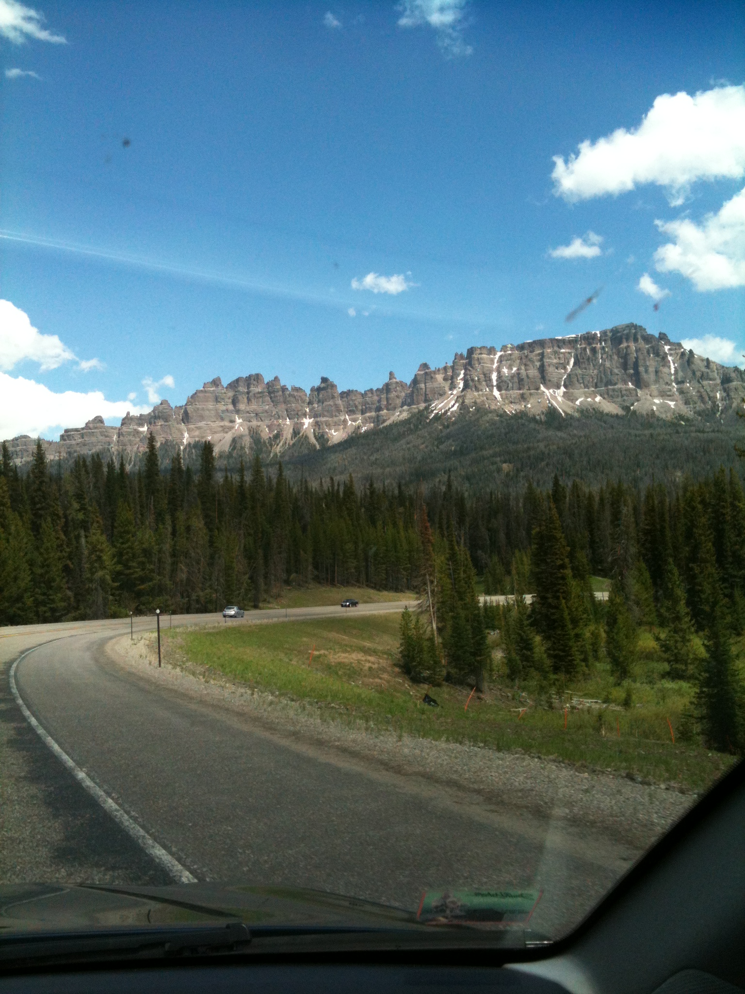
So, we’re driving east again on Highway 20 alongside the Big Southern Butte now:

IMG_7671

Then the highway curves past the twin Buttes

IMG_7677

We’re just outside Idaho Falls now; Taylor Mountain has come into view. I’m sitting in the back seat, looking at Taylor Mountain in the distance – and see this herd of free-range cattle ahead. I snap a photo as we’re sailing by:

IMG_7685

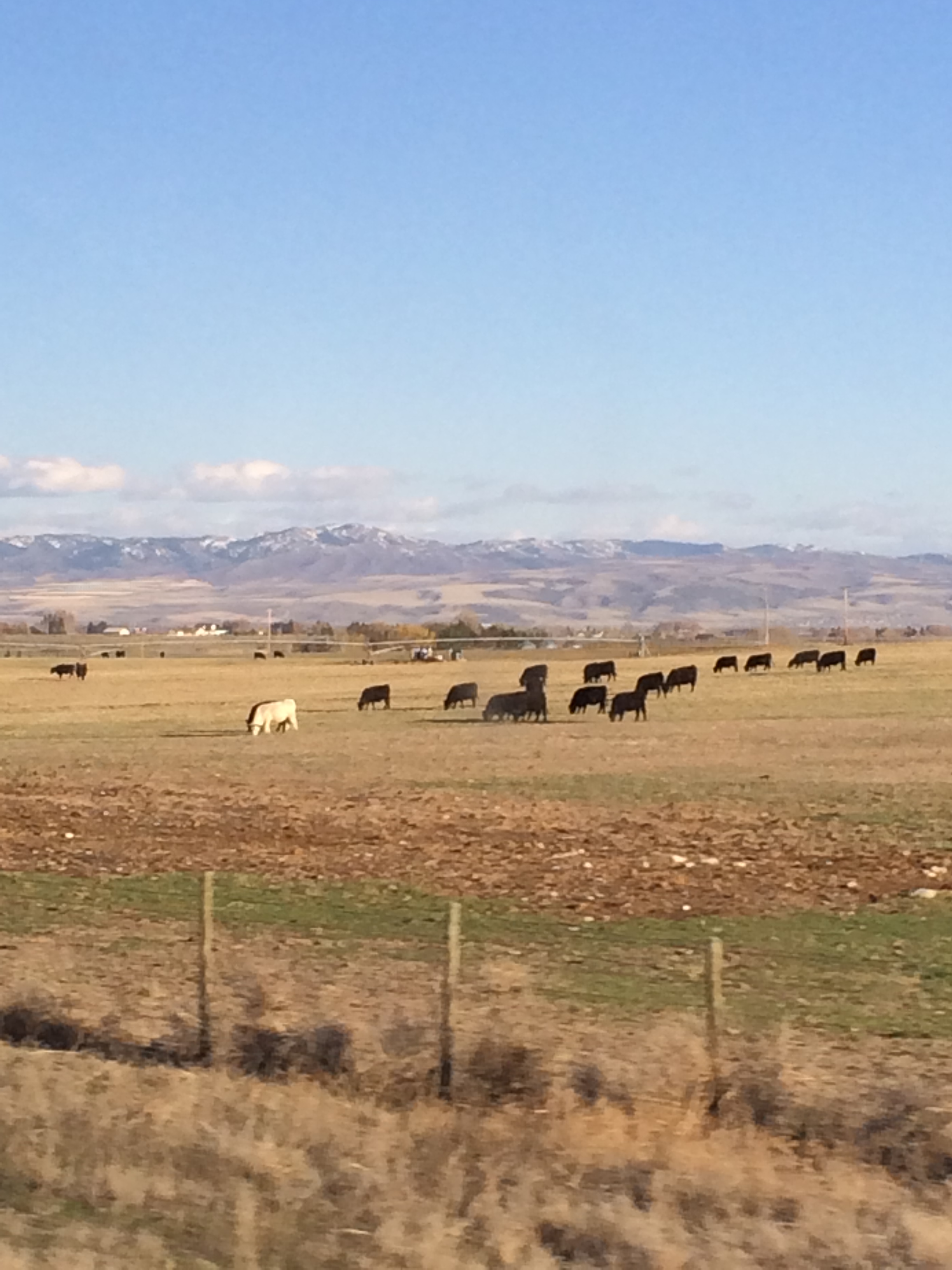
Eric pipes up, “That herd of cattle has its very own albino rock star!”

Huh?

“You know. We humans have our albino rock star; why can’t a herd of cattle have their albino rock star too?”

“You mean ….” well, if you were born before say, 1960, you know exactly who Eric is talking about. But I’ll give all you old fogies a hint, just in case: His initials are E.W. and his brother, J.W. is also an albino musician.

Okay, so here’s a link to E.W.’s Wikipedia page. He states, “In school I had a lot of friends. I wore a lot of white shirts to, like, blend in I guess. No one really gave me a hard time about being albino or taking special education classes. Then again, I wasn’t really popular.” He and his brother were both in Special Ed classes in High School (I guess because people couldn’t deal with their looks?) even though Edgar (has it come back to you yet?) was a musical prodigy.

All right, so here are you-tube links so you can listen to E.W.’s monster 1972 and ’73 hits, ‘Free Ride’ and ‘Frankenstein.’ (Has it come back to you now?)

And on that note, I guess I can officially declare it a ‘wrap’ on the blogs about our April 11-13 weekend-getaway.

Um, unless I’ve forgotten something … is that possible?

From Jackpot to the Magic Valley

April 27, 2014

You probably aren’t panicked about this, or anything, but I never got us (David, Eric, and I) safely home from our weekend get-away to the City of Rocks two weekends (and two blogs) ago. You’ve been worried, haven’t you? No? I do have a few more photos to share, granted, it has occurred to me that, given modern technology, smart phones, and the like – just about every other Joe Blow on earth has photos to share, too. Yeah, but do they have THIS photo:

IMG_7604

of us entering Jackpot, Nevada, a gambling town in northern Nevada sitting on Highway 93 about a mile south of the Idaho border.

Jackpot, Nevada, middle of no-where. Population: 1200 – of which, save a few stragglers out on the nearby golfcourse, I’ve likely about captured the entire population in this photo.

That tall tower on the left is Cactus Pete’s Hotel and Casino and off to the right is the Horseshoe Inn and Casino (owned by Cactus Pete’s). Otherwise you can stay at the West Star Resort on Poker Street or the Four Jacks Hotel a bit further south on Highway 93.

We had reserved a room at the Horseshoe for Saturday night (April 12) on account of to consider this a ‘weekend’ get-away we had to be away at least one more night. Jackpot is about two hours south of the City of Rocks. Cactus Pete’s brings in respectable entertainment from time to time, too, and I was game to see a show. Eric and David were game too – for about any show, really. Oh WOW! The Chippendales 25th Year Anniversary Show is in town! – an all-macho-male erotica troupe of ten hunky guys putting on a big sexy strip show! Check out the link here. (Great photos! You could piece them together for your own virtual show. Gr-oww-lll!!!)

“The Chippendales dancers’ distinctive upper body costumes include a bow tie and shirt cuffs worn on an otherwise bare torso.” Whoopee! “Established in 1979, Chippendales was the first all-male stripping troupe to make a business performing for mostly female audiences. Through the quality of its staging and choreography, Chippendales also helped legitimize stripping as a form of popular entertainment.”

“We’re not going.” Declared Eric and David.

“AWWWWWWW.”

They played poker instead, which was fine with me. I was exhausted anyway, from all that hiking in the City of Rocks we did earlier today, and I fell straight into bed after dinner. As for Eric and David’s success at the Poker tables, let me just say, they were both back in the room before midnight and neither one are furthering their fantasies about quitting their day jobs and becoming professional poker players.

It’s Sunday morning now, and we’ve hit the road north back toward Idaho Falls, through Twin Falls, or the area known in Idaho as the “Magic Valley.” It’s magic all right, with the smell of concentrated cow manure strong enough to burn out the insides of your nostrils. We must have passed about five enormous cattle feedlot operations. I tried to just ignore them at first but finally snapped a photo of one.

IMG_7601

In these operations the cattle are fenced in – in a big mud-shit hole (surrounded in the fenced area by huge mounds of collected manure) and the rancher just sets the hay bales along the outside perimeter of the fence – with holes in the fence barely large enough for the cows to stick their heads through to get the hay. We passed the largest feedlot you could ever imagine, which was back from the road about a half mile. You could barely see it; we gasped to glimpse the size of it – you could surely smell how large it was. I have now solemnly sworn to serve only pastured beef raised in humane conditions at our house (and I’m sticking to it). The images and smells of those feed lots still make me sad, and sick!

The feedlots aside, (YUCK YUCK YUCK) there is a very magical place in the Magic Valley, Shoshone Falls – a waterfall on the Snake River located about five miles east of Twin Falls. At 212 Feet high and about 900 feet wide, they are known as the Niagra of The West. The Shoshone Falls are actually 45 feet higher than Niagra Falls.

Depending on the volume of water present in the falls it may take on many different forms. When the water is high it will rage over the cliffs in a solid broad wall of water, and drop low enough (depending on time of year and diversion of the Snake River for irrigation) to where three or four delicate streams braid down the nearly dry cliffs. (Check out this great informational link about the Falls)

A park overlooking the waterfall is owned and operated by the City of Twin Falls. Here we are, standing on the overhang checking out the falls and the canyon. I see Eric is wearing his bomber hat and another one of his fashionable t-shirts:

IMG_7620

offering invaluable care-for-the-liver advice.

Here is a picture of the canyon below the falls (taken on Sunday, April 13, 2014.)

IMG_7625

Gorgeous! With a beautiful sky to match.

In 1974 daredevil Evil Knievel attempted to jump the south ridge of the Snake River Canyon – about 2 miles down that canyon from where we are standing.

And here are pictures of the falls:

IMG_7622

IMG_7624

“Braided streams.”

Okay, so today the water level is low and although it’s still beautiful, it’s a bit underwhelming compared to the experience we had here three years ago, June 11, 2011. Granted, we were standing here at the same time the Snake River in Idaho Falls was overflowing its banks, flooding the riverside parks. But hey! We took photos and videos of it then. And I still have them on my i-Phone. Of course. Here they are:

The canyon:

IMG_0648

The Falls:

IMG_0643

IMG_0642

IMG_0640

IMG_0645

My video of the falls:

David’s video of the falls:

And one last shot of a very magnificent rainbow.

IMG_0639

Yeah. The ‘Magic Valley’ in south cental Idaho. You really gotta see it to believe it.

Albion, Idaho, and the ‘City of Rocks’

April 15, 2014

This past weekend David and I, and my brother Eric, visited the ‘City of Rocks National Reserve’ in south central Idaho. We can hardly travel now without Eric, besides, he is familiar with about every rock and cranny of Idaho and suggested the trip in the first place. Our only condition was wherever we went it had to be ‘south’ – we are so winter-weary. The City of Rocks is about 120 miles southwest of us, near the Utah border.

We left Idaho Falls Friday, April 11 about 4 PM. Destination: Albion, Idaho, a town of about 260 people near the east entrance to the park. We reserved a room at the Albion Bed and Breakfast –

We are south of Burley now, traveling on 500 South toward Albion. Check out the sky! “Lenticular clouds.’ David explains.

IMG_7488

IMG_7498

Lenticular clouds ( I Googled it) are stationary lens-shaped clouds that form in the troposphere, normally in perpendicular alignment to the wind direction. (And, yes, we’ve had lots of wind direction.) Due to their shape, they have been offered as an explanation for some Unidentified Flying Object (UFO) sightings. Uh, you mean like the UFO sighting above that town we’re approaching?…

IMG_7491

I can’t resist posting one more photo – of the waxing moon rising between the lenticular clouds:

IMG_7493

We arrive at the Albion Bed and Breakfast just before dark. It is owned and run by a very interesting fellow named Chad, who restored/converted the Albion State Normal School, established in 1893, into a very comfortable place to stay. The school was established as a teacher’s training school but closed it’s doors in 1951. It was in quite a state of disrepair when Chad bought the property about a decade ago. He gave us a tour, describing all the improvements he had made to open it up as a bed and breakfast. Chad served us up a killer homemade breakfast on Saturday morning – here is a link to the B&B – for detailed reviews and photos (including a photo of Chad and his family).

By Saturday late morning we entered the City of Rocks. Here we are embarking on our first hike, the Stripe Rock Loop, near the east (Almo) entrance of the park,.

IMG_7504

We pass a grove of quaking aspen, stunning even in dormancy

IMG_7510

The ‘Inner city’ of the City of Rocks is sprawled out before us in the distance

IMG_7514

with the Albion mountains as a backdrop.

Monsters and critters seem to inhabit the granite spires. I am pretty sure that’s an owl gazing at me

IMG_7516

– the critter on the left of that outcropping.

Now we are looking down the back of someone’s throat – at a giant uvula

IMG_7520

supported by reams of muscle and connective tissue.

Go for the ‘Beef Jello/Banana’ or …

IMG_7524

the North Fork Circle Creek trail? We chose the latter.

There are over 22 miles of hiking in the City of Rocks. Here is a link to a map of the trails.

Granite spires and rock structures range in height from 30-600 feet. There are several enormous textured rock structures that are tailor made for rock climbing. Here is one:

IMG_7535

If you look carefully, you will see two climbers scaling the face of this rock. Here I have zoomed in on the same rock –

IMG_7536

The climbers have several companions at the base manning the ropes.

Eric poses for a photo

IMG_7538

Is that critter in the rock right behind Eric mimicking his pose? Hmmmm?????
(What do YOU think?)

Then we see this Giant riding a Harley with his helmeted side-kick seated behind him.

IMG_7554

David captured a photo of me –

IMG_7690

I had just shed my fleece – the clouds were clearing and the day opened up into marvelous warmth and sunshine.

We passed by “Bucket Land”

IMG_7560

What’s on your bucket list? A close encounter with Aliens?

Next we pass ‘Mad Grandpa Furby with Gentle Turtle,’ surrounded by their offspring

IMG_7561

Protected from eastern invaders by their friend, Giant Snake.

IMG_7562

We’re headed by car now to the ‘Inner City’ of the City of Rocks. Along the way we can hear the howls of

IMG_7564

a southwestern coyote.

We stop at campsite 32, walk a few hundred feet, peer through the widow arch

IMG_7565

and check out the adjacent canyon.

IMG_7566

We drive to the parking lot at “Parking Lot Rock” and hit the Creekside Towers Trail into the ‘Inner City.’

Right off the bat we meet this rhesus monkey – you see his head in profile

IMG_7571

peering to the west.

Then we meet this sad-eyed elephant

IMG_7576

perched all by himself.

And a snake

IMG_7578

sunning himself –

A thinker …

IMG_7577

(David, struck by a bolt of inspiration…),

A proud couple standing erect (shall I say?) amongst some very large boulders

IMG_7568

Female?… and indisputably… MALE

“No, David and Eric, don’t even consider it – you don’t have crash pads.”

IMG_7574

I derive such comfort from these “You Are Here’ Maps:

IMG_7579

Except I doubt the map would be of much use to this person right now…

IMG_7588

traversing the face of this huge granite rock.

We stood and watched her plant, cling, and claw her way toward the top

IMG_7592

connected to a line tethered from the top –

While hungry predators circled above

IMG_7698

Actually, A whole ‘clean-up’ crew was hovering, too wily and swift to capture in a photo.

Gotta put a wrap on this!

We’re headed back toward the car now – ascending the Stairway’s Trail. We open up to this panoramic view:

IMG_7697

And then darned if we don’t run into Mount Rushmore

IMG_7692

A Monument of characters inhabiting the City of Rocks.

Back at the parking lot stands a rock as big as Noah’s Ark – “Parking Lot Rock.” Except the sun is shining so brightly behind it I can’t take a decent photo of it.

I do take photos of the bulletin boards in the parking lot.

IMG_7696

Not too decent either. But Eric and I find the message board interesting. We tried reading them all.

IMG_7694

Then Eric pointed this one out:

IMG_7693

Thank goodness for social media. I bet he’ll be so happy to hear the news from Pegg when she finds him on Facebook. Well, all I can say is, aside from being stiff and broken all over from all that hiking we did today, being the old fart that I am does have its advantages.

March White Lamb Madness

March 30, 2014

In southeast Idaho, March came in like a lion, with howling winds, snows, temperatures hovering in the 20s and 30’s. And it was good. You know, because “In like a lion, out like a lamb,” right? Looking forward to that!

Yeah, fast-forward to this morning, Sunday, March 30. Just as daylight was worming its way through the cracks in my eyelids I heard David mutter, “Snowing out there.” Huh? I raised myself up in a slant toward the bedroom window and squinted at the sky exploding in white.

Down to the kitchen now – I let the dog out, and back in, wiped him down with a towel. Turned on the coffee. Hey, it is gorgeous out there! I snapped a couple photos of the back yard.

IMG_7435

Spring snow clings to even the tiniest of branches, painting the lines of the landscape with white-out.

IMG_7434

Out front now to grab the newspaper. Oh my goodness! Here’s the view looking west out our front door.

IMG_7443

Back in the kitchen now. Standing at the kitchen sink looking through the window. What the heck – I’ll snap a photo of our knarly old flowering plum tree here, a rather ‘long-in-tooth’ tree that’s not long for this world.

IMG_7436

Zoom in a bit – for a different shot.

IMG_7442

It’s Christmas!! ( No? ) It’s amusing (no it’s slothful). Our Christmas lights are still on the plum tree. I should just turn them back on! The clumps of snow accumulating on the web of tiny plum branches block out the solidness of the pine tree in the background. So the pine tree looks like a wreath perched in the middle of the plum tree. A wreath pleading for bulbous shiny ornaments and a red bow.

(And if you look carefully again you will see what looks like an upside-down human skull hanging from a limb above the wreath. Uh … not sure what that means – the ‘Hallow’s Eve’ Christmas or something.)

I need groceries. I should zip myself into a one-piece snow suit with a massive fur-trimmed hood, put on my sheepskin boots, scarf, and thick woolen mittens, hop on a reindeer and slosh on into Albertson’s. Look for hot apple cider. Track up their aisles.

The snow gets bigger and bigger.

IMG_7446

Soon whirring sounds penetrate the air from all directions like armies of raging bees. Neighbors with snow blowers. Dang! So we will have to shovel! It’s March 30th. Why can’t we just expect this snowstorm to blow over us and melt away all in the same day?

It did stop snowing by early afternoon.

Yeah, well, I’m blogging.

David is the one shoveling.

IMG_7448

One of these days I’ll run out of my ‘cuz it’s winter in Idaho’ excuses and get out there and get those Christmas lights off the plum tree. You know, maybe before it flowers.

‘Aloha’ Idaho’a

March 8, 2014

“Aloha …WHAT?” – “Are you kidding? I thought you were done with these endless Kauai blogs!”

Well, actually, not. As you might recall, I left off with Steph searching for her sandals as we were leaving Larsen Beach.

Which, that’s a problem with a nude beach. You wear clothes getting there, shed them on the beach – and preferably not in a trail, because you have to gather them all up again when you leave the beach. (And hopefully, you also put them back on to avoid getting arrested.)

In any case, another 24 hours passed between the time we left Larsen Beach to when we pulled into our driveway in Idaho Falls. (Does this frighten you?) My main focus on our last leg of this trip was to ’embrace the journey’ if you will. How to carry the ‘Aloha’ home to Idaho?

‘Aloha’ is the most Hawaiian word. It can mean ‘Hello’ or ‘Goodbye’. It also means ‘love’ and ‘affection’. The literal meaning of ‘Aloha’ is the ‘presence of breath.’

‘Aloha’ is sending and receiving positive energy, living in harmony –

IMG_7003

for example, the harmony you see in nature.

‘Aloha’ was the working philosophy of Native Hawaiians and was presented as a gift to the people of Hawaii.

“Aloha means to hear what is not said, see what cannot be seen, and to know the unknowable.” Easy-peasy.

Well, all I know now is, the sun is setting on Kauai…

IMG_7270

“Steph – take one last photo of us!”

IMG_7267

Awwwwww. Too late for photos now. It’s time to head to the airport anyway…

Aloha Kauai! For real this time.

Fourteen hours later we are nearing the descent into Salt Lake City where David’s truck is parked.

IMG_7282

The landscape seems surreal.

We land safely and have just climbed into David’s truck – Now we have to make the 3-hour drive home to Idaho Falls.

Eric’s riding shot-gun.

IMG_7291

Out of no-where that fur-lined, Mad Bomber hat or whatever that thing is called, appears on his head. He travels prepared.

“BRRRRRR!!!” Is all I care to contribute to the conversation from the back seat, wincing from the sting of the frozen lining of my down jacket against my arms …

The whole Salt Lake Valley is blanketed in a thick smog. I had taken a few photos of the smog, but inadvertently deleted them, maybe a Freudian thing, especially in the spirit of carrying the ‘Aloha’ home to Idaho. The smog around Salt Lake and further north into Ogden was thick, ugly and toxic. A stark contrast to Paradise.

We were glad to drive out of the smog into Idaho.

IMG_7297

We’re starving now, and I think it’s Malad where we decide to pull off the freeway into Burger King for a quick gut-bomb to hold us over. I capture a photo of this sign as we exit the parking lot:

IMG_7292

Yep, we’re in Idaho, all right. Not your most ‘progressive’ state.

There sure is a dearth of snow for this time of year.

IMG_7299

We’re not complaining. It’s just an observation. Not going to let fear or worry worm their way into our minds about potential drought or anything, either. In the spirit of ‘Aloha’ – we’re all about sending and receiving positive energy.

Within 40 miles of home we notice an abundance of frost.

IMG_7308

IMG_7324

‘Whore-frost.’ David explains. At least that’s what I heard from where I was in the back seat.

“WHORE-Frost? Are you serious?” (in the spirit of Aloha, you know, being conscious of the ‘presence of breath’ and all, I’m seeing the presence of whore’s breath all over the trees.)

IMG_7339

“Yes. Whore-frost. You know, (now he spells it) “H-O-A-R-frost”

“You mean there are two spellings in the English Language of the word, “whore?” (That’s the English language for you. Unnecessarily complicated and redundant.) Looking at the landscape “whore-frost” makes complete sense to me. Why is it necessary to invent a different word for this frost, a word that sounds just like ‘whore’ but is spelled differently? Wow! Bravo!! – Look at me using the spirit of Aloha within me – hearing what is not said, seeing what cannot be seen, and knowing the unknowable. (that it’s really whorefrost.)

But, okay, in the spirit of Aloha, and maybe, too, in the spirit of American patriotism

IMG_7321

I’ll go with ‘hoarfrost.’ (We are blowing past Blackfoot now)

I capture a video next, I guess because I knew all those trees sailing toward us at 82 mph were not going to fit in a photo:

The hoarfrost leads us all the way into Idaho Falls.

IMG_7336

It was nice to be home. Eric is so prepared he had even left his boxed wine in David’s truck so it was chilled and ready to imbibe as soon as he got home with it.

IMG_7343

The next week turned colder than a witch’s tit. And we were pounded by snow. We must have shoveled at least six times.

IMG_7345

IMG_7351

Good thing we were in such good physical shape with all those hikes we took in Kauai.

How to keep the spirit of Aloha alive? Well, I’ve just been telling myself that this:

IMG_7355

is just the Idaho version of this:

IMG_6926

I’m incorporating that positive energy thing, and … how does that go again? “Hearing what is not said, seeing what cannot be seen and knowing the unknowable.” Yeah. Something akin to that.

Is it spring yet?

Through the Tetons to Dubois, Wyoming

July 15, 2013

I can’t help it. I’ve about a hundred or two new photos on my i-Phone from this road trip we took in June.  And I can’t wait to share them with you.  HUH? You don’t want to see ALL the photos?  Awwwwww. Okay.  That’s fair.

So where do I begin?  At the beginning, of course! 10 A.M – Thursday, June 13. Today’s destination: Casper, Wyoming, about an 8-hour drive from Idaho Falls. We’re driving west now – on Highway 26 – out of Idaho Falls toward Jackson, Wyoming.

Approaching Swan Valley.

IMG_5671

It’s going to be a beautiful drive!

Every so often you see the peaks of the Tetons poking up on the horizon.

IMG_5677

We turn left at Swan Valley onto Highway 31 toward Victor, Idaho and the Teton pass.

We have just passed over the Teton pass summit. Here we are, overlooking Jackson ‘Hole’

IMG_5684

Making the descent toward Jackson now

IMG_5688

Except, we turn left after Wilson, to bypass Jackson, onto Moose Wilson Road.

The Tetons come into full view.

IMG_5693

There is nothing quite so magnificient as the Tetons painted across the sky on a vibrant June day.

IMG_5706

The view changes every few seconds. Don’t want to miss the show!

IMG_5697

It’s amazing how close we get to them by car (with maybe a little help from a zoom lens…)

IMG_5712

The Grand is the tallest Peak, at 13,770 feet. The two peaks to the right are Mount Owen and Teewinot. To the left are the Middle and South Tetons. This link:

http://faculty.deanza.edu/donahuemary/stories/storyReader$2802

gives you the names and elevations of all the peaks:


IMG_5708

“Pull over at the scenic overview for tourists, honey, so I can snap a photo of all the peaks!”

“Naw. You’ve seen the Tetons a hundred times. We still have a 6-hour drive ahead.”

But …. “We’ll never see the Tetons again as they look today!” (I wanted to call out, but I suppose he’s right. Also, he’s the one driving, while I’m the one, uh, snapping photos.)

I snap a photo of the Teton’s as we whiz past the scenic overview on the Wyoming Centennial Scenic Byway.

IMG_5717

I have to admit. The photo looks remarkably similar to the June photo I took of the Tetons several years back, now framed and hanging on a wall at home.

We have passed the Tetons now, headed for Moran junction, where we turn south. Wait a minute! They’re in my rear view mirror!

IMG_5723

Visible as ever. They are just behind us now.

“Are we coming back this way?” I ask the driver (David).

“No.”

IMG_5722

IMG_5720

“What are you doing?” He asks.

“The Tetons are in the rearview mirror! And out the back window! We are missing the view you get when you approach Jackson from this direction!”

IMG_5724

IMG_5725

Here’s my last shot of the Tetons as we approach Moran Junction and head south.

IMG_5726

We’re headed into the the Absaroka mountains now.

IMG_5729

This view of the Absaroka peaks opens up and and disappears very quickly

IMG_5735

after you round that curve.

Well, that’s my photo tour, that gets us as far as Dubois, Wyoming, where we stop for lunch – on the first day of our six-day road trip (uh, minor detail there).

I did take one photo in Dubois. At the place we pulled into for lunch with the sign out front that said “Cafe.”

This precious little notice was posted inside the restaurant on their bulletin board:

IMG_5737

I guess life is pretty much the same every where you go.

1-13-13

February 17, 2013

So where did I leave off? Oh yeah, Paradise.

IMG_3733

IMG_3865

But, alas, the evening of 1-12-13 has arrived and we must catch the Red-Eye home again.

I snap one last photo of the scenery zooming past as we head to the airport in Lihue:

IMG_3956

But, oh well. Vacation’s over. We land in Salt Lake City (stopping in L.A.) 10 AM Sunday, 1-13-13.

Catch a 20-minute shuttle from the airport to David’s truck in long term parking – outside – at a Park n’ Fly motel in Bountiful.

We’re at the truck now. Eric has just gotten the back end open…

IMG_3959

David starts the truck. He and Eric work furiously to dig it out.

IMG_3964

IMG_3967

Hop in! We’re ready to go!

IMG_3968

“Geez, turn up the heat!” I call from the back seat. I just can’t get warm. Do you want to see what minus 8 degrees looks like out my window?

IMG_3970

It’s about a 3-hour drive straight north home to Idaho Falls. We notice the outside temperature keeps dropping.

We’re in Idaho now.

IMG_3972

Temperature: Minus 12.

Turns out, with a low at minus 18, 1-13-13 marked the coldest day of winter 2013 in Idaho Falls. We would have to pick this day to return home from Paradise – and acclimate ourselves to a difference in temperature of about 100 degrees.

The bitter cold hung around for at least another week and then two days of 30 mph winds ushered in a winter storm.

There’s nothing like shoveling yourself out of a 10-inch snowfall to whip you back into shape!

IMG_5032

IMG_5030

Idaho winter Paradise? It’s a stretch, but …

What does 80 degrees feel like, again?

Kauai seems just a ghost of memory eating at us now.

IMG_3869

What’s summer without a camping trip in the wilderness?

August 27, 2010

It’s 11 Am, Sunday, August 22 – time to embark on our yearly two-day camping trip in our retro 1973 16′ Bell camper.

Megan demurs on the invitation (can’t imagine why) and she and the dog stay in town with a friend.

After one full day of preparations David and I are ready to roll:

We head west out of Idaho Falls through Arco, and Mackay, Idaho, to a remote campsite off Trail Creek Road. My brother Eric is following us in his camper. We love having him along. He knows the central Idaho wilderness as well as any person on earth.

I capture the view of the Lost River Range from my car window:

and the reflection of Eric’s camper in our extended rear view mirror.

It’s about a 2 1/2-hour drive to our campsite. It’s cloudy and rainy. But that’s okay. We need to rest up for the rigorous hike Eric has planned for tomorrow …

It’s Monday, now, and the only full day we have. It’s sunny! And cool. Perfect for a long hike. We drive in on a dirt road alongside Mt. Borah.

At 12,662 feet, it’s Idaho’s tallest peak.

Eric has suggested a hike up a remote trail he had taken 25 years ago. Although, to get to the trailhead you have to drive over 16 miles of dirt road that takes you behind Mt. Borah and its neighboring peaks in the Lost River Range.

No problem!

Through the first mile, that is. Then we get a flat tire.

But, Hey! Those two fine strapping men are right on, uh… under it!

We head onward.

We’re on the right road, Eric says.

IMG_5776

The road to Upper Pahsim..io? 12 more miles?

Sign ahead…

Cattle guard? What’s that supposed to mean?

Oh. We’re intimidated now.

They’re guarding us from all sides.

Hey! Back up! What does that sign say?

IMG_5833

“Not advised for trailers or cars?” … Hmmm. Should we just turn around?

No way!

We thrash, bump, and break, at about 5 mph for the next two hours.

“The road is much more weathered and worn than I remembered it being” says Eric.

Oh. Oh.

As opposed to what?

Are you sure we aren’t driving down some dirt road in Afghanistan?

That’s Corruption Mountain in the distance.

“Take the West Fork” says Eric. I just wish we had cell phone coverage and a couple more spare tires. At what point would we be missed at home? How many days before we’d hope to see helicopters searching for us overhead? How would they know where to search for us? Did we even think to inform anyone of where we were going? Are we going to die?

But, finally, Thank God, we do arrive safely at the trailhead –

IMG_5801

2 miles to Merriam Lake!

And over a thousand vertical feet, we find out.

That last half-mile of the hike is particularly gruelling.

IMG_5796

As I claw my way up this rock face, the trek starts to feel like a death march in Afghanistan.

But David and I make it to the lake,

a good twenty minutes behind Eric, who we see sitting on that log down there. Yeah, well, he’s half man, half mountain goat.

We flop. And snack. And skip rocks.

And fish. Here is Eric fishing:

Here is David fishing:

David barely gets his line untangled and in the water, when it’s time to head back.

“On top of the world, Ma!”

We’re surrounded by rugged peaks:

As we head down, down. Don’t lose your footing over that rock face!

My knees and ankles hurt.

We’re most of the way down now …

Yay! Ain’t life grand!

We have to drive back the way we came, over that same 16 miles of dirt road.

And leave the magnificent view of Mt. Corruption behind us.

Back across the creek … (had I mentioned that?)

The sun is dropping over the mountains now:

And disappearing:

We’re almost out now – back to where we got the flat tire.

The sun is still shimmering over Mt. Borah:

There you see the ‘Chicken Out Ridge’ on one face, that leads to the top.

Magnificent Borah:

It’s 9PM now, and, starving and exhausted, we decide to drive into Mackay for dinner.

There you see Mt. Leatherman – that peak in the middle. We were hiking just behind it just hours ago!

The full moon is rising!

Dark is descending as we approach Mackay:

We stuff ourselves with hamburgers and onion rings at Ken’s Club in Mackay and then drive back to the campsite. We stay up to watch the full moon rise above our heads and light up the landscape around our campfire.

On Tuesday we jump up and head home. We are driving out now on Trail Creek Road, with the Lost River Range sprawled out in its glory in front of us …

That peak on the left is Mount Borah.

We turn onto highway 93 toward Mackay.

And make it back home by 1 pm, Tuesday.

The camper is parked in our driveway.

Now we have to clean up the mess.

And in my mind I keep wondering if, during that 50-hour camping trip, we sneaked in a trek across Afghanistan.

… Truckin’ On Home

March 23, 2010

So, to pick up where I left off with Megan and her surgery – we were still in Boise – and Megan was ready to check out of St. Luke’s hospital.

Oh, wait! Before we do that, I want to share a few more photos I took of downtown Boise.

I took this photo standing on the second floor of the Capitol Building, looking out through the columns over the city, down Capital Avenue:

Far in the distance you will see a tower poking up in the sky. That’s the old Boise train depot. We decided to drive to the other end of Capital Avenue and check it out:


The Boise Depot

We stood in front of it and I snapped a photo looking back over Capital Ave:

Follow Capital Avenue back, toward the center of the picture, and you will spot the dome of the Capitol Building.

I got David to pose in this picture I took of the back, track side, view of the Depot:

There are some well-preserved old buildings downtown, like this one on Idaho Ave:

Okay, so now Megan has checked out of the hospital and it’s time to hit the road for the 275-mile trek back to Idaho Falls.

Megan is in the car ready to roll …

And get back online texting her friends.

It had been three days since we had driven to Boise – and now, on our return, I was hoping to glean from the landscape some fresh signs of spring …

The signs were fresh, all right. With more snow clouds on the horizon.

Then we passed this rig:

What are those things stacked upside down in the back – giant dog kennels? Who bought this stuff?

I spotted something that might be photo-worthy in the field ahead, advancing toward us at 80 mph, an old barn and … OOOO! Where’s my iphone? … fiddle … fiddle …tricky to capture it!…”Click!”

What? Trucks? Where did they come from? I never even got another glimpse of that barn. By the time we got past those two trucks that barn was a good half-mile behind us.

A few miles down the road I took this photo. Any buds on the trees? Or did the leaves recently fall? I’m suddenly confused …

This sure looks like November to me.

We kept driving and driving, with David at the wheel and me making sure he wasn’t dozing. I had a strategy in place for keeping him awake. If I saw as much as one eye lid droop I would begin chattering at him non-stop. Or he would have to pull over and let me drive.

He stayed alert.

Here I captured a typical southern Idaho landscape:

Is that truck following us?

I glanced at Megan in the back seat …

ZZZZZZZZZZ”

Okay, so I was bored, too, and trying to keep myself awake, in case I had to start chattering …

I captured this picture:

Do people actually live here? How far is the mall? Does that truck look suspicious to you?

I was determined to capture scenery with my iphone. I’d have the camera function ready and I’d be focusing on some subject of interest, but then we’d accelerate into the passing lane, I’d hear the loud roar of a truck, and …

…”Poof!” – shoot an abstract of the inside of our car.

Here I captured another farm, pretty close to Idaho Falls. You gotta take what you can get.

I wasn’t going to demand David to “Stop the car now and let me out!” to take the photo, especially given that the odds of getting run over by a truck might be pretty high.

Okay, so we’ve pulled into our driveway now. We’re home! Whew.

Time to get Megan out of the car and into the house …

… without being impaled by crashing icicles on our way to the front door. Ahhh! A fresh sign of spring!

Flowers arrived!

So did the new faucet for the main floor bath –

It’s a perfect fit – with the holes in the sink, that is. David spent most of a Saturday adapting and attaching the plumbing, with several trips to Lowe’s for various sized plumbing pieces.


Is that you, honey?

He proved himself a handy plumber. The faucet works great. That pull-out hose is handy for washing hair, or rinsing out bins.

Or if you are a grandparent or parent of young children, I say, out with rubber duckies and squirt guns. This faucet could offer hours of great fun for small children and immature adults. So if you think you might want one of these for your bath, for whatever reason, it is made by Delta – model number 550.

We’ve been home for almost two weeks now. Megan has long since settled in. So has the dog …

… until she boots him off.

We’re just hanging out, mostly. She in her recliner with cell phone, books, music, art supplies, and TV controllers and I with my iphone. Hey I’ll photograph anything. And post it on my blog.

I just took a picture of our new dining room table arrangement:

It turns out, you need the leg supports off the wheelchairs more than you need them on. But you also need to put them somewhere handy.

Interesting still-life there.

Maybe I should take up painting?

“And Here We Have Idaho…”

March 18, 2010

I must admit to feeling a little remiss about how much I botched our State Song, And Here We Have Idaho, in my last blog. Thank you, Wendy, for commenting and fleshing out more words to the chorus. I thought the word ‘grain’ was gonna be right-on, since it rhymed with ‘fame’ and all, and this being Idaho, but, my bad. The word was … ‘flame’, eh, name?

I was discussing with my husband, how I botch the State song, and he replied, “Okay, so what is the Idaho State Motto?”

“Uh … How would I know?” was my obvious reply.

“Well, it’s on the State Seal, which you walked over on the rug at the Capitol, then photographed, uploaded to your blog, and wrote about.” he said.

“Really!”

“Yes. For your information it is ‘Esta Perpetua.’ And what is the Idaho State flower?” he asked, leaning over his iphone.

“I don’t know. I think it’s white, or maybe yellow.” I said. “Not a dogwood, for sure.” I was trying to sound as intelligent as I could, but it was becoming clear that something was awry. He was poring over some site he’d googled on his iphone …

“The State Flower is the syringa.”

“So, what are you looking at?” I asked. I wasn’t going to be answering any more of his inquiries about Idaho State’s ‘this’ and ‘that’ under these circumstances.

“Wikipedia.”

Of course. But I’m too slow with my iphone to get to any link with Idaho symbols in time to be up to speed in this conversation.

But I did find a link containing Idaho symbols for my blog … in case you are interested. Would be good to have some of these symbols ready to roll off your tongue if you are planning to run for an Idaho public office, or something.

Or if you think you may find yourself at a Graduation or some other event where you have to sing the state song and you don’t want to be ‘la-la-la-ing’ it, or making it up as you go, you can find the words at this link.

Ah, well, to totally redeem myself, here are both verses to the chorus:

And here we have Idaho,
Winning her way to fame.
Silver and gold in the sunlight blaze,
And romance lies in her name.

Singing, we’re singing of you,
Ah, proudly too. All our lives thru,
We’ll go singing, singing of you,
Singing of Idaho.

And here’s one more picture I took of our fine State Capitol Building:

Now, quick! What is the Idaho State Fossil?