Archive for the ‘travel’ Category

Albion, Idaho, and the ‘City of Rocks’

April 15, 2014

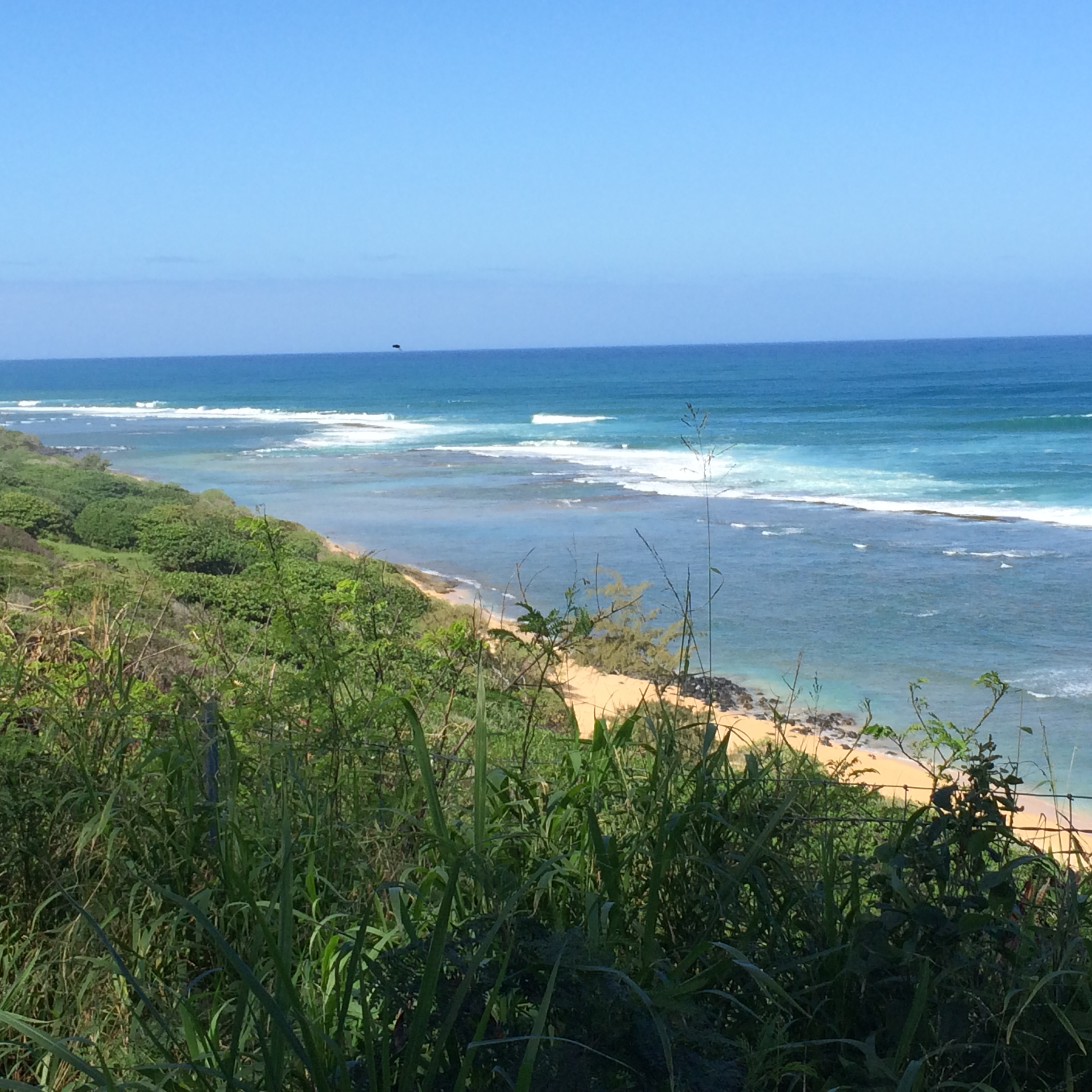
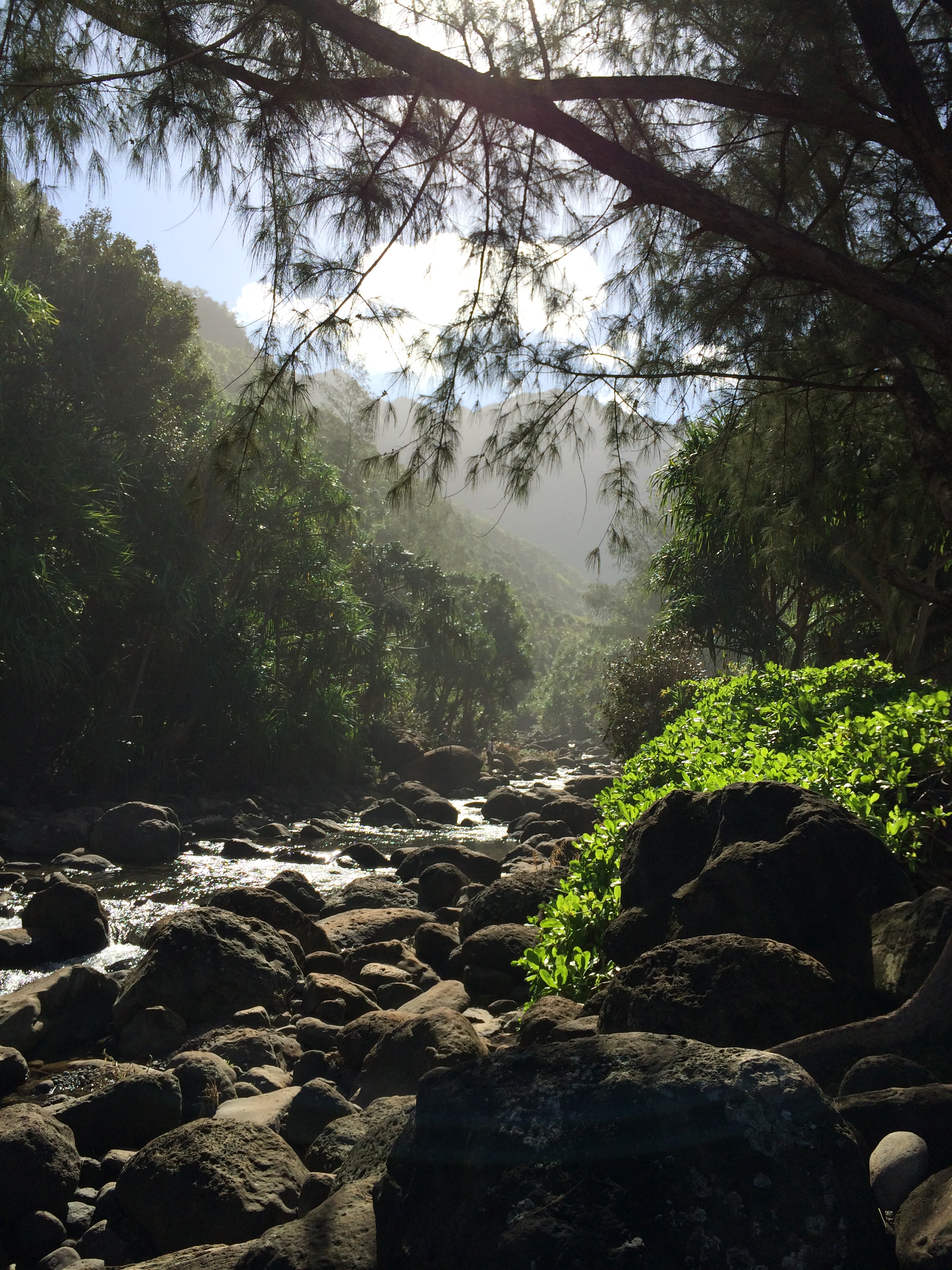
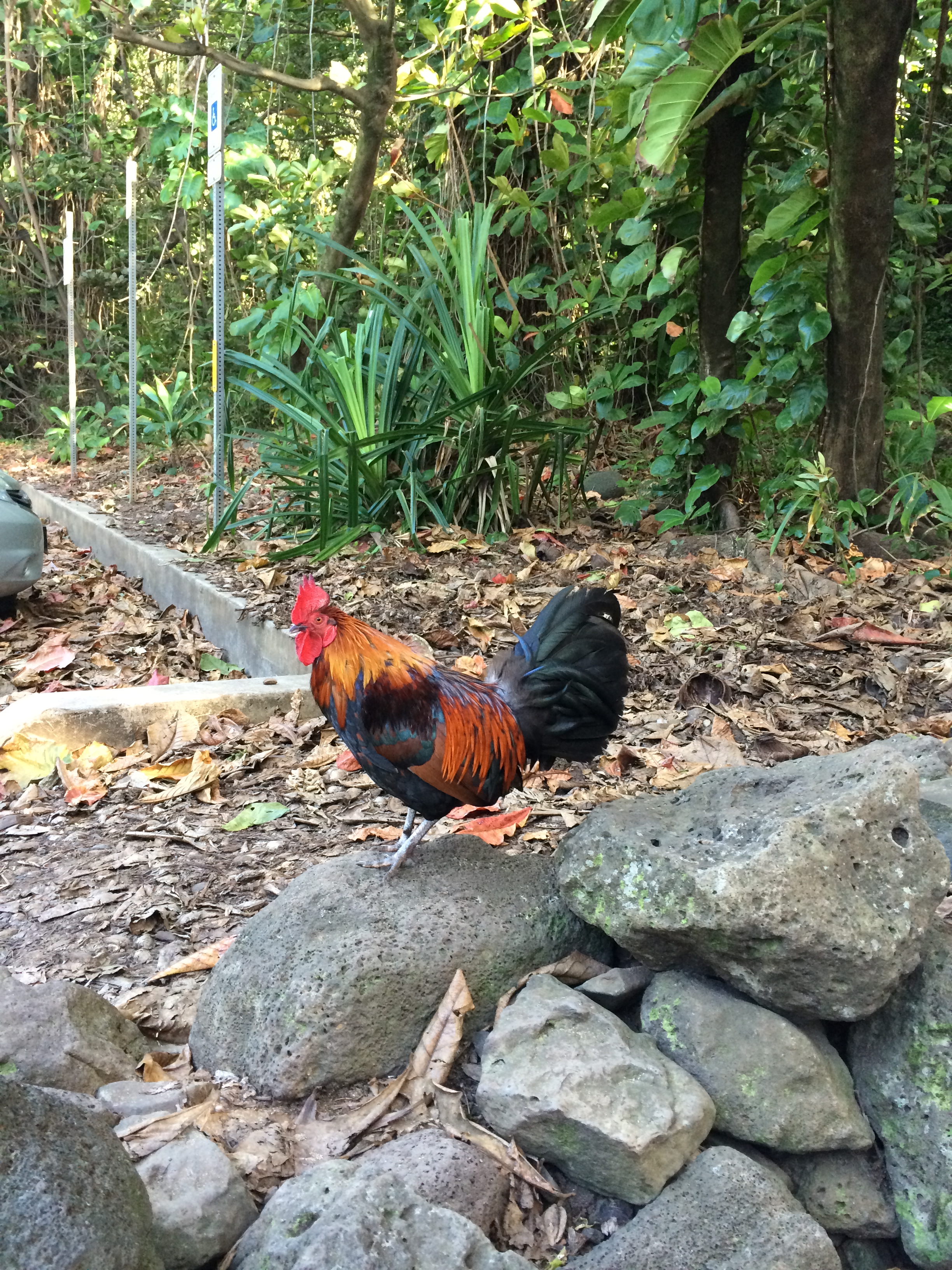
This past weekend David and I, and my brother Eric, visited the ‘City of Rocks National Reserve’ in south central Idaho. We can hardly travel now without Eric, besides, he is familiar with about every rock and cranny of Idaho and suggested the trip in the first place. Our only condition was wherever we went it had to be ‘south’ – we are so winter-weary. The City of Rocks is about 120 miles southwest of us, near the Utah border.

We left Idaho Falls Friday, April 11 about 4 PM. Destination: Albion, Idaho, a town of about 260 people near the east entrance to the park. We reserved a room at the Albion Bed and Breakfast –

We are south of Burley now, traveling on 500 South toward Albion. Check out the sky! “Lenticular clouds.’ David explains.

IMG_7488

IMG_7498

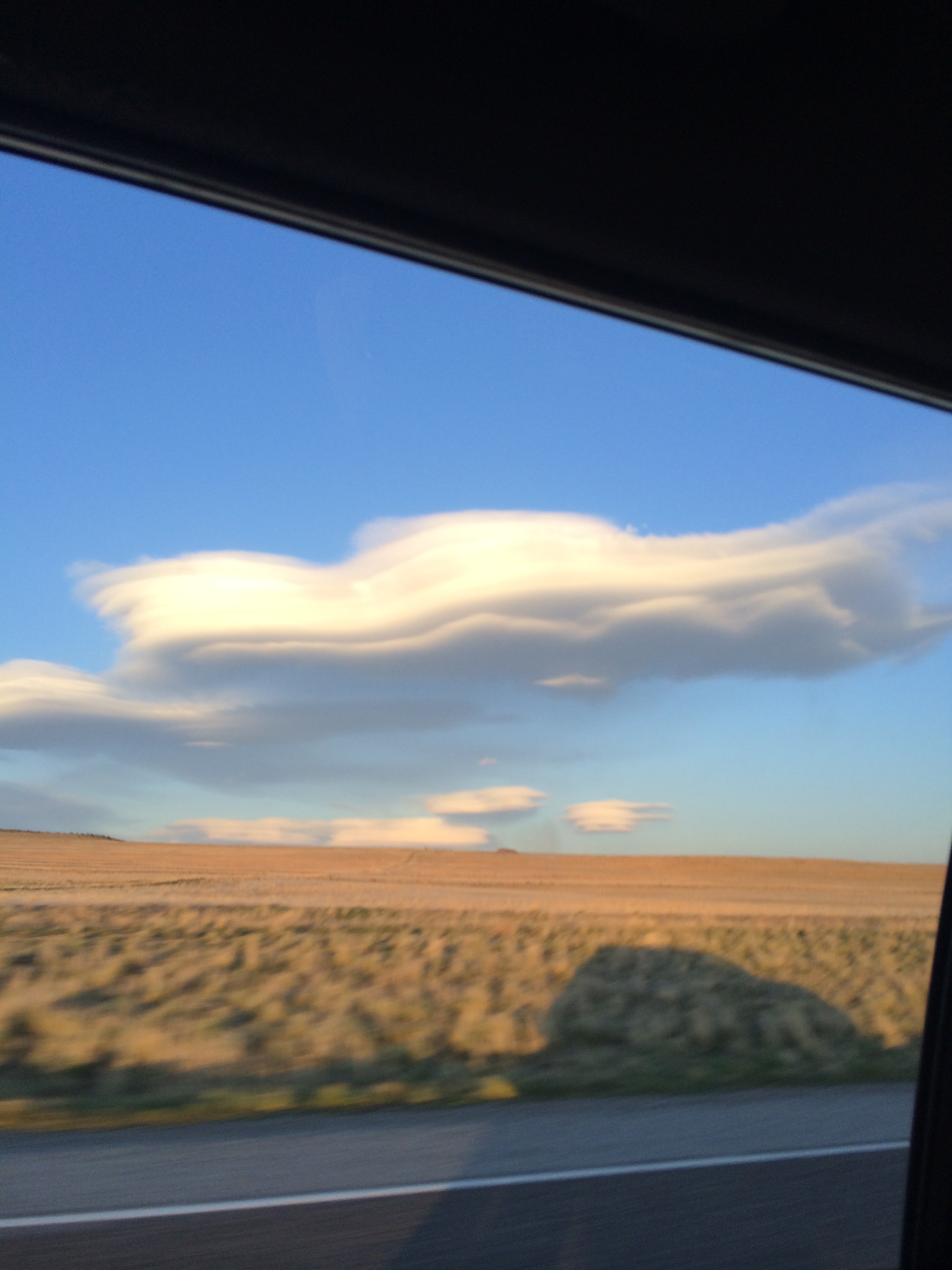
Lenticular clouds ( I Googled it) are stationary lens-shaped clouds that form in the troposphere, normally in perpendicular alignment to the wind direction. (And, yes, we’ve had lots of wind direction.) Due to their shape, they have been offered as an explanation for some Unidentified Flying Object (UFO) sightings. Uh, you mean like the UFO sighting above that town we’re approaching?…

IMG_7491

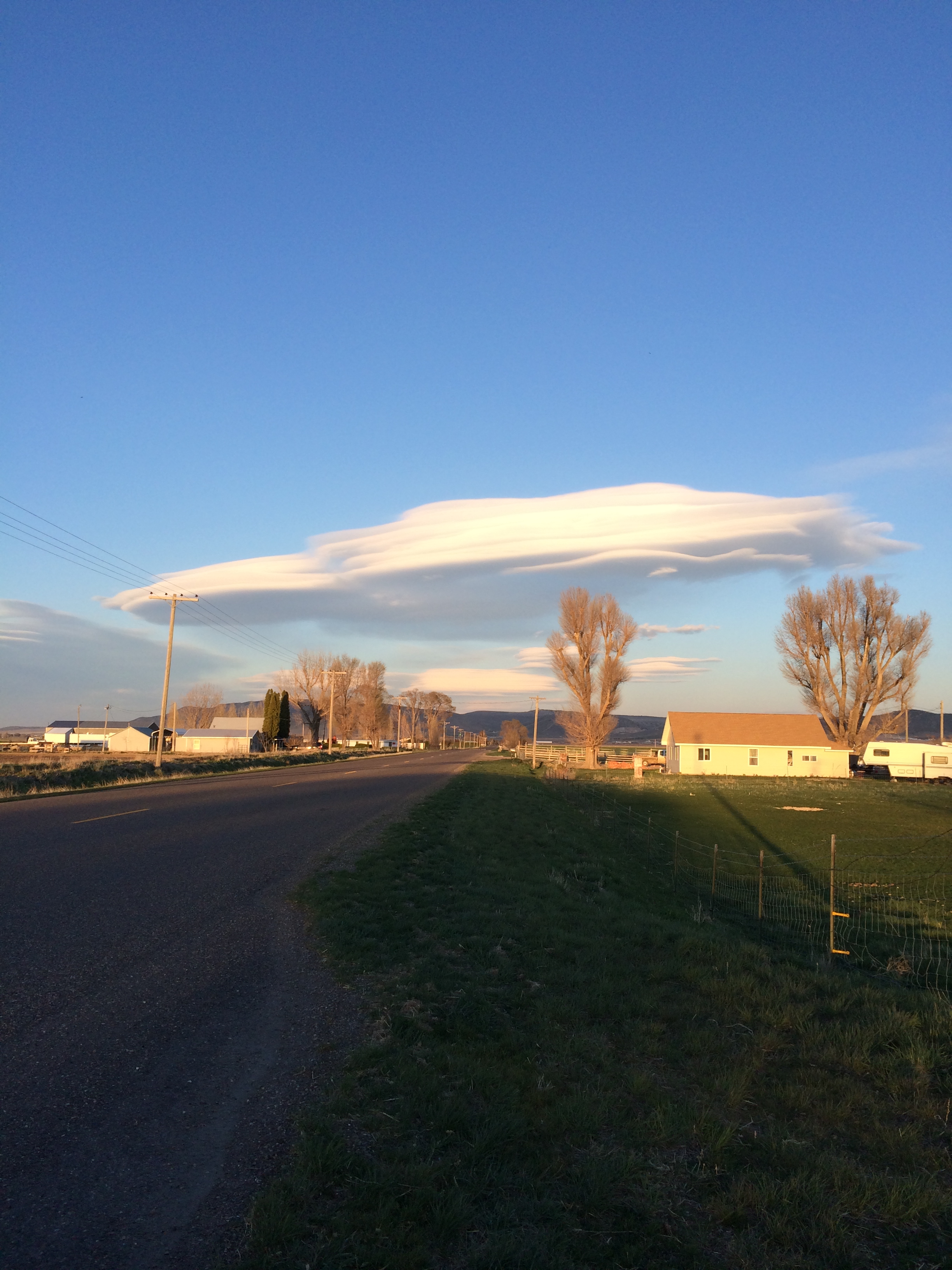
I can’t resist posting one more photo – of the waxing moon rising between the lenticular clouds:

IMG_7493

We arrive at the Albion Bed and Breakfast just before dark. It is owned and run by a very interesting fellow named Chad, who restored/converted the Albion State Normal School, established in 1893, into a very comfortable place to stay. The school was established as a teacher’s training school but closed it’s doors in 1951. It was in quite a state of disrepair when Chad bought the property about a decade ago. He gave us a tour, describing all the improvements he had made to open it up as a bed and breakfast. Chad served us up a killer homemade breakfast on Saturday morning – here is a link to the B&B – for detailed reviews and photos (including a photo of Chad and his family).

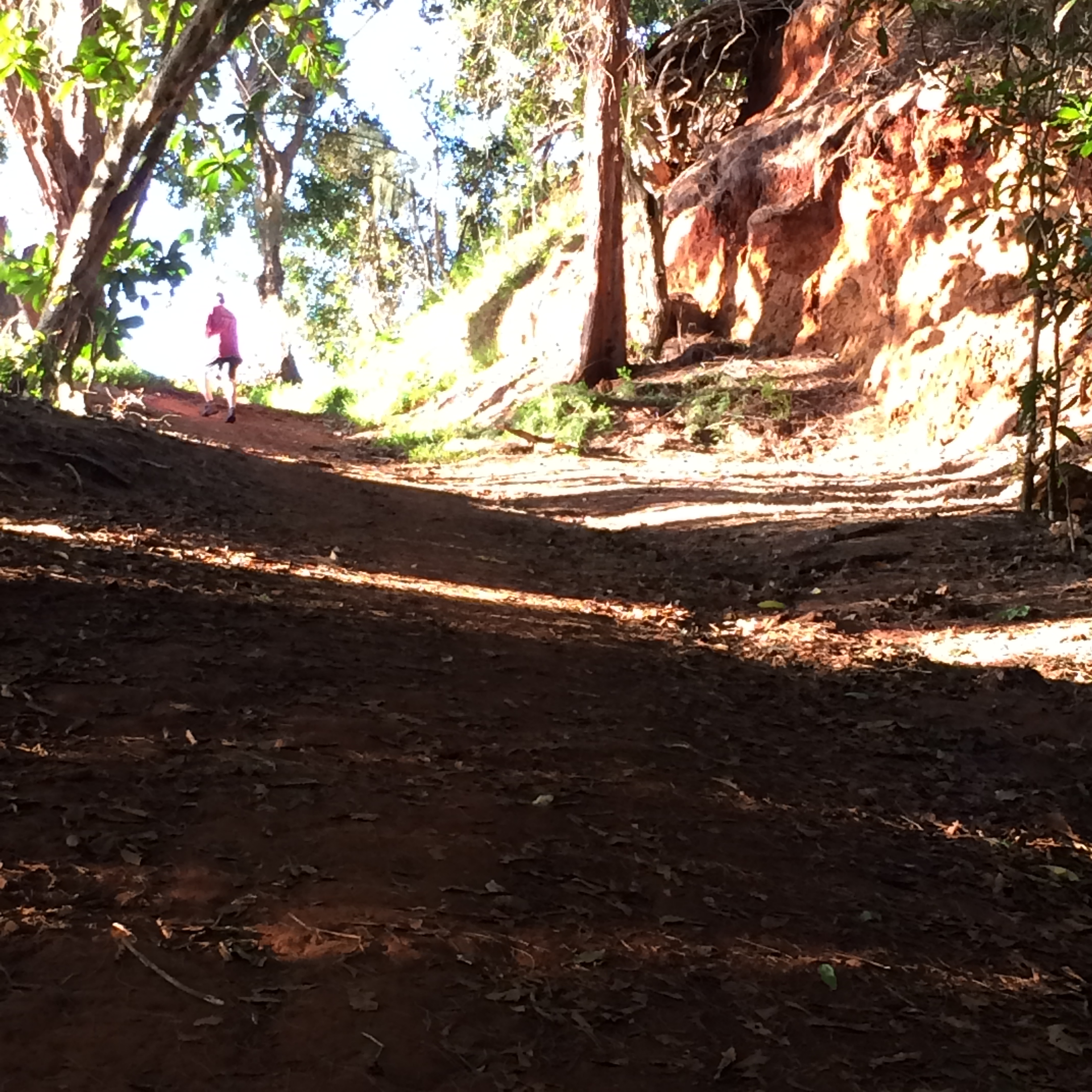
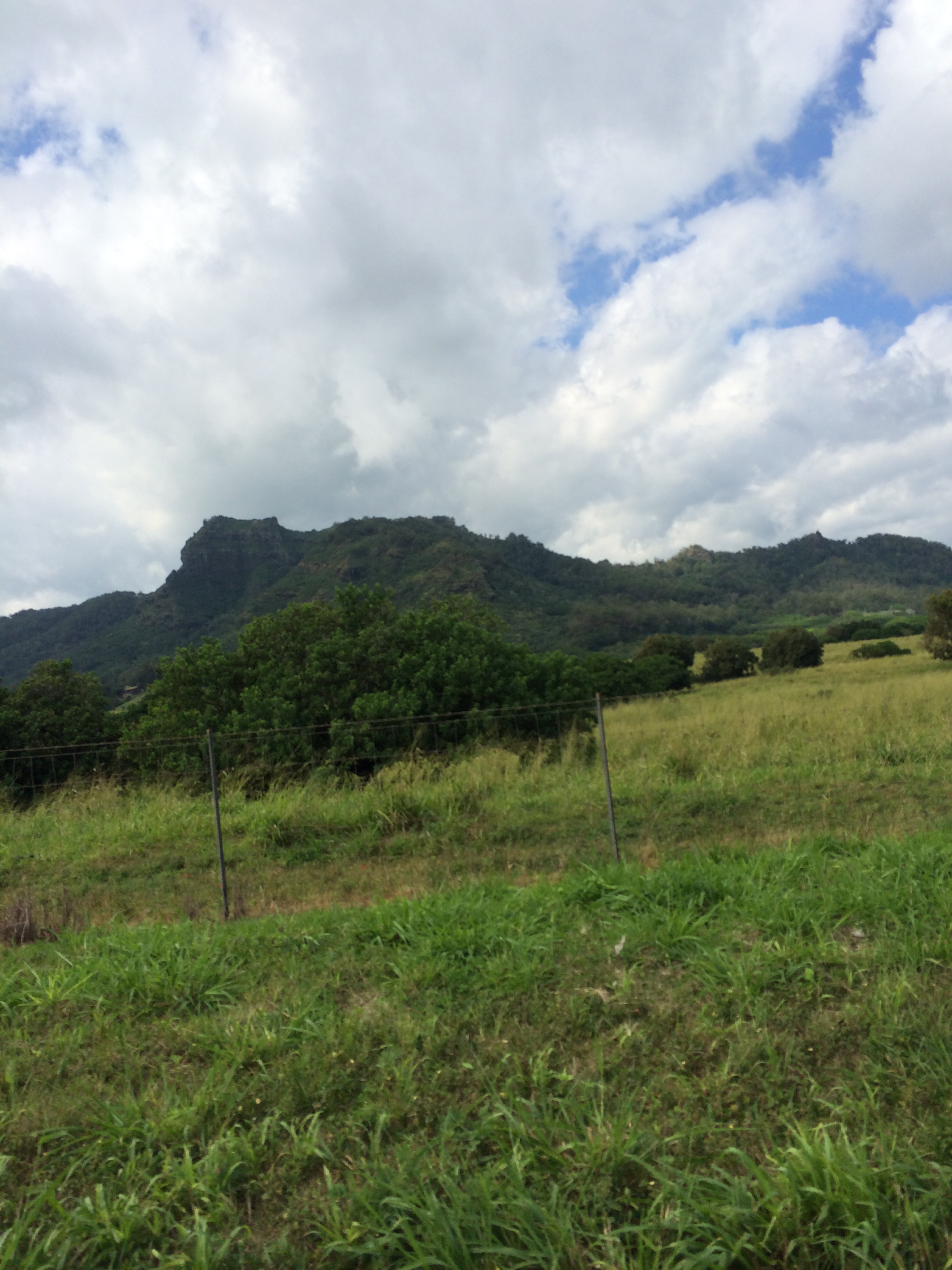
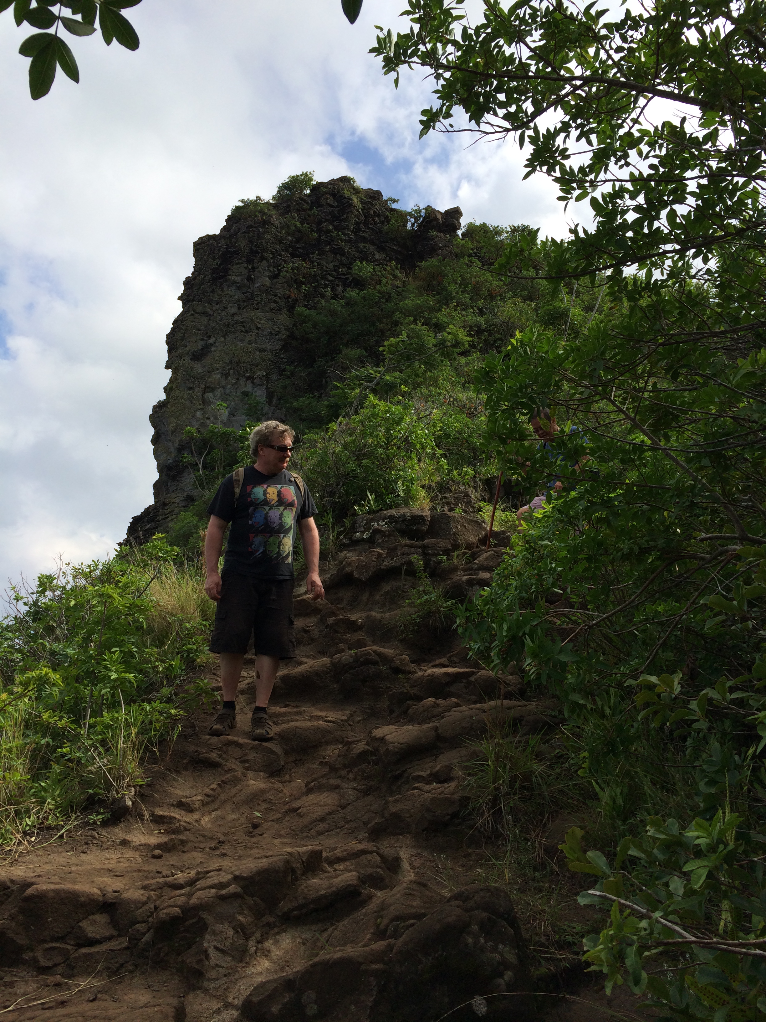
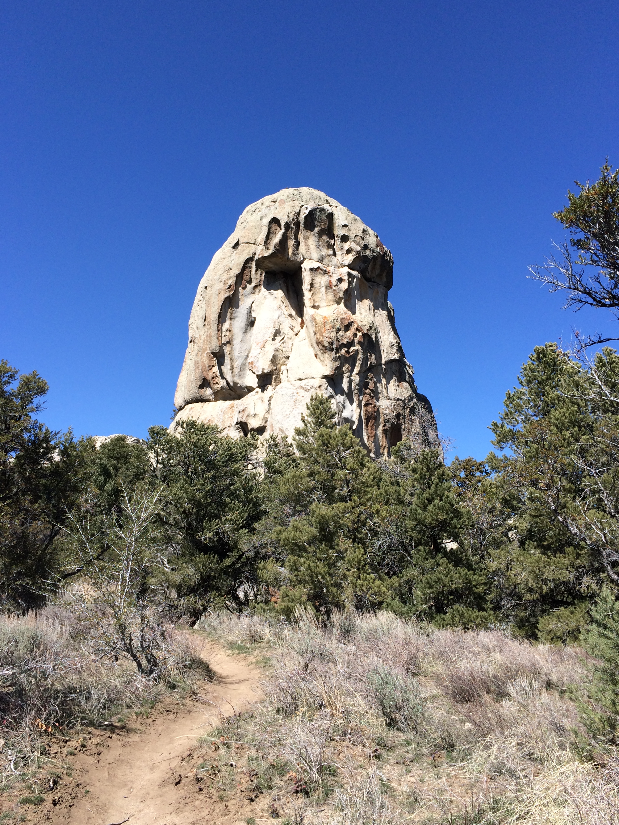
By Saturday late morning we entered the City of Rocks. Here we are embarking on our first hike, the Stripe Rock Loop, near the east (Almo) entrance of the park,.

IMG_7504

We pass a grove of quaking aspen, stunning even in dormancy

IMG_7510

The ‘Inner city’ of the City of Rocks is sprawled out before us in the distance

IMG_7514

with the Albion mountains as a backdrop.

Monsters and critters seem to inhabit the granite spires. I am pretty sure that’s an owl gazing at me

IMG_7516

– the critter on the left of that outcropping.

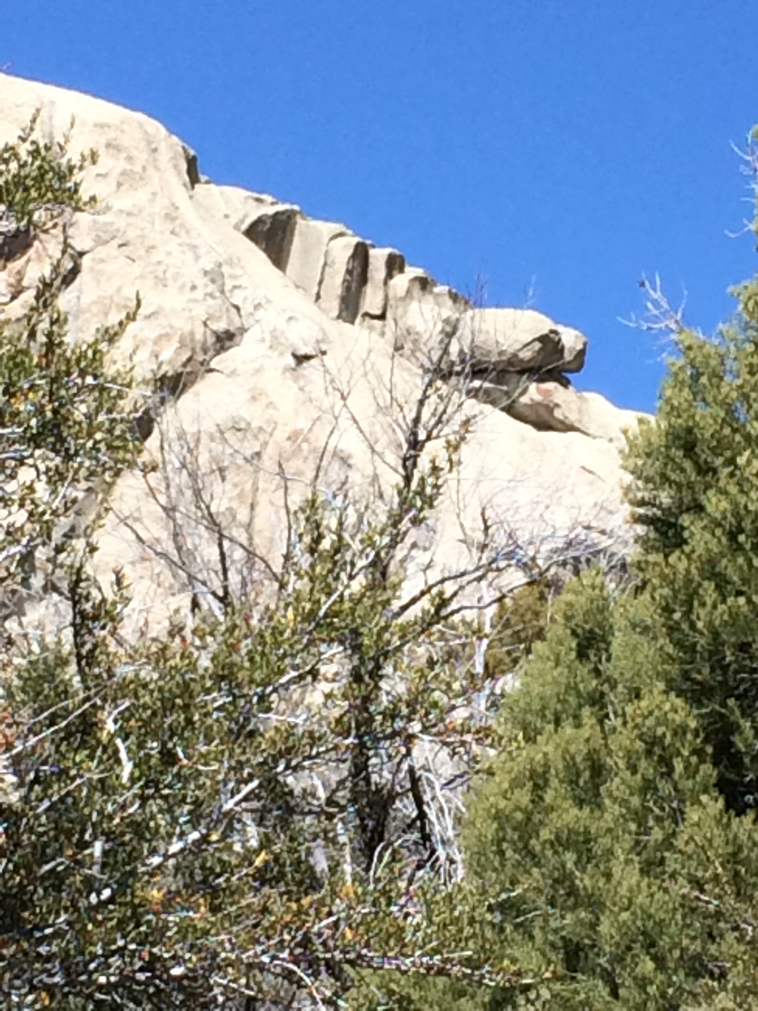
Now we are looking down the back of someone’s throat – at a giant uvula

IMG_7520

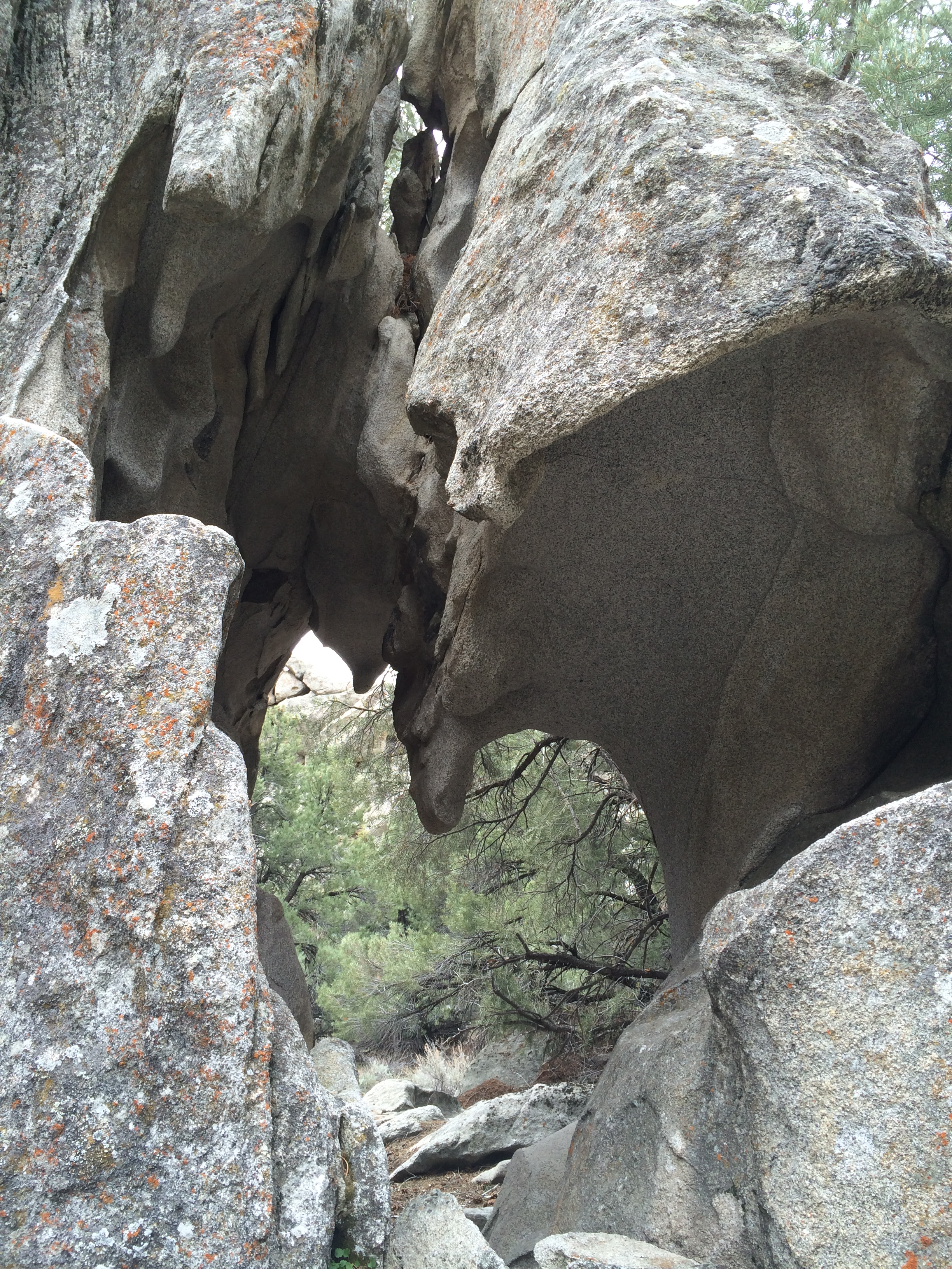
supported by reams of muscle and connective tissue.

Go for the ‘Beef Jello/Banana’ or …

IMG_7524

the North Fork Circle Creek trail? We chose the latter.

There are over 22 miles of hiking in the City of Rocks. Here is a link to a map of the trails.

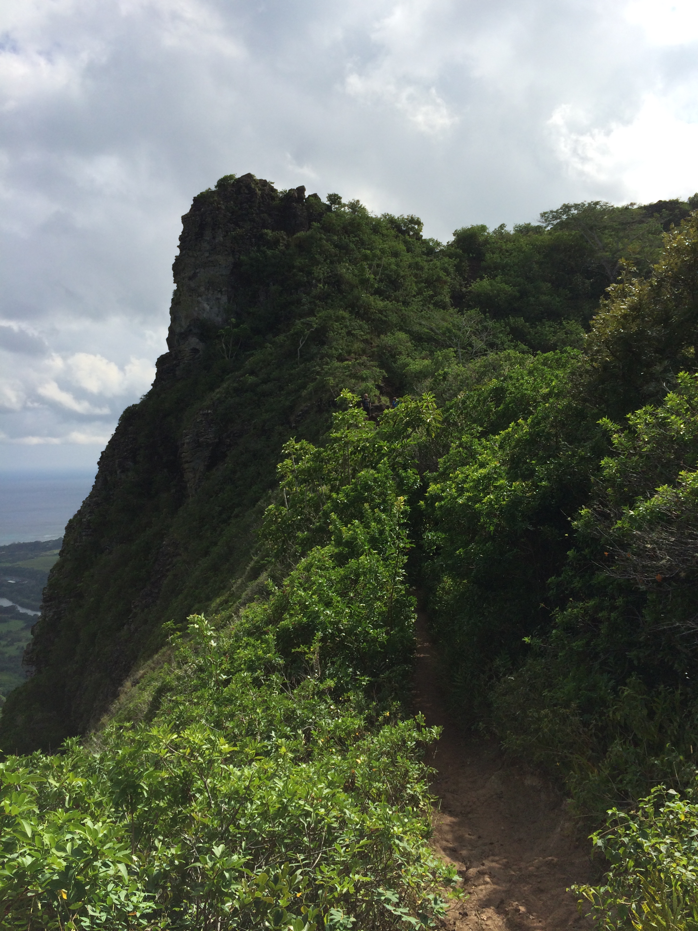
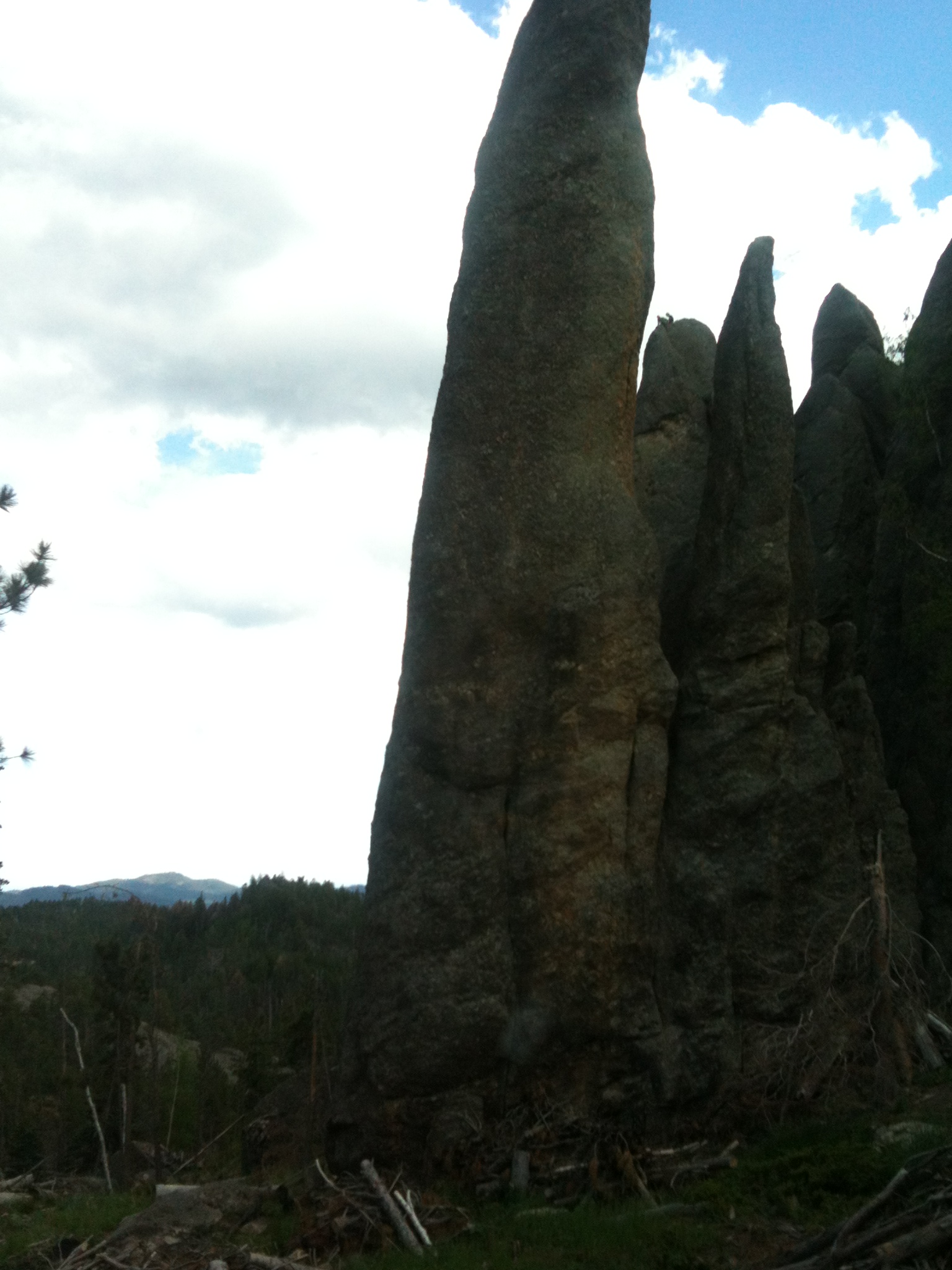
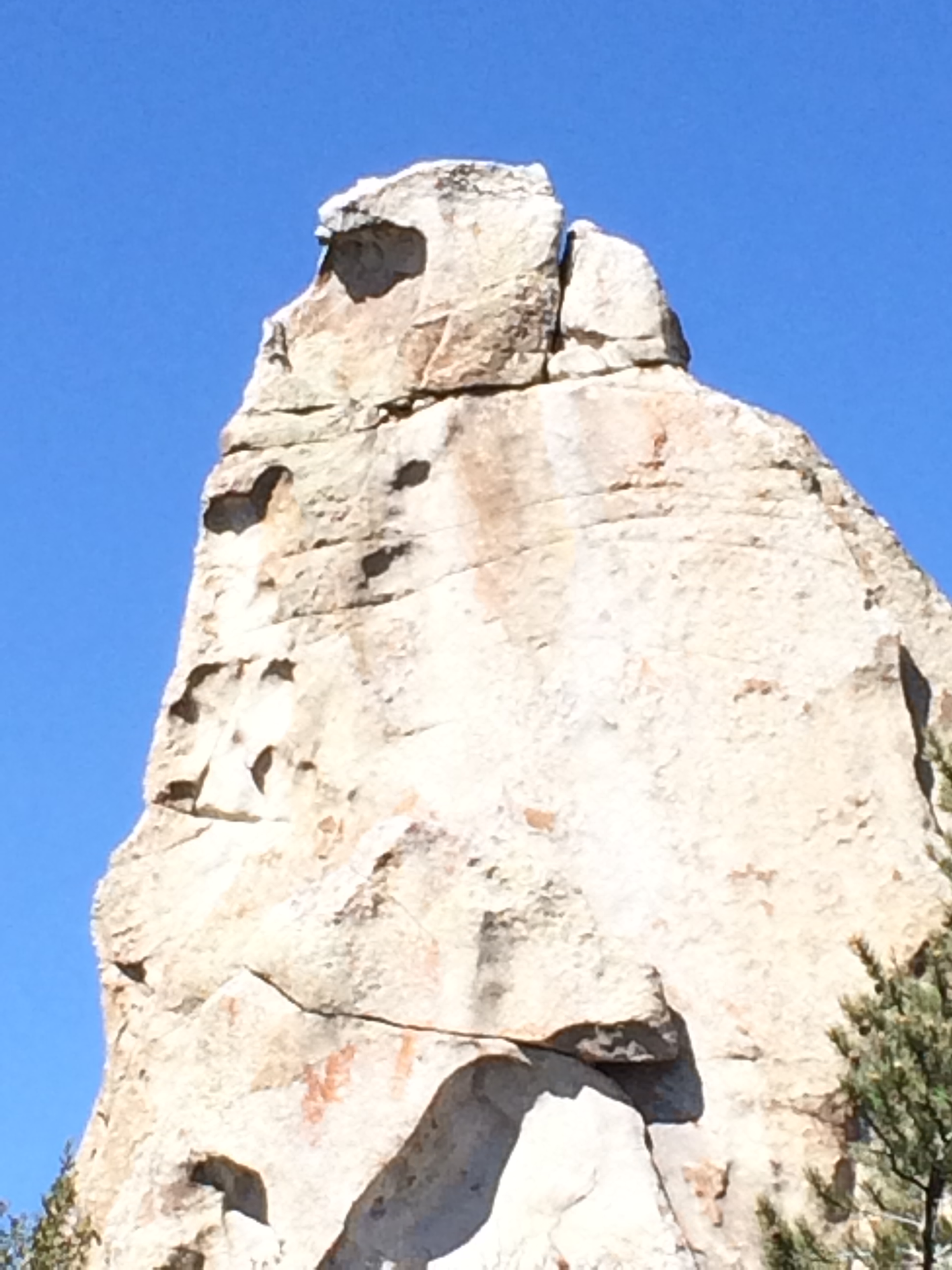
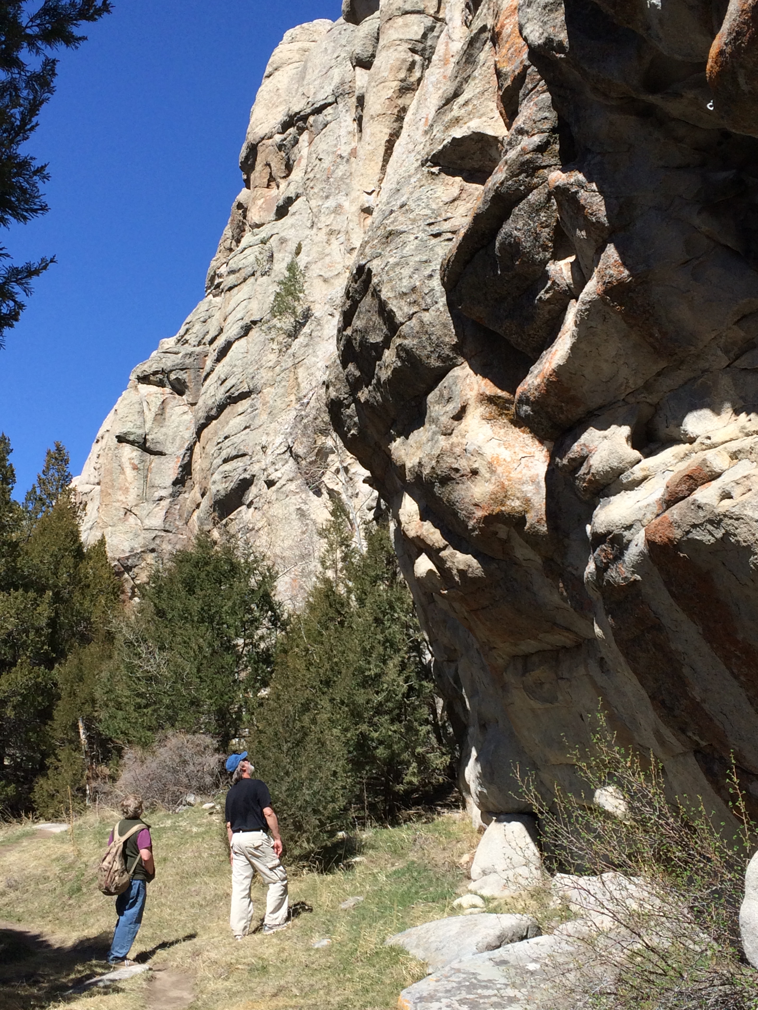
Granite spires and rock structures range in height from 30-600 feet. There are several enormous textured rock structures that are tailor made for rock climbing. Here is one:

IMG_7535

If you look carefully, you will see two climbers scaling the face of this rock. Here I have zoomed in on the same rock –

IMG_7536

The climbers have several companions at the base manning the ropes.

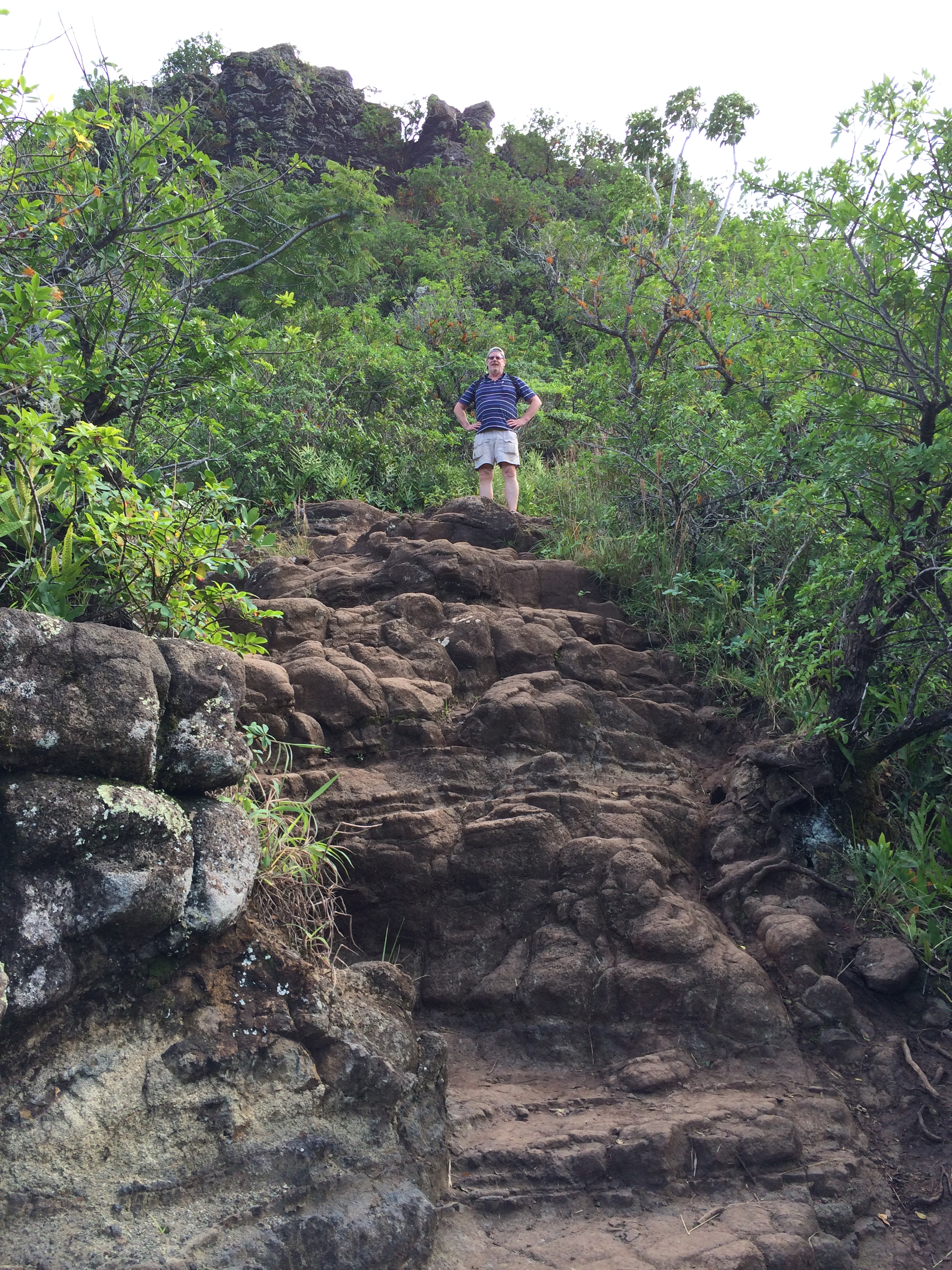
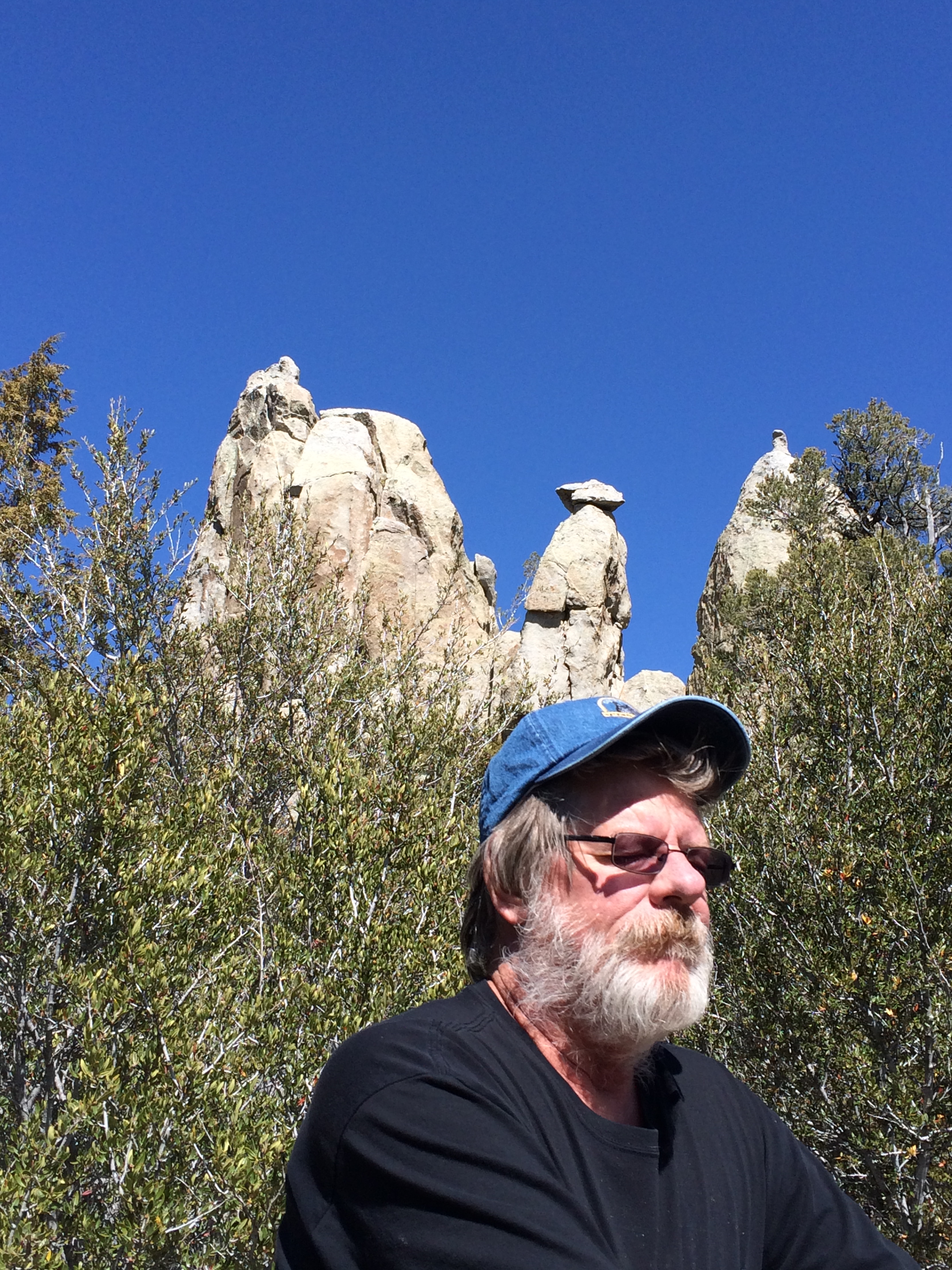
Eric poses for a photo

IMG_7538

Is that critter in the rock right behind Eric mimicking his pose? Hmmmm?????
(What do YOU think?)

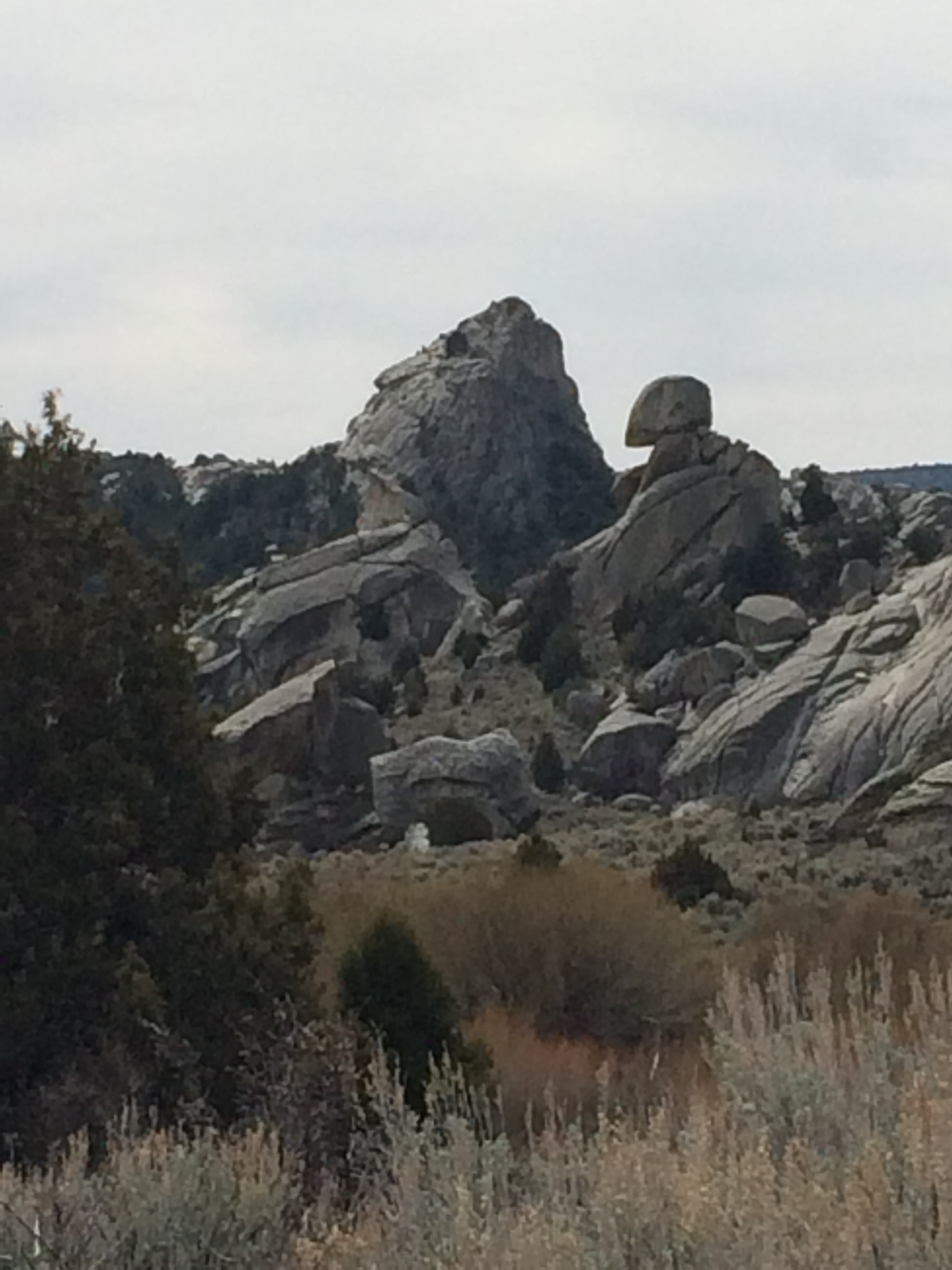
Then we see this Giant riding a Harley with his helmeted side-kick seated behind him.

IMG_7554

David captured a photo of me –

IMG_7690

I had just shed my fleece – the clouds were clearing and the day opened up into marvelous warmth and sunshine.

We passed by “Bucket Land”

IMG_7560

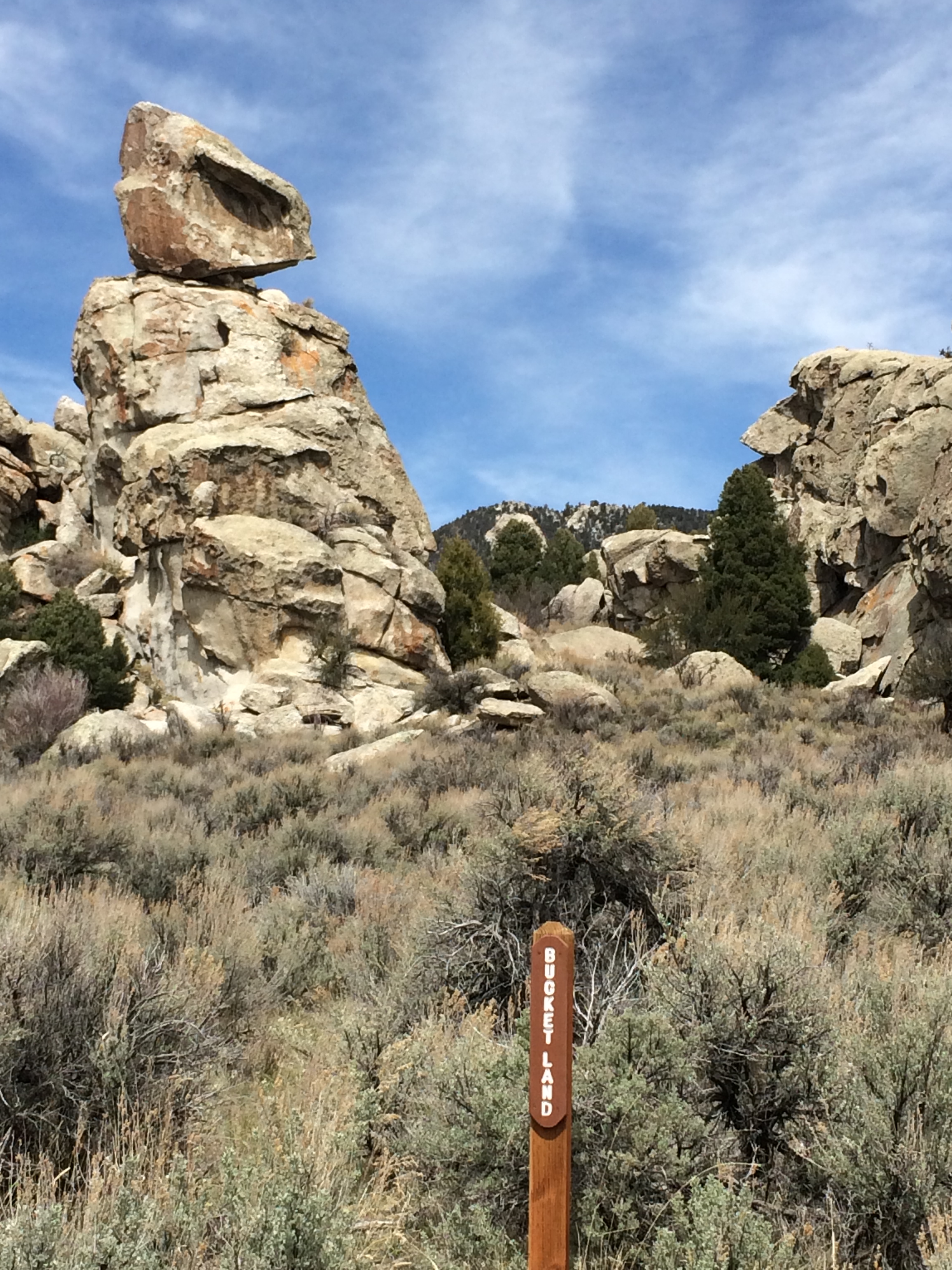
What’s on your bucket list? A close encounter with Aliens?

Next we pass ‘Mad Grandpa Furby with Gentle Turtle,’ surrounded by their offspring

IMG_7561

Protected from eastern invaders by their friend, Giant Snake.

IMG_7562

We’re headed by car now to the ‘Inner City’ of the City of Rocks. Along the way we can hear the howls of

IMG_7564

a southwestern coyote.

We stop at campsite 32, walk a few hundred feet, peer through the widow arch

IMG_7565

and check out the adjacent canyon.

IMG_7566

We drive to the parking lot at “Parking Lot Rock” and hit the Creekside Towers Trail into the ‘Inner City.’

Right off the bat we meet this rhesus monkey – you see his head in profile

IMG_7571

peering to the west.

Then we meet this sad-eyed elephant

IMG_7576

perched all by himself.

And a snake

IMG_7578

sunning himself –

A thinker …

IMG_7577

(David, struck by a bolt of inspiration…),

A proud couple standing erect (shall I say?) amongst some very large boulders

IMG_7568

Female?… and indisputably… MALE

“No, David and Eric, don’t even consider it – you don’t have crash pads.”

IMG_7574

I derive such comfort from these “You Are Here’ Maps:

IMG_7579

Except I doubt the map would be of much use to this person right now…

IMG_7588

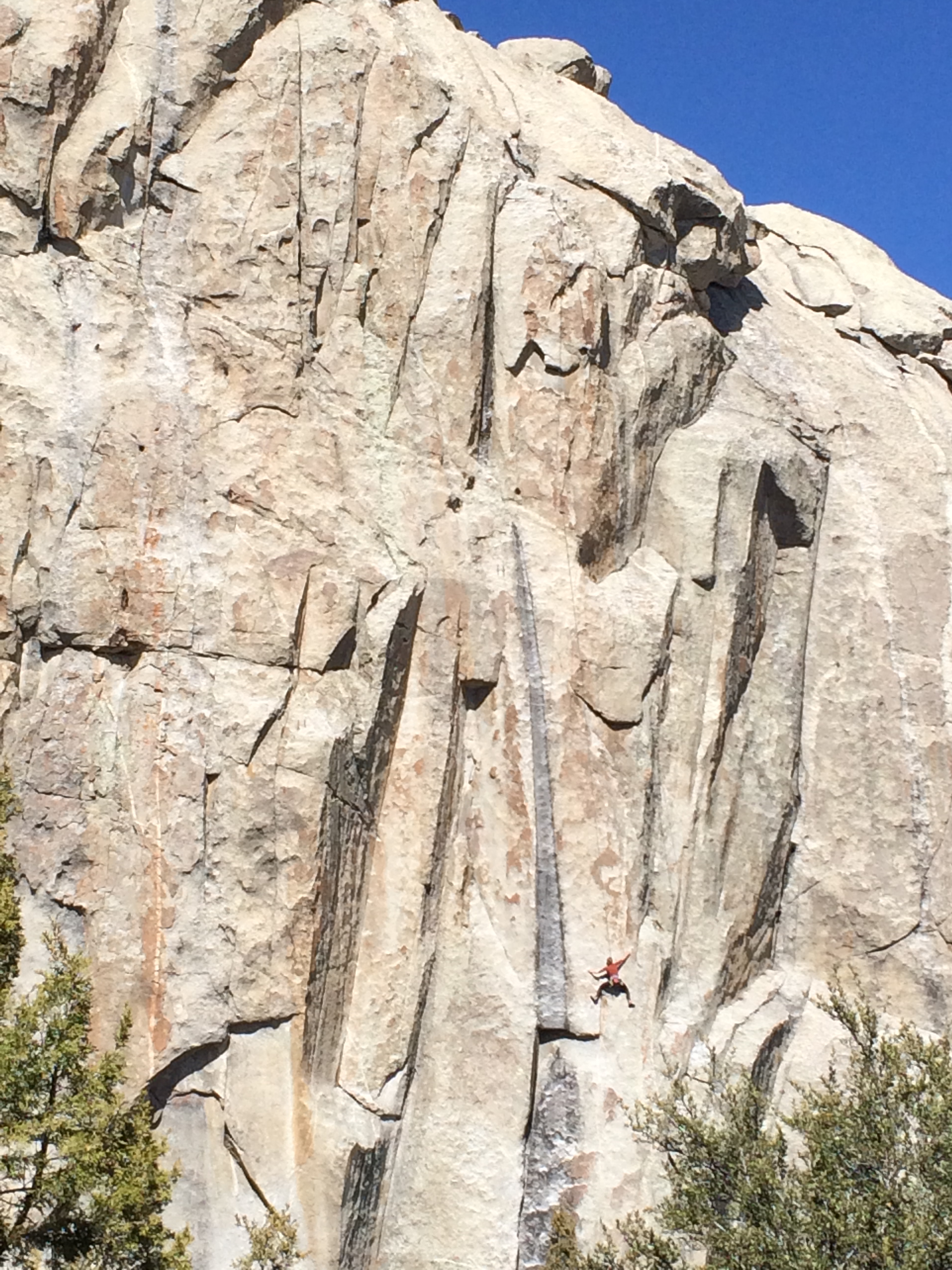
traversing the face of this huge granite rock.

We stood and watched her plant, cling, and claw her way toward the top

IMG_7592

connected to a line tethered from the top –

While hungry predators circled above

IMG_7698

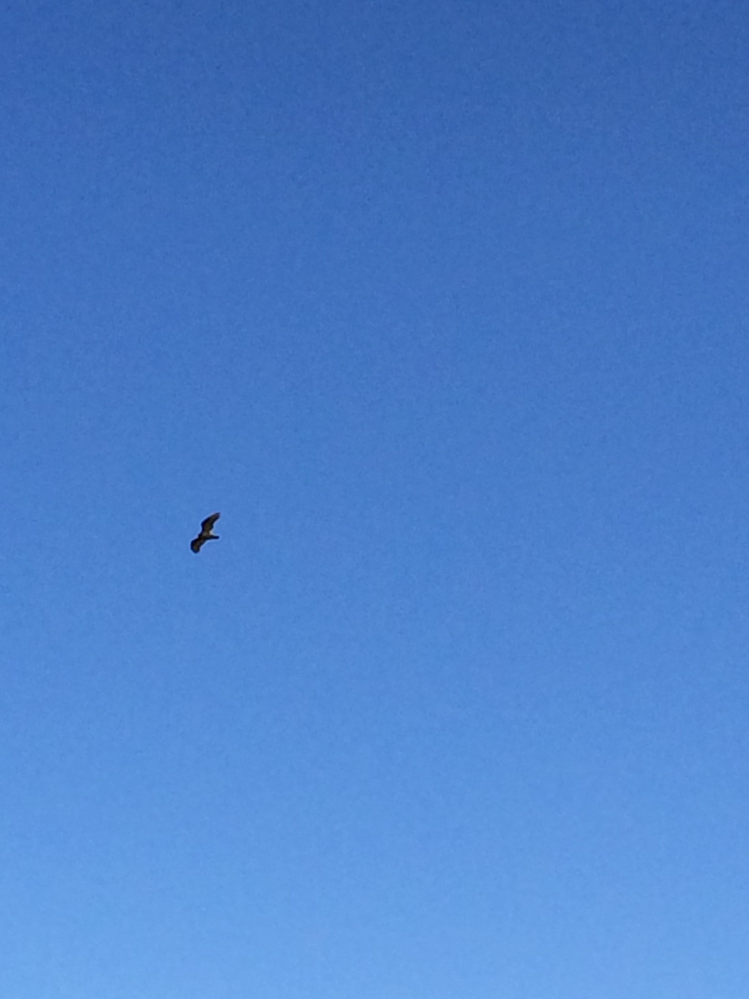
Actually, A whole ‘clean-up’ crew was hovering, too wily and swift to capture in a photo.

Gotta put a wrap on this!

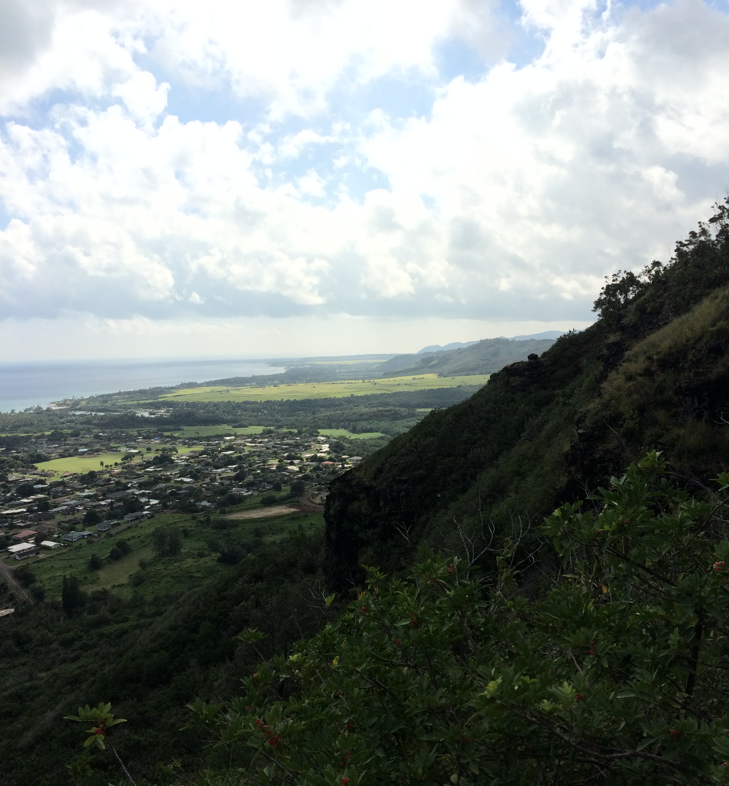
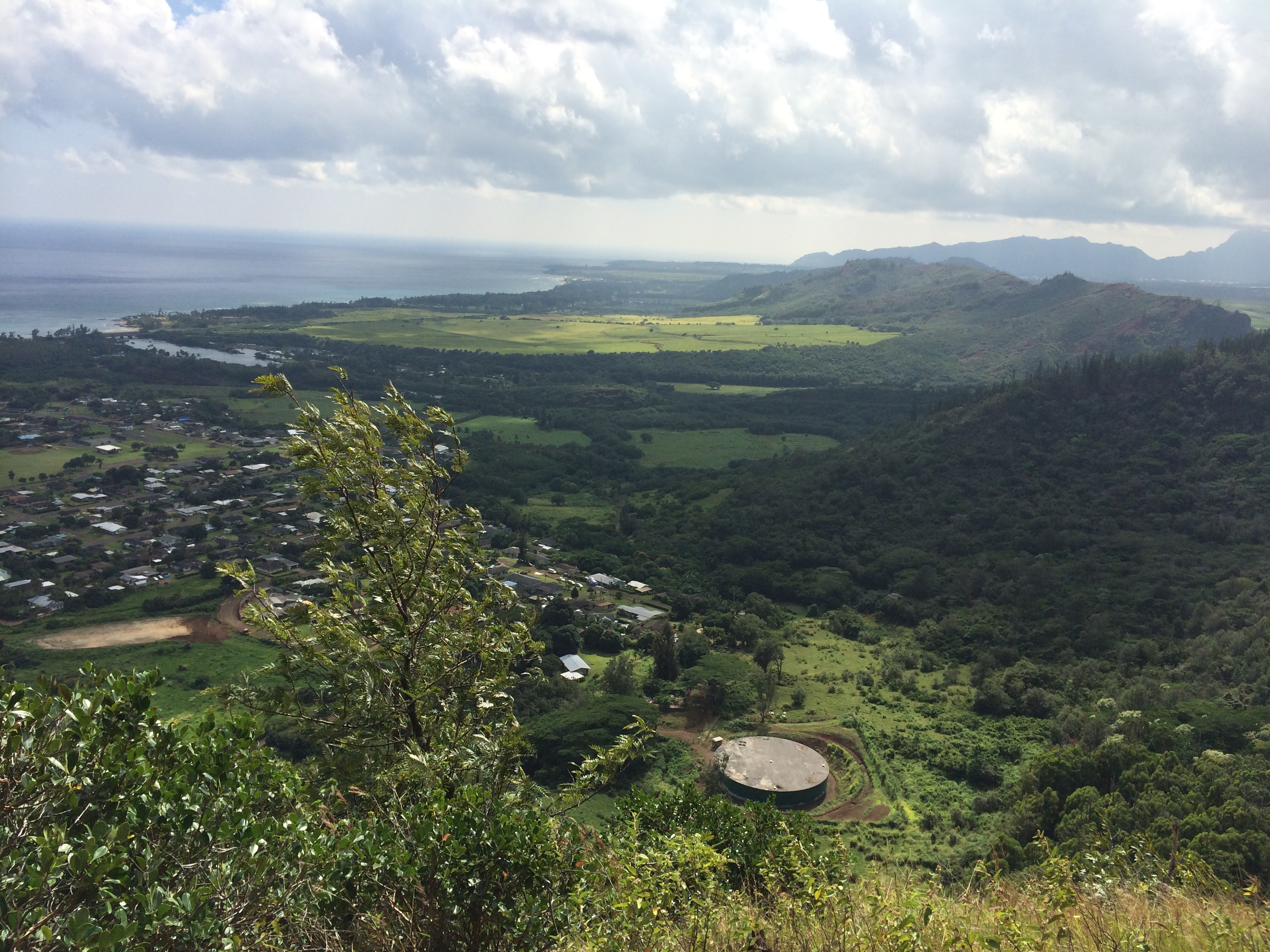
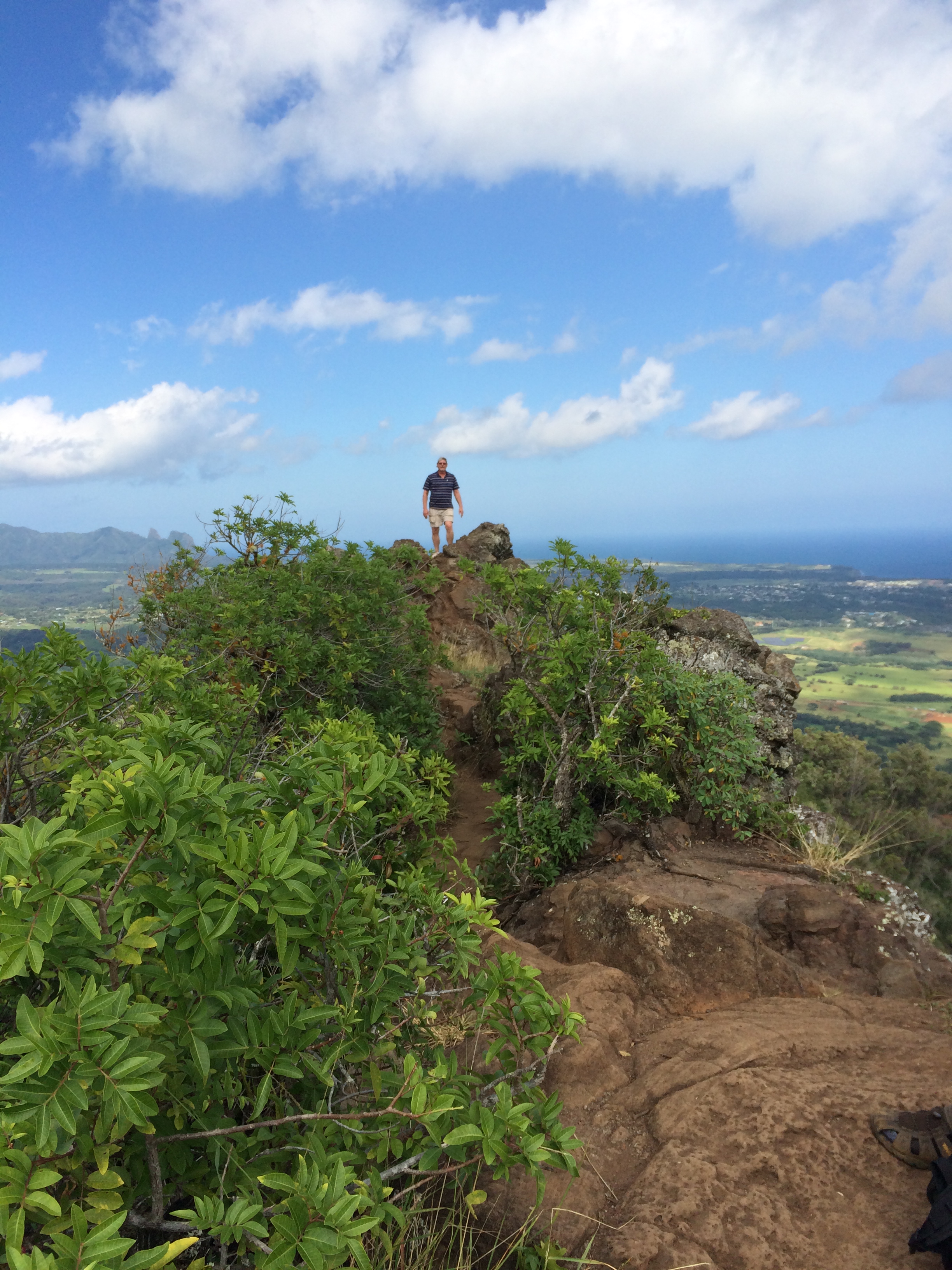
We’re headed back toward the car now – ascending the Stairway’s Trail. We open up to this panoramic view:

IMG_7697

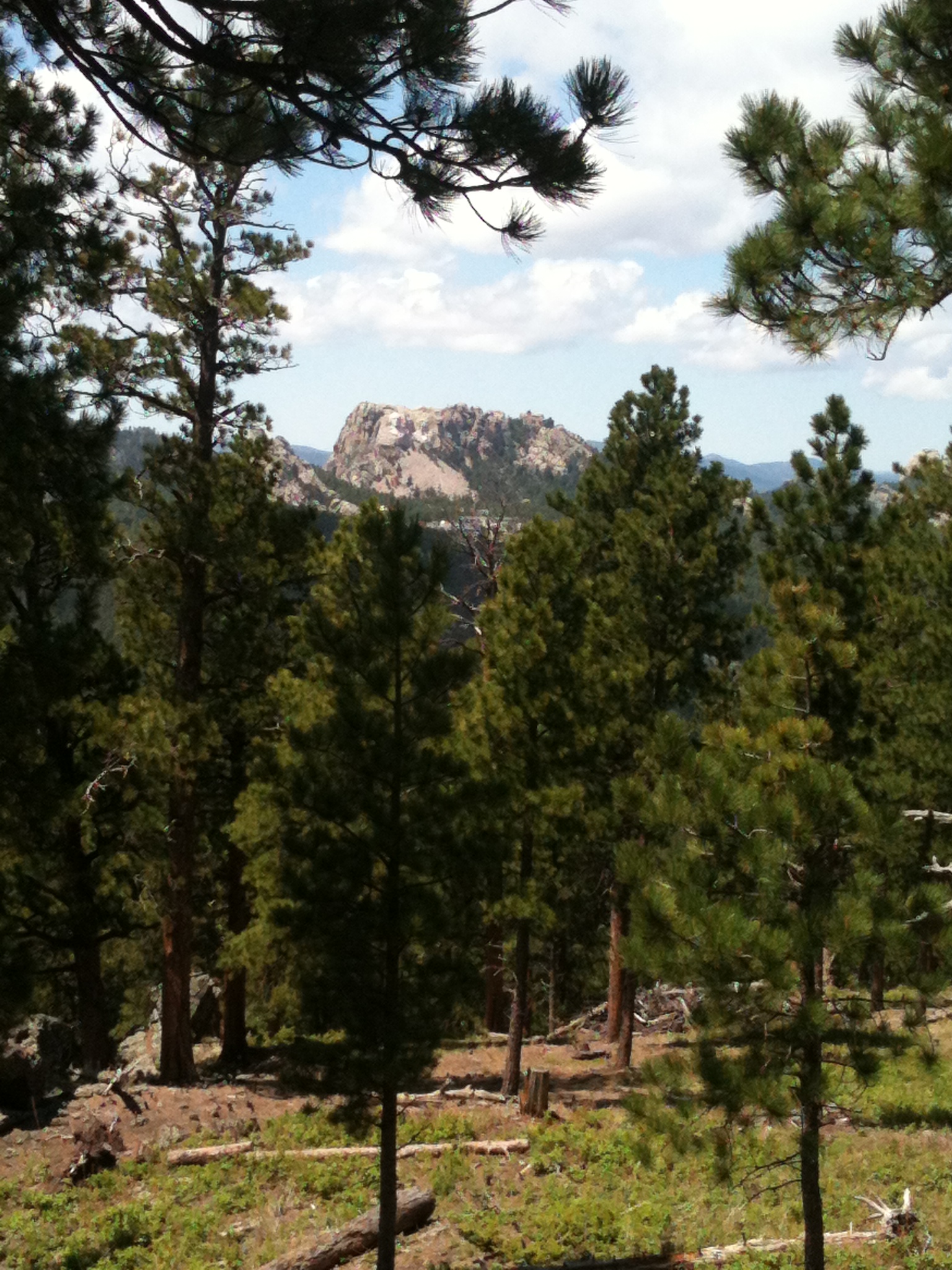
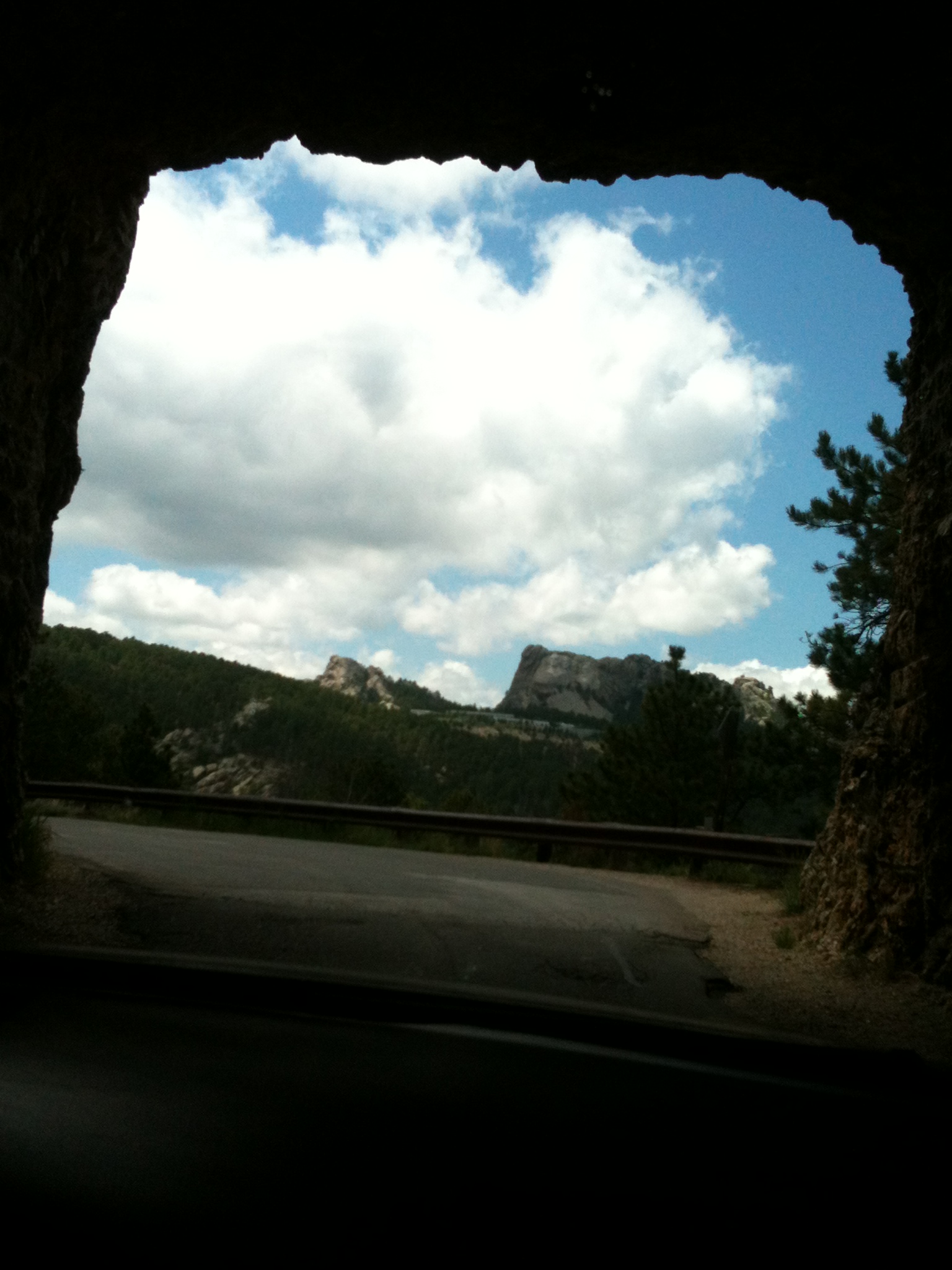
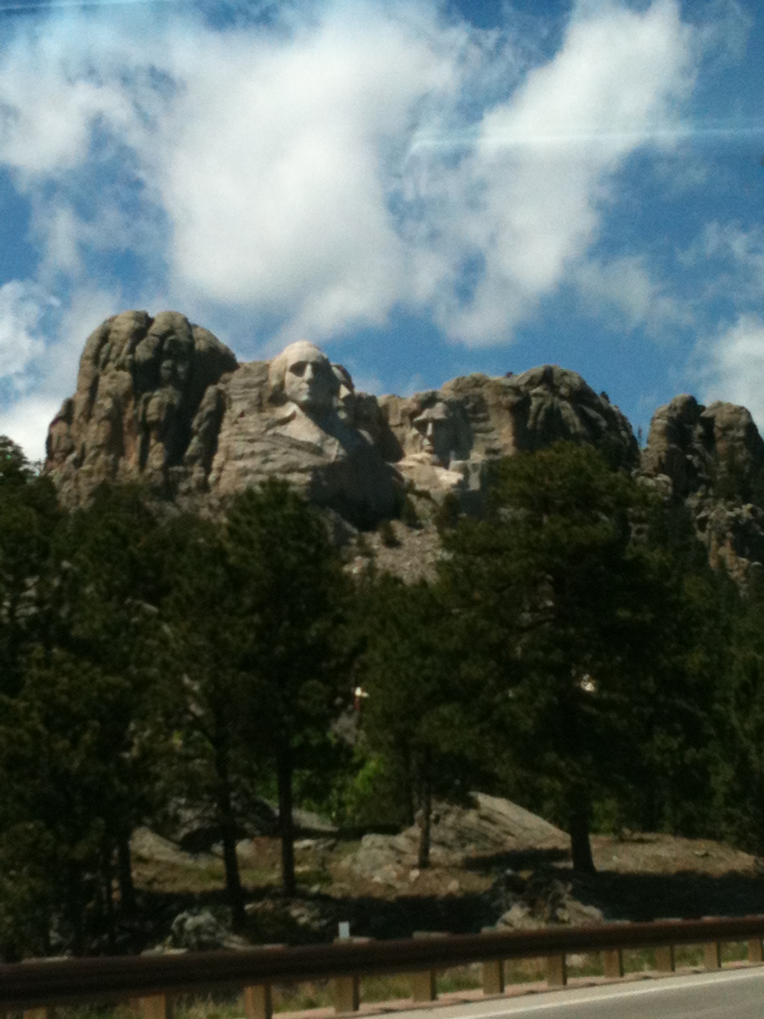
And then darned if we don’t run into Mount Rushmore

IMG_7692

A Monument of characters inhabiting the City of Rocks.

Back at the parking lot stands a rock as big as Noah’s Ark – “Parking Lot Rock.” Except the sun is shining so brightly behind it I can’t take a decent photo of it.

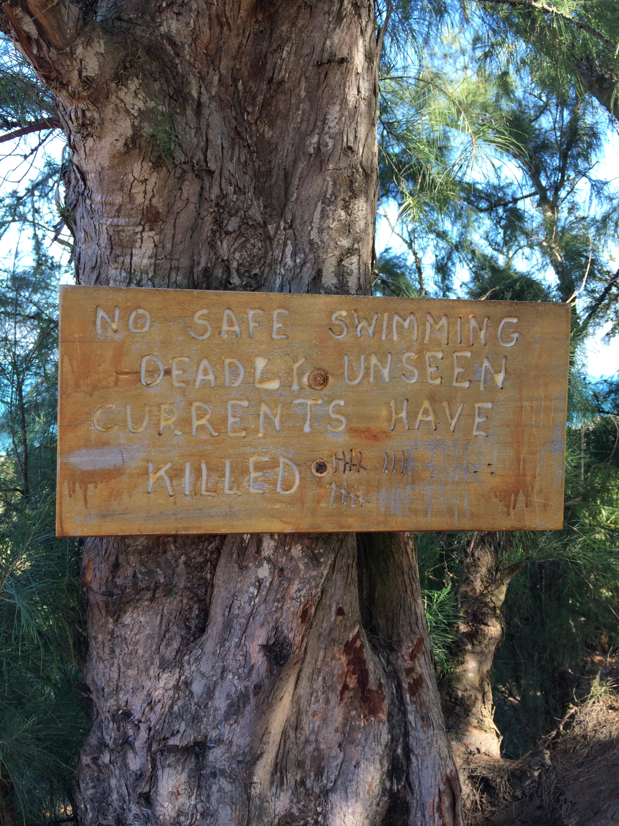
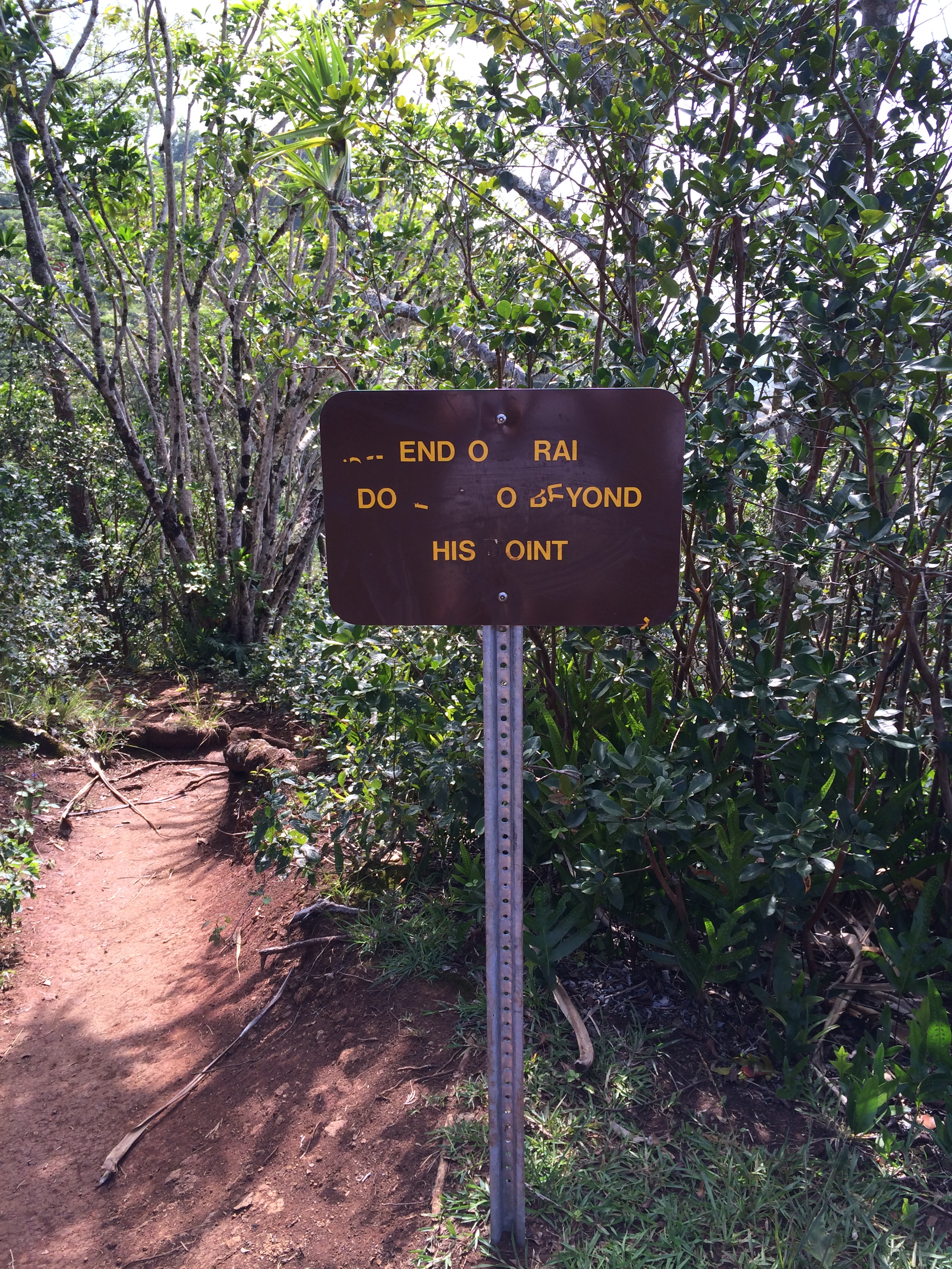
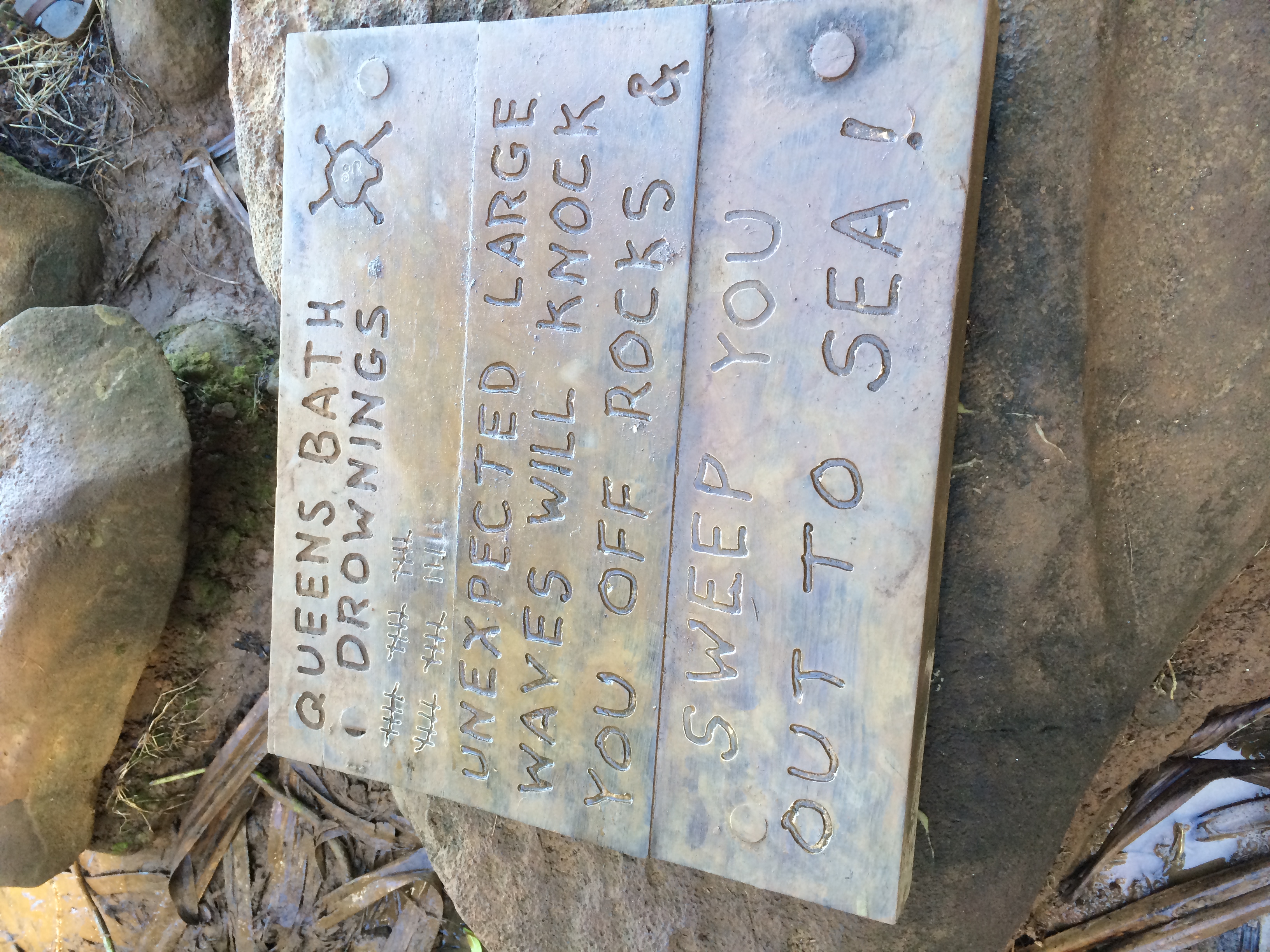
I do take photos of the bulletin boards in the parking lot.

IMG_7696

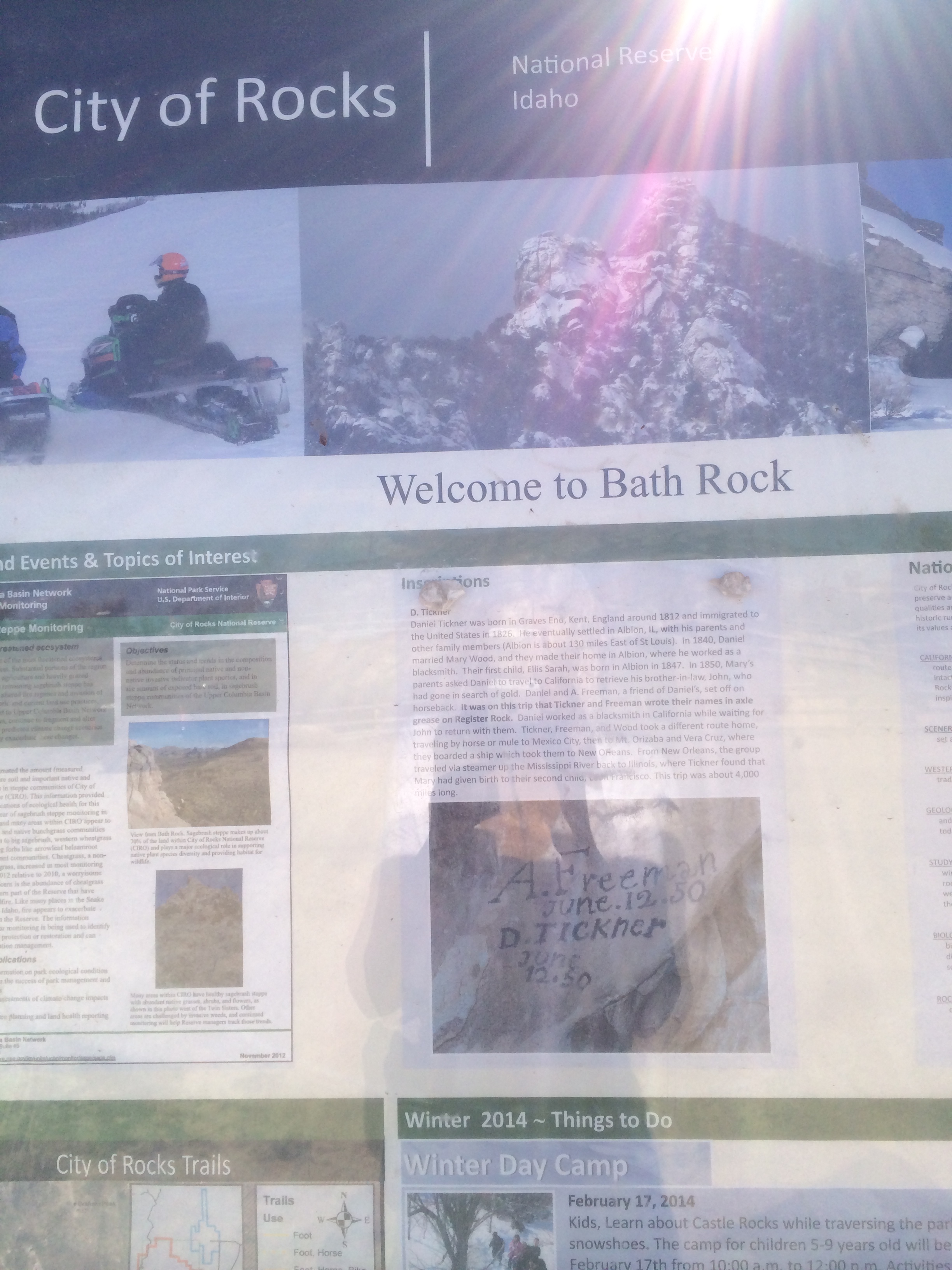
Not too decent either. But Eric and I find the message board interesting. We tried reading them all.

IMG_7694

Then Eric pointed this one out:

IMG_7693

Thank goodness for social media. I bet he’ll be so happy to hear the news from Pegg when she finds him on Facebook. Well, all I can say is, aside from being stiff and broken all over from all that hiking we did today, being the old fart that I am does have its advantages.

‘Aloha’ Idaho’a

March 8, 2014

“Aloha …WHAT?” – “Are you kidding? I thought you were done with these endless Kauai blogs!”

Well, actually, not. As you might recall, I left off with Steph searching for her sandals as we were leaving Larsen Beach.

Which, that’s a problem with a nude beach. You wear clothes getting there, shed them on the beach – and preferably not in a trail, because you have to gather them all up again when you leave the beach. (And hopefully, you also put them back on to avoid getting arrested.)

In any case, another 24 hours passed between the time we left Larsen Beach to when we pulled into our driveway in Idaho Falls. (Does this frighten you?) My main focus on our last leg of this trip was to ’embrace the journey’ if you will. How to carry the ‘Aloha’ home to Idaho?

‘Aloha’ is the most Hawaiian word. It can mean ‘Hello’ or ‘Goodbye’. It also means ‘love’ and ‘affection’. The literal meaning of ‘Aloha’ is the ‘presence of breath.’

‘Aloha’ is sending and receiving positive energy, living in harmony –

IMG_7003

for example, the harmony you see in nature.

‘Aloha’ was the working philosophy of Native Hawaiians and was presented as a gift to the people of Hawaii.

“Aloha means to hear what is not said, see what cannot be seen, and to know the unknowable.” Easy-peasy.

Well, all I know now is, the sun is setting on Kauai…

IMG_7270

“Steph – take one last photo of us!”

IMG_7267

Awwwwww. Too late for photos now. It’s time to head to the airport anyway…

Aloha Kauai! For real this time.

Fourteen hours later we are nearing the descent into Salt Lake City where David’s truck is parked.

IMG_7282

The landscape seems surreal.

We land safely and have just climbed into David’s truck – Now we have to make the 3-hour drive home to Idaho Falls.

Eric’s riding shot-gun.

IMG_7291

Out of no-where that fur-lined, Mad Bomber hat or whatever that thing is called, appears on his head. He travels prepared.

“BRRRRRR!!!” Is all I care to contribute to the conversation from the back seat, wincing from the sting of the frozen lining of my down jacket against my arms …

The whole Salt Lake Valley is blanketed in a thick smog. I had taken a few photos of the smog, but inadvertently deleted them, maybe a Freudian thing, especially in the spirit of carrying the ‘Aloha’ home to Idaho. The smog around Salt Lake and further north into Ogden was thick, ugly and toxic. A stark contrast to Paradise.

We were glad to drive out of the smog into Idaho.

IMG_7297

We’re starving now, and I think it’s Malad where we decide to pull off the freeway into Burger King for a quick gut-bomb to hold us over. I capture a photo of this sign as we exit the parking lot:

IMG_7292

Yep, we’re in Idaho, all right. Not your most ‘progressive’ state.

There sure is a dearth of snow for this time of year.

IMG_7299

We’re not complaining. It’s just an observation. Not going to let fear or worry worm their way into our minds about potential drought or anything, either. In the spirit of ‘Aloha’ – we’re all about sending and receiving positive energy.

Within 40 miles of home we notice an abundance of frost.

IMG_7308

IMG_7324

‘Whore-frost.’ David explains. At least that’s what I heard from where I was in the back seat.

“WHORE-Frost? Are you serious?” (in the spirit of Aloha, you know, being conscious of the ‘presence of breath’ and all, I’m seeing the presence of whore’s breath all over the trees.)

IMG_7339

“Yes. Whore-frost. You know, (now he spells it) “H-O-A-R-frost”

“You mean there are two spellings in the English Language of the word, “whore?” (That’s the English language for you. Unnecessarily complicated and redundant.) Looking at the landscape “whore-frost” makes complete sense to me. Why is it necessary to invent a different word for this frost, a word that sounds just like ‘whore’ but is spelled differently? Wow! Bravo!! – Look at me using the spirit of Aloha within me – hearing what is not said, seeing what cannot be seen, and knowing the unknowable. (that it’s really whorefrost.)

But, okay, in the spirit of Aloha, and maybe, too, in the spirit of American patriotism

IMG_7321

I’ll go with ‘hoarfrost.’ (We are blowing past Blackfoot now)

I capture a video next, I guess because I knew all those trees sailing toward us at 82 mph were not going to fit in a photo:

The hoarfrost leads us all the way into Idaho Falls.

IMG_7336

It was nice to be home. Eric is so prepared he had even left his boxed wine in David’s truck so it was chilled and ready to imbibe as soon as he got home with it.

IMG_7343

The next week turned colder than a witch’s tit. And we were pounded by snow. We must have shoveled at least six times.

IMG_7345

IMG_7351

Good thing we were in such good physical shape with all those hikes we took in Kauai.

How to keep the spirit of Aloha alive? Well, I’ve just been telling myself that this:

IMG_7355

is just the Idaho version of this:

IMG_6926

I’m incorporating that positive energy thing, and … how does that go again? “Hearing what is not said, seeing what cannot be seen and knowing the unknowable.” Yeah. Something akin to that.

Is it spring yet?

‘Aloha’ Kauai!

March 2, 2014

Saturday, January 25, 2014 – our last day in Paradise. This evening we will catch the Red-eye from Lihue – land in L.A. tomorrow morning and then travel back home to Idaho.

We’ve washed up our tennies and have to be light-weights today – no vigorous muddy hikes!

David, Eric, and I start the morning in Princeville with one last hike down to Anini beach –

IMG_7232

Trying to stave off melancholy….

We huff our way back up again

IMG_7233

and take one last stroll along the Princeville golf course.

IMG_7237

IMG_7241

IMG_7243

Oh, how we’ll miss Kauai!

The beaches…

IMG_6923

IMG_6927

The exploding surf

The birds of paradise – the Albatross and Nene geese…

IMG_7366

IMG_6810

IMG_7234

IMG_7021

the ‘bird of paradise’ and last, but not least (in numbers, anyway), the mighty foul, uh, fowl.

We’ll miss all those goofy, nearly indecipherable warning signs to tourists:

IMG_7029

(Yes, we’re very afraid.) Snow boards?

We’ll miss the police station on the road to Hanalei

IMG_7063

with that sign out front. It imparts such a feeling of … comfort?

We’ll miss the NO-GMO movement gaining momentum in Kauai –

[IMG_7261

These GMO FREE signs pop up everywhere. No Genetically Modified Organisms! Have you heard of ‘Roundup ready’ crops? GMO corn, soy, sugar beets, cotton, alfalfa, and canola are designed to withstand huge applications of roundup. The same company (Monsanto) that makes the seeds also sells the herbicide (surprise, surprise). Except the weeds have adapted into super weeds which, in turn, has caused a steady increase in the use of roundup on the crops. There was a huge “March Against Monsanto” in Kauai on March 9th of this year – (check it out here). Because of the experiments taking place with pesticides and genetically engineered seeds on the west side of the island, Kauai is considered ‘ground zero’ internationally in the fight to stop these bio tech companies.

Here is a link to a you-tube video posted by a member of GMO Free Idaho(!!) entitled “Is Glyphosate Killing our Gut Flora?” You might want to watch it, especially if you or someone you care about suffers from a digestive illness or disorder. Glyphosate, the active ingredient in Roundup, is not harmless to humans, contrary to what Monsanto would have you believe.

While we’re on the subject, here’s another link to an article just published, “5 Reasons Monsanto’s Science Doesn’t Add Up” including the toxic effects of glyphosate, specifically in relation to kidney disease and failure.

I’m on a roll here!

Anyway, oh my goodness, we’ll miss the tropical hikes

IMG_7004

Albeit, some of them kicked our butts. Bug-wise, we really only worried about close encounters with Kauai’s ferocious-looking garden spiders.

We’ll miss Eric ‘pouring on the charm’ – you know, like, when we’re out to dinner:

Okay Eric, so what’s on the agenda for this afternoon, our grand finale adventure on our last day in Kauai? How about a beach walk or something where we don’t injure ourselves or get our feet all muddy?

“Larsen’s Beach.”

“Huh?” My ears were expecting something a little more, you know, ‘Hawaiian’ sounding, like, Pu’u Poa Beach, or Po’ipu, Waipouli, Kaweonui, Kaluapuhi, Waiakalua, Kekaha, Nawiliwili … this being Kauai and all.

“You’re kidding. Larsen’s Beach?”

“Yep. At Larsen’s Beach there’s a nice walking trail that runs parallel to the beach.”

It’s early afternoon by now. We all pile into the car: David, Eric, Steph, Vic, and I. David is driving, Eric is navigating. After several wrong turns, Victor and I are scoping out the route to Larsen Beach on our i-Phones. Mostly out of a process of elimination we hang a left on this dirt road (this has to be it!) and drive till it ends – at this sign:

IMG_7259

Yeah, we know, we know. Deadly unseen currents, the whole nine yards. We’ve found Larsen’s Beach.

It extends along the shoreline below.

IMG_7256

We spot the trailhead and hike the trail through the grassy area to the end of the beach.

IMG_7254

Wow! There’s even a picnic table. We pile around…

IMG_7255

Surely Eric has beer in his back pack. We’ll know to bring a picnic next time. Hey, too bad we didn’t wear our bathing suits – we could’ve waded in the ocean one last time.

You know, like that guy.

IMG_7249

Huh? … Hey, wait a minute, he’s naked!

I zoom my camera in a little, you know, to make sure my eyes aren’t playing tricks on me…

IMG_7250

Well, he’s not completely naked. Did you notice his cap? See any tan lines? His vitamin D level must be sky-high. Yeah, like I’m going to go up and ask him…

“Eric, you rascal, you led us to a nude beach!”

“Yeah, and have you noticed that young nude couple over there near those bushes?”

“No, Eric, not particularly. Not until you pointed them out…”

Walking back out, Steph couldn’t remember where she had shed her sandals. That’s the extent of the clothing that came off of us.

Well, all I can say is, while vacationing in Kauai, you can learn a lot. And you will likely check some things off your bucket list.

You might even check some things off that weren’t on your bucket list.

Especially with Eric along.

Hanakapi’ai Falls

February 23, 2014

It’s Friday morning, January 24 – the last full day of our trip. Steph and Victor have several items on their agenda to attend to. Eric is pressing David and me. “Let’s do that hike you refused to do last year – to Hanakapi’ai Falls! – if not today then when would we ever do it?” (Okay, Eric, I guess if it’s on our bucket list, we old farts better do it NOW…) Last year we made it as far as Hanakapi’ai beach (I blogged about it last February) on the Kalalau trail, an 11-mile ridge trail along the Napali Coast.

IMG_7227

Hanakāpīʻai Beach is about 2 miles from the start of the Kalalau Trail but the trail climbs 600-ft to the ridge and then drops 600-ft to the beach.

IMG_7165

It’s a very popular hiking trail, but you’d better wear firm footwear and not do it during or after a solid rain. Parts of the trail are rocky and always muddy.

But today the weather is purr-fect!

IMG_7168

Oh – there’s that crazy sign posted near the descent to the beach –

IMG_7167

84 people have drowned at the beach? (Is this number higher than last year?… Who’s keeping track here, anyway?)

We’re at the beach now. I snap a photo:

IMG_7177

Then a video

Yeah, like we’re not going swimming because of ‘unseen’ currents.

Last year there were feral cats hanging out near the beach. They’ve had goats here in the past, too, but no sign of either one this year. What did we see? A mouse! Ha. (It’s true.) Anyway, here is a shot of the canyon leading up to the falls.

IMG_7184

‘Paradise.’

We crossed that stream (the Hanakapi’ai stream, of course) to get to the beach. Looks serene now, but I wouldn’t want to attempt the crossing after a considerable rain. In fact, I’d be heading back to the trail head now, if it started to rain. But the weather remains accomodating and exquisite.

Hitting the trail now toward the falls.

IMG_7186

IMG_7185

Yep. It’s rocky. And muddy. I was careful not to get my shoes wet on the first river crossing, but just plunged my feet in the water by the time we crossed it the third and fourth time. There were five river crossings on the 2-mile hike to the falls.

We passed several outcroppings of bamboo.

IMG_7209

Not your average plant, height-wise

IMG_7213

Great chair material for the Sleeping Giant, you know, in case he wakes up.

The falls have come into view!

IMG_7189

I hardly take any photos getting to the falls. Too busy watching my footing with so many river crossings.

But don’t worry. I make up for the dearth of photos at the falls. (Are you ready for this?… turn up your sound…)

Close your eyes.

Now open them… play the video:

You’re there!

The falls are 300 feet high. Incredible.

First photo. Eric eating a sandwich …

IMG_7195

Okay, so I had to capture a ‘picture-perfect’ photo of that hot, cute, young female posing in front of the falls. No idea who she is.

My turn:

IMG_7196

Uh, maybe not as ‘picture-perfect’. How did David put it? … “The other girl’s body might be hotter, Jody, but your outfit is hotter.” (Thank-you for the kudos, honey) A photo of about anything with that falls as a backdrop qualifies as a fabulous photo.

Thus, Eric:

IMG_7200

David:

IMG_7201

David and me:

IMG_7203

Enough already!” You say?

One more video?

Okay so now we have to hike the four miles back to the trailhead.

No stopping at the beach. We just keep going, and going. Is that the trail ahead on that next ridge?

IMG_7215

Yep, sure is. Working our way toward it now

IMG_7216

across a pretty rough stretch of muddy rocks.

We’re trudging up that ridge now

IMG_7217

Wearing the tiredness on our bodies …

Yay! There’s the ocean! Ka’e beach (and the trailhead!) can’t be too far now …

IMG_7221

Yeah, right. It seems to take forever to get there.

IMG_7229

But we make it back to the entrance.

IMG_7162

A rooster greets us at the trail head, from where we started six hours ago

IMG_7230

As if to remind us to pause, take it in!! Savor it. “Pinch yourselves if you have to!”

The wonders of Kauai!

Tomorrow is our last day. In the evening we catch the red-eye back to Idaho. We’ve got to squeeze every bit of adventure we can out of the time we have left!

Eric is on it …

Nounou Mountain (Sleeping Giant)

February 15, 2014

On Kauai’s east side between Wailua and Kapaa is the Nounou mountain range, more famously known as “Sleeping Giant.”

IMG_6942

Looking at the ridge from afar you can make out what looks like a giant human figure lying on his back.

Local legend tells of a giant who attended a feast in his honor where the local villagers tricked him into eating such a vast amount of rocks hidden in fish and poi that he laid down for a nap and never awoke.

The trail (Nounou trail) is about a two-mile hike to the top of Sleeping Giant. We are hiking it today, Steph and Vic, Eric, David and I. The trailhead begins at Halelilo Road in Wailua.

Eric is rarin’ to go

IMG_7011

In his hideous Einstein t-shirt.

We climb in elevation from the get-go. I keep a constant eye on my feet – to maintain a solid footing – don’t think to look above my head …

IMG_6950

Yikes! Don’t want to upset that critter in any way.

Starting to enjoy some pretty wide vistas now

IMG_6957

We stop to take a break.

IMG_6962

It does feel at times that you could just fall right off the side of the mountain.

IMG_6964

Uh, I guess you could just fall right off the side of the mountain.

Closer view of the Giant’s head now.

IMG_7005

We’ve decided that the most protuberant point must be his chin.

We’re nearing the top now

IMG_6966

Have reached a picnicking area. We aren’t actually on the Giant’s head yet. Hey, can you read that sign?

IMG_6971

Nope, can’t read it. We do see a trail. Eric and David forge ahead. Okay, so we decide to follow- for maybe fifty feet – uh, when we run into another sign

IMG_6972

Can’t read this one either – hey, wait a minute… “go beyond this sign – please’

Okay.

We have to climb up to his chinny-chin-chin!

IMG_6973

David climbs ahead of me and shows me where to step

IMG_6974

I’m near the top now but skiddish to go any further – where David is:

IMG_6968

‘On top of the World, Ma!”

IMG_6981

Eric joins him. He’s identifying the landmarks below

IMG_6975

“Let me take your picture!”

IMG_6976

IMG_6978

Haha. Problem of ‘eye-sore t-shirt’ solved.

We crawled through a few little tunnels on the top, nestled right in the flesh of his chinny-chin-chin.

IMG_6997

(I had to post this just to show off David’s butt- which to be honest, got soiled in a different manner than what you might imagine.)

IMG_6989

David had packed some beer in his pack, and ice with it, of course, to keep it cold. The ice melted and dripped over the seat of his pants and then he sat down on a dirty rock or something when he drank a beer…

Here we are inside the cave on top, Steph and Vic, David and I

IMG_6987

And posing on the edge…

IMG_6988

“Uh, you pose, and I’ll take the picture,” I said. (I wasn’t getting near the edge!)

Headed back down now. I watched David and Victor tackle this face before I attempted it.

IMG_6999

One last view of the chinnny-chin-chin!

IMG_7001

The foliage and blooms of Paradise…

IMG_6967

And one last closeup of the giant’s head. Thank goodness rocks take eons to digest!

IMG_7014

Driving back toward home now – long day!

IMG_7016

We’ll know tomorrow what conquering the Giant did to us today. Let’s see:

OLD FARTS – 1
GIANT – 0

Do you suppose that Giant is going to rear up one day – just lift his head, then his body; tear himself off the ground, raise up and come after the local villagers and gawking, bragging tourists in a mad rage?

Surf’s UP!

February 9, 2014

IMG_7086

High winds and surf rolled into Hawaii on Wednesday, January 22. The surf stayed high for 48 hours. According to one buoy northwest of the island of Kauai, the surf was at its highest level since 1986.

On Wednesday morning we take a stroll on the beach at Hanalei.

IMG_7058

To the end of the dock

IMG_7039

I take a couple photos of the roiling surf:

IMG_7042

IMG_7040

Back on the beach a crew is cutting coconuts out of the palm trees

IMG_7043

to keep them from dropping on the heads of unsuspecting beach walkers like us.

We stop for lunch at the Kalypso in Hanalei

IMG_7059

Eric is buying.

IMG_7060

I captured some videos of the surf – this is Lumahai Beach – just a few miles beyond Hanalei- on the north coast of Kauai

Don’t want to get too close watching the waves through a camera lens …

On Thursday morning we head back over to Sea Lodge. The surf is definitely up

IMG_7100

No cruise ships on the horizon today…

One last video – of Sea Lodge Beach.

Here’s a link to an article in the L.A. Times about the storm surge with more photos and videos from Hawaii.

Wanna go swimming? Didn’t see any surfers out there on the beaches these two days.

Queens Bath – (Kauai – Part III)

February 7, 2014

“The Queen’s Bath is a tide pool about the size of a swimming pool, located below some cliffs in Princeville along a rocky shoreline.” (This is the description given in a tour guide.) “Like many ocean attractions, the area can be dangerous with those dangers difficult for tourists to identify.”

Hey Eric, remember, we are tourists.

He and David have forged ahead. I see these signs are posted everywhere

IMG_6819

Eric treks on out of sight. I capture a few photos of the waves crashing against the shoreline.

IMG_6834

IMG_6844

IMG_6835

And then a video…

Another group of tourists are there. From Alaska. One is a serious photographer toting a telephoto lens as big as her calf. They jump down on the rocks below us. I’d sure like to see her photos and video, that is, if the ocean didn’t devour them…

Feeling pressed for a lunch date, David and I decide to turn back – this might be a better attraction to see in the summer, anyway. Eric catches back up to us before we make it back to the car.

The weather is sunny and exquisite so after lunch we head out to explore several other local attractions. This time my sister Steph is along. Our first stop is the ‘lava pools’ which we don’t see because of the tide. But the scenery is worth it.

IMG_6894

Eric, Steph and I gather together on a rock for David to take a picture of us, a fine picture indeed with Secret Beach in the background. Except Eric is holding a beer bottle between his legs and David suggests that maybe for the photo Eric should conceal the bottle. I think, no problem, let big sister intervene here –

IMG_6871

I could just hide the bottle with my hand (I guess is what I was thinking)

“Jody, I don’t think you want to show this picture on your blog.”

IMG_6872

Hahaha! Eric, this is all your fault. If you didn’t require so much adult supervision these things wouldn’t happen.

Anyway, we finally settle into a proper pose:
IMG_6873

Had you noticed that in the far distance on the penninsula you can see the Kilauea Lighthouse? No?

Next we head over to what we called “surfer beach’ – you can pull right off and park right there at the beach and you can actually swim and surf the beach. And picnic with your dogs. Well, we didn’t stay long, but there were a few surfers. I captured this video of the beach which I have entitled: “Who Let the Dogs out on Surfin’ USA”:

In the beginning you can just hear the Beach Boys singing “Surfin’ USA” (okay, if you’re over 55) and then the song “Who Let the Dogs Out’ butts right in and then gives way to the the surfin’ song again. (An imaginary sound track. Hmmm. Nice touch…) Yeah, right.

Well, that brings us to Monday afternoon, Jan 20. Nearly half our trip is over …

Kauai – Part II

February 3, 2014

To continue at the dump where we left off … Yeah, well, as aroused as Eric might have been at the prospect of hanging out (so to speak) on a nude beach – we had to consider the question: Would we willingly accost our own eyes with full frontal or derrier views of anyone remotely near the age of 60 and beyond? People like US? NO. Nude beaches are for voyeurs and exhibitionists – YOUNG SUPPLE ONES.

“Not on my bucket list, Eric.”

We headed over to Sea Lodge in Princeville where we could hike down to the ocean – another ‘anger us’ hike in wet weather, but a pretty safe bet today, with the scant amount of rain we’ve had.

I snapped a picture of the shoreline from the trailhead…

IMG_6787

It’s a beautiful but challenging hike. I’m too busy trying to keep my footing to take photos, but I do capture this one:

IMG_6785

We’re down now. At the shore. I pose for a photo, trying to contain my senses

IMG_6763

standing on the rocks – enveloped in cool sea mists with the surf crashing behind me.

I captured the moment in a video (turn up your sound). David inadvertantly adds a funky sound track of “Ah – ooo – ooo – ooo’s and AH- ah- ah- ah’s…

That’s a Princess cruise ship on the Horizon, or Carnival Lines, or something. And about a hundred people are throwing up right now from norovirus.

Eric, don’t strain so hard to smile, you could get naked –

IMG_6764

we’ve found such a remote spot here…

Time to hike back up-

IMG_6788

rest our chests in the banyan forest.

The weather stayed clear – so we decided to embark on another adventure before noon per Eric’s suggestion – to the Queen’s Bath.

We pass a waterfall on the hike down, you know, your average every day waterfall on Kauai…

IMG_6813

Which is pretty much what ‘Paradise’ looks like if one were to imagine it.

We’ve reached the shoreline, scrambling across rocks now –

IMG_6817

toward the Queen’s Bath. I stumble a bit – then come upon this plaque. Don’t know why the picture is sideways, maybe it’s my stumble, or nerves, or both …

IMG_6814

Yeah, well, I wouldn’t protest getting swept off my feet, if the occasion offered, but ‘out to sea’ would be another matter. Of course, with Eric in the lead, we have to find the Queen’s Bath, and explore about every square inch of it along the way.

Princeville, Kauai

February 1, 2014

IMG_6795

Aloha! Are you ready to embark on another virtual trip to Paradise?

“NO!” You say? You hate me? You don’t want to read another series of seemingly endless blogs about yet another one of our trips to Kauai?

Awwwww….

What can I say? My sister and her husband own a house in Princeville and they invited us (David and me, and my brother Eric, a.k.a. ‘mountain goat’) back again this year. And I was NOT going to blog about this Jan 16-26, 2014 trip. ABSOLUTELY NOT. That is, until our first morning walk, when we ran into this sign at the edge of the golf course in Princeville:

IMG_6753

Haha. It’s posted at the path that descends to Anini Beach.

IMG_6754

Which, you’d better step carefully in snug shoes with deep treads to avoid this happening to your butt on your way down

IMG_7012

And stop to rest your heaving chest as you grind your way back up.

IMG_6803

We walked on the golf course about every morning.

IMG_6811

Greeted along the sidelines by it’s perky inhabitants.

IMG_6808

IMG_7236

The Kauai state birds. Okay, not the feral chickens in that first photo (haha), but that second set of birds – the ones with zebra-like markings and bands on their legs. They are the Nene Goose, or Hawaii state bird. And they are on the Federal List of Endangered Species. During the 1940s, the Nene were almost wiped out by laws which allowed the birds to be hunted during their winter breeding seasons when the birds were the most vulnerable. The Nene is threatened today by introduced mongooses and feral dogs and cats which relentlessly prey upon the Nene’s eggs and young. Preservation efforts are continuing and the success of the Nene in Hawai’i, although not a certainty, is promising. There are now about 800 wild Nene in Hawai’i and the numbers are rising with each breeding season (to quote the linked article).

Along the golf course you will invariably hear the beak claps and calls or witness the gyrating mating dance of the Albatross.

IMG_7263

IMG_7246

There was an Albatross nesting just off the paved golf cart path.

IMG_6755

Meet “Moli” the Layson Albatross. The species nests on Kauai from November through July. These birds mate for life and both parents take care of the chick. A single egg is laid in December and is incubated for approxiamtely 2 months. In early February the chicks hatch. After two weeks chicks are left alone, often for a few days, while parents are feeding at sea, returning regularly to feed the chick. In late June or early July, the chicks take their first flight to the sea and do not return for 3-4 years. (This information comes from the sign.)

Feeling obliged to be of some assistance around the house, Eric and David took a load to the dump. (I’m always such a big help, tagging along with my i-Phone.)

IMG_7023

IMG_7026

Eric can’t be satisfied with just dumping the trash, of course, he has to scope out every potential new adventure no matter the setting. Well he found one right there at the dump.

IMG_7028

Yeah, Eric, like we’re going to scope out a nude beach, enticed by the teaser from you …

Whatdoyathink? Shouldn’t visiting a nude beach in Kauai be on everyone’s bucket list?

Stay tuned …

SoDak!

August 26, 2013

South Dakota welcomes you!

IMG_5960

The Black Hills … Mount Rushmore … The Needles Highway … Deadwood … Sturgis … Hill City … Wall Drug…

How could I not blog about our visit with the Langerman’s who live in Hermosa, South Dakota? Hermosa is about 20 miles south of Rapid City. Here is a photo of a map of the area I took with my i-Phone. You can see how close Hermosa (center right of map) is to Mount Rushmore (center of map).

IMG_6563

We had visited the Mount Rushmore National Memorial on a previous visit here. This time we decided to drive through the Black Hills around Mount Rushmore – into Custer State Park, on the Needles Highway, through the tunnels … Do you want to join us on our tour around Mount Rushmore through the Black Hills ?

We pass through Keystone driving parallel to this 1880 vintage steam- powered train

IMG_5848

owned and operated by the Black Hills Central Railroad.

Click on this site to learn more about the train:

http://www.1880train.com/

Buy a ticket and board the train for a 2-hour and 15-minute round trip ride through the Black Hills between Hill City and Keystone!

Or … (as we did) drive yourself to Hill City so you have time to lunch at at the Alpine Inn

IMG_5851

on a hearty helping of fine authentic German food.

From Hill City we wind south on Highway 87 – on the ‘Needles Highway’… through the first of several tunnels carved through the rock.

IMG_5857

We’re at Sylvan Lake now – you can take the short hike around the lake through interesting rock formations and stop at the lodge to eat, drink, or crash a wedding (option 3 for us, since they had closed off the patio because of a wedding).

We did manage to stake out a table …

The Langerman's - Mike, David and Kristen

The Langerman’s – Mike, David and Kristen

And a good time was had by all.

Back on the Needles Highway now

IMG_5869

IMG_5871

Past Cathedral Spires

IMG_5873

IMG_5876

Through another tunnel.

IMG_5878

We’re headed up Iron Mountain Road now, toward Mount Rushmore.

IMG_5898

Hey, are we looking at Mount Rushmore through the clearing?

IMG_5899

I zoom my camera.

IMG_5902

It is Mount Rushmore! Awesome!

Look. Tunnel ahead!

IMG_5908

We’re passing through now.

IMG_5907

Whoa! We open out to a view of Mount Rushmore!

IMG_5909

What an engineering feat. Did they build the tunnels first, or the monument first, to achieve this awesomely contrived special view of Mount Rushmore as you exit the tunnel? It couldn’t have just magically turned out this way, however, they didn’t exactly have the option of moving mountains to achieve the effect, either.

We’re getting closer to the Memorial now

IMG_5911

Wow! It’s really coming into view!

IMG_5916

We’re staying in the lane for ‘thru traffic’…

IMG_5918

Three of the the Presidents in plain view now!

IMG_5920

It’s very surprising how well you can see the Memorial just driving past. But then it is carved into the top of a mountain.

IMG_5925

Can you name the Presidents?

‘George Washington, Thomas Jefferson, Teddy Roosevelt, and Abe Lincoln’

Click on this link for your ‘real-life’ virtual tour of Mount Rushmore!

http://www.blackhillsvacations.com/activities/parks/supplierdetail.cfm?s=652291&utm_source=GooglePPC&utm_medium=PPC&utm_campaign=BHDS&xtor=SEC-1-GOO-[group_1]-[Var_1]-S-[mount%20rushmore%20monument]&xts=510259&gclid=CJe-n6KNnLkCFeV7Qgod2EwAdg

IMG_5924

Awwww. The Memorial is behind us now. Wait a minute! I know how to deal with this! (Remember the Tetons?)

IMG_5929

IMG_5928

We round a curve and glean one last view out David’s window.

IMG_5931

Headed back now

IMG_5933

Are you sure this isn’t August and we’re in Sturgis???

Back at the Langerman’s house now.

We are greeted by a pot of blooming iris that were handed down to Kristen over the generations from her great-grandmother.

IMG_5891

In the Langerman’s kitchen now – gazing out at the view over their back patio from their kitchen window.

Thomas Kinkade would love this

Thomas Kinkade would love this

Juxtaposed against the magnet on their fridge.

IMG_5977

In this setting? I’ll say.